

Bukit Pelindung (Puncak Kanan) Introduce
### Introduction / Overview
Nestled in the vibrant heart of Kuantan, Pahang, lies a gem for nature enthusiasts and fitness buffs alike: Bukit Pelindung (Puncak Kanan). Far from just another hill, Bukit Pelindung is a beloved local landmark, offering a refreshing escape into nature without venturing too far from the city. Standing at approximately 277 meters above sea level at its east peak, it provides a fantastic opportunity for a vigorous uphill walk or a leisurely stroll amidst lush tropical greenery. What truly sets Bukit Pelindung apart is its accessibility and the unique nature of its main trail, making it a perfect spot for individuals and families looking to incorporate outdoor activity into their routines.
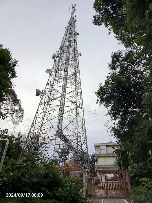
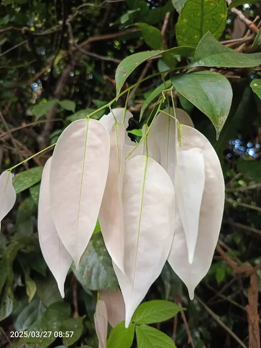
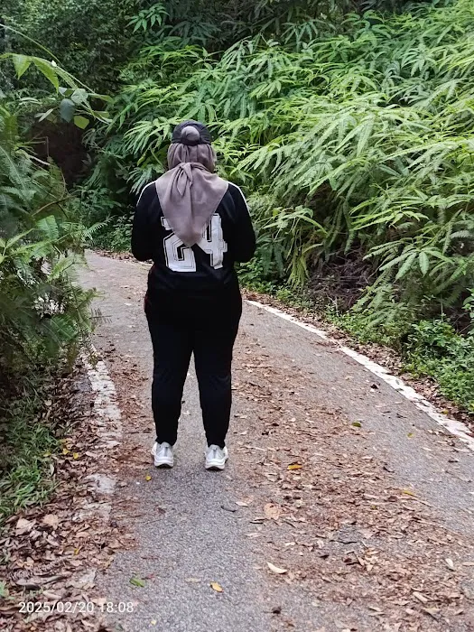
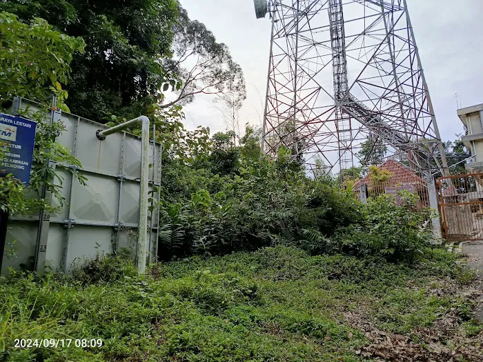
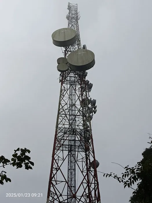
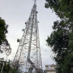
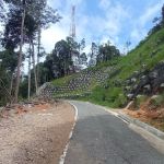
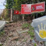
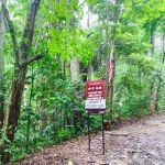
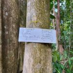
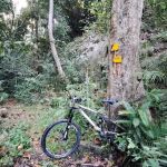
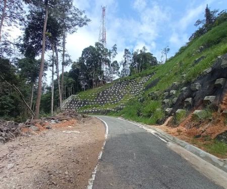
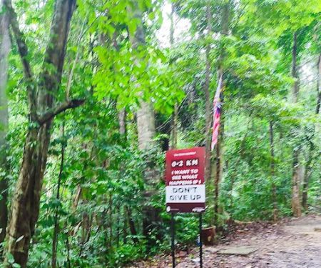
The primary route up Bukit Pelindung is, surprisingly, a paved road. This isn't just any road; it's the access route for Telekom Malaysia's transmission towers located at the summit. Despite its paved surface, it has become an incredibly popular exercise route for local folks, transforming what might seem like a mundane path into a lively thoroughfare of health and camaraderie. Hikers are often greeted by encouraging signboards strategically placed along the route, offering words of cheer and motivation as they ascend. For those new to the tropical climate, a delightful surprise awaits: many sections of the path are wonderfully shaded by the towering canopy of rainforest trees, providing a welcome respite from the Malaysian sun and creating a surprisingly cool and invigorating environment for your hike.
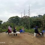
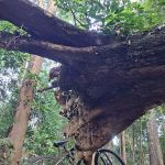
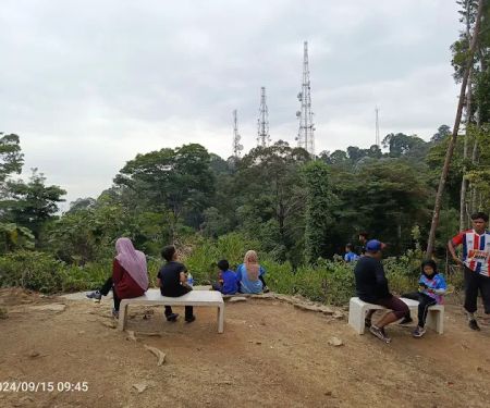
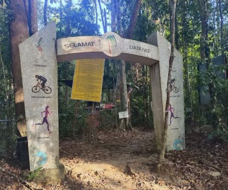
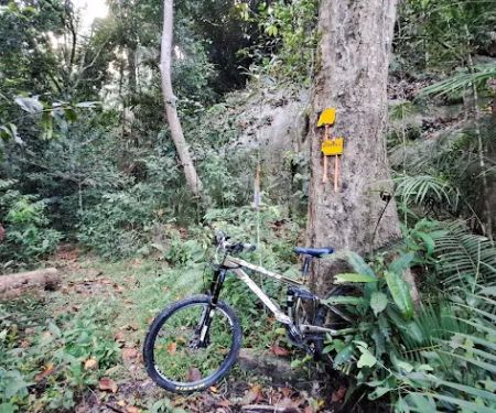
The journey to the east peak, which is about 1.5 kilometers from the starting point at the foot of the hill, offers a consistent incline that’s challenging enough to get your heart rate up but manageable for most fitness levels. As you near the summit, you’ll encounter a Y-junction. Taking the path to the right will lead you directly to the east peak, culminating at the main gate of the TM transmission towers, marking the official end of this particular trail. While the summit offers a vantage point, it's worth noting that a panoramic view is not the main draw here, as the surrounding tall trees mostly obstruct it. Instead, the appeal lies in the journey itself, the invigorating exercise, and the serene natural surroundings.
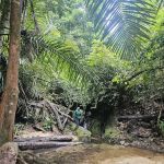
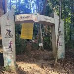
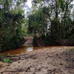
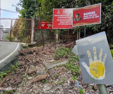
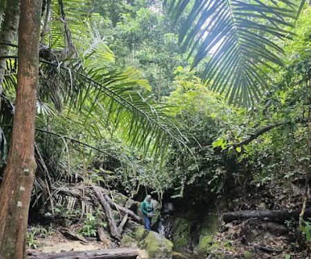
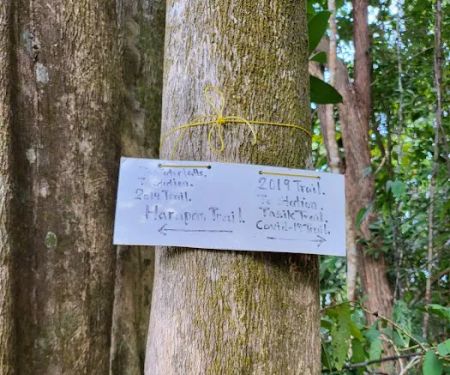
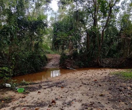
Over the years, the popularity of Bukit Pelindung has led to the emergence of various other forest tracks, branching off from different sections of the main paved route. Among these, the mountain bike trail leading towards the beautiful Teluk Cempedak beach is particularly renowned, offering an adventurous alternative for those seeking a more rugged experience. However, a word of caution for first-timers: most of these jungle trails are not clearly signposted. It's highly advisable to explore these unpaved paths with an experienced hiker who is familiar with the terrain to ensure a safe and enjoyable adventure. Bukit Pelindung truly is a versatile hiking area, catering to different preferences, from straightforward uphill walks to more challenging off-road explorations, making it a fantastic asset for the Kuantan community.
### Location and Accessibility
Bukit Pelindung (Puncak Kanan) is conveniently located at R9J7+GR, 25250 Kuantan, Pahang, Malaysia. Its position within Kuantan makes it highly accessible for residents across the city and even visitors from nearby areas. The ease of reaching this hiking spot is one of its major advantages, allowing locals to integrate a dose of nature and exercise into their daily or weekly routines without extensive travel time.
Getting to Bukit Pelindung is straightforward. Whether you're driving, taking a ride-sharing service, or even cycling, the location is well-known to locals. The paved access road, originally built for maintenance of the Telekom Malaysia towers, ensures a smooth entry point to the hiking trail. There is usually ample space available for parking near the foot of the hill, making it hassle-free for those arriving by car. The proximity to residential areas and main roads means that even public transportation options, such as local buses or taxis, would likely be able to drop you off within a short walking distance of the starting point.
The well-defined nature of the main trail also contributes to its accessibility. Even for individuals who are not seasoned hikers, the paved surface provides a stable and predictable path, reducing the risk of uneven terrain or obstacles often found in traditional jungle trails. This makes Bukit Pelindung suitable for a wide range of age groups and fitness levels, from young children enjoying an outdoor excursion with their families to seniors seeking a gentle yet effective exercise route. The signboards along the way not only provide encouragement but also act as helpful markers for those unfamiliar with the route, ensuring a guided and pleasant experience.
Furthermore, Bukit Pelindung’s location offers connections to other popular Kuantan attractions. As mentioned, some jungle trails from Bukit Pelindung lead directly to Teluk Cempedak beach, a famous tourist spot known for its beautiful coastline and recreational facilities. This connectivity allows for extended adventures, combining a challenging hike with a relaxing beach visit. For local residents, this means they have a diverse range of recreational opportunities practically at their doorstep, enhancing the overall appeal of Bukit Pelindung as a central hub for outdoor activities in Kuantan.
### Services Offered
While Bukit Pelindung (Puncak Kanan) is primarily a natural outdoor space, it offers several implicit "services" through its design and the surrounding environment that cater to hikers and visitors:
- Well-Maintained Paved Hiking Trail: The main trail is a paved road, providing a smooth, consistent surface for walking, jogging, or running. This ensures a relatively easy and safe ascent, suitable for a wide range of fitness levels, from beginners to regular exercisers.
- Shaded Pathways: A significant portion of the trail is covered by the natural canopy of tall rainforest trees. This natural shading offers a comfortable hiking experience, especially during sunny days, protecting visitors from direct sun exposure and keeping the path cooler.
- Motivational Signage: Various signboards are strategically placed along the route, offering cheering words and encouragement to hikers. These small but impactful touches enhance the overall experience, providing a sense of camaraderie and motivation.
- Access to Unsignposted Jungle Trails: For more adventurous and experienced hikers, Bukit Pelindung serves as a gateway to several unsignposted jungle tracks. These offer a more challenging and immersive experience in the natural forest, including the well-known mountain bike trail leading to Teluk Cempedak beach.
- Natural Exercise Environment: The hill provides an excellent natural setting for cardio and strength training. The consistent uphill climb on the paved road offers an effective workout, making it a popular spot for locals to maintain their fitness.
- Relaxation and Serenity: Despite its popularity, the dense forest surrounding the main trail offers pockets of tranquility. The sounds of nature and the fresh air contribute to a calming environment, ideal for mental rejuvenation.
### Features / Highlights
Bukit Pelindung (Puncak Kanan) boasts several distinct features and highlights that contribute to its popularity among Kuantan locals:
- East Peak Elevation: The east peak stands at approximately 277 meters (909 feet) above sea level. This elevation offers a significant, yet manageable, climb that rewards hikers with a sense of accomplishment.
- 1.5 KM Main Trail Length: The primary hiking trail from the foot of the hill to the east peak is roughly 1.5 kilometers long. This makes it an ideal distance for a moderate exercise session, allowing for multiple ascents for those seeking a more rigorous workout.
- Telecom Malaysia Access Road: The main path is a paved road, originally built for access to the Telekom Malaysia transmission towers. This unique feature makes it an unusually smooth and accessible hiking route compared to typical forest trails, perfect for all ages and fitness levels.
- Natural Rainforest Canopy: A significant and appreciated feature is the extensive natural shading provided by the tall rainforest trees that line much of the route. This canopy keeps the path cool and comfortable, making midday hikes more pleasant, even in the tropical heat.
- Motivational Signboards: Along the route, hikers will find various signboards with cheering and encouraging messages. These small details add a personal touch to the hiking experience, boosting morale as you climb.
- Y-Junction Leading to East Peak: Near the summit, a distinct Y-junction directs hikers. The right path leads directly to the east peak and the TM transmission tower gate, marking the end of the paved trail.
- Connection to Teluk Cempedak Mountain Bike Trail: Bukit Pelindung is famous for its connection to a mountain bike trail that leads down to Teluk Cempedak beach. This provides an exciting option for adventure seekers and offers a direct link to another popular Kuantan attraction.
- Network of Unsignposted Jungle Trails: Beyond the main paved road, numerous unsignposted forest tracks have emerged over the years. These provide more challenging and rugged hiking experiences for those with a sense of adventure and, ideally, a local guide.
### Promotions or Special Offers
As Bukit Pelindung (Puncak Kanan) is a publicly accessible natural park and hiking area managed by local authorities, it typically does not offer commercial promotions or special offers in the traditional sense, such as discounts or package deals. Its value lies in its free access and the natural beauty it provides to the community. However, its existence inherently offers several "promotions" in terms of public benefits:
- Free Access for All: The most significant "promotion" is that access to Bukit Pelindung is completely free. There are no entrance fees or parking charges, making it an incredibly affordable and accessible recreational option for everyone in Kuantan and beyond.
- Year-Round Availability: The hiking area is generally open to the public year-round, from early morning to evening, allowing individuals to visit at their convenience, whether for a sunrise hike or an afternoon stroll. This consistent availability is a huge benefit for regular users.
- Health and Wellness Promotion: By providing a safe, well-maintained, and engaging environment for physical activity, Bukit Pelindung actively promotes a healthy lifestyle among locals. This is a priceless "offer" for public well-being, encouraging exercise and connection with nature.
- Community Gathering Spot: The popularity of Bukit Pelindung naturally fosters a sense of community. It’s a place where friends and families can meet, exercise together, and bond over shared experiences, indirectly "promoting" social cohesion and support networks.
- Nature Appreciation and Education: The diverse flora of the rainforest canopy provides a living classroom for appreciating local biodiversity. While not a formal program, it offers an inherent "promotion" of environmental awareness and the beauty of Pahang's natural heritage.
While you won't find traditional sales or discounts here, the inherent value and free accessibility of Bukit Pelindung make it a continuous and invaluable "special offer" for the health and happiness of the Kuantan community.
### Contact Information
For Bukit Pelindung (Puncak Kanan), as a natural public area, direct contact information like a dedicated phone line or email address for the hiking area itself is typically not available as it is managed by the local council or forestry department. However, you can use the following address for navigation:
Address: R9J7+GR, 25250 Kuantan, Pahang, Malaysia
For general inquiries related to public parks and recreational areas in Kuantan, you may consider contacting the Kuantan City Council (Majlis Bandaraya Kuantan - MBK) or the Pahang State Forestry Department, as they are likely responsible for the maintenance and management of such natural sites. Their general contact details can usually be found on their official websites.
Please note that specific inquiries about the hiking trails themselves, especially the unsignposted ones, are best directed to local hiking groups or experienced local hikers, as they possess practical, on-the-ground knowledge of the various paths and their conditions.
### Conclusion: Why this place is suitable for locals
For the residents of Pahang, particularly those in Kuantan, Bukit Pelindung (Puncak Kanan) is more than just a hill; it's a cherished local institution, perfectly suited for integrating health, nature, and community into daily life. Its suitability for locals stems from several key factors that cater directly to their needs and preferences.
Firstly, its prime location and exceptional accessibility within Kuantan means that a refreshing escape into nature is never far away. Unlike remote hiking trails that require extensive travel, Bukit Pelindung is practically on your doorstep, making it incredibly convenient for a quick morning workout before work, an evening stroll with the family, or a weekend adventure. This ease of access encourages regular visitation, fostering consistent physical activity among community members.
Secondly, the unique nature of its main trail, a paved road, makes it remarkably inclusive. It's not just for the seasoned mountaineer but for everyone. Parents with young children can confidently navigate the path, seniors can enjoy a safe and stable walk, and beginners can ease into the world of hiking without the immediate challenges of rugged terrain. This universality means that families can easily enjoy outdoor time together, promoting healthy habits across generations.
Furthermore, the natural comforts offered by Bukit Pelindung are a huge draw. The dense canopy of rainforest trees provides much-needed shade, turning what could be a hot, strenuous climb into a pleasantly cool and invigorating experience, even in the tropical climate of Malaysia. This natural air-conditioning is a significant advantage, making it comfortable to hike at various times of the day. The simple yet effective motivational signboards along the path also add a touch of local charm and encouragement, making the journey feel less like a chore and more like a shared community endeavor.
Beyond the main trail, the presence of emerging jungle tracks, especially the famous mountain bike trail leading to Teluk Cempedak, adds another layer of versatility. While requiring more local knowledge or an experienced guide, these paths cater to those seeking a more adventurous and immersive experience in the untouched forest, offering a diverse range of challenges for different preferences. This variety ensures that Bukit Pelindung remains engaging for all types of outdoor enthusiasts as their skills and interests evolve.
Finally, and perhaps most importantly, Bukit Pelindung serves as a vital community hub. It's a place where neighbors meet, friends exercise together, and new connections are forged, all amidst the beauty of nature. It’s a testament to healthy living and a strong sense of local pride. For the people of Pahang, Bukit Pelindung (Puncak Kanan) isn't just a place to hike; it's a fundamental part of their active lifestyle, a sanctuary for wellness, and a vibrant cornerstone of their community, truly making it the ideal outdoor escape right here in Kuantan.
Bukit Pelindung (Puncak Kanan) Photos

Bukit Pelindung (Puncak Kanan) Location
Bukit Pelindung (Puncak Kanan)
R9J7+GR, 25250 Kuantan, Pahang, Malaysia
 Bukit Pelindung (Puncak Kanan)
R9J7+GR
 End Trail Bukit Pelindung
424
 Bukit Pelindung (Puncak Kiri)
424
 Halfway Trail Bukit Pelindung
424
 Kopitiam Tasik
R9J6+Q8
 Pelindung Beach Trail
Pelindung Hills
 Bukit Pelindung (Pondok Rehat)
424
 Starting Trail Bukit Pelindung
11459
 Flying Roots
R9F9+7Q
 Bukit Pelindung D Embassy Hiking Trail
81
 Trailhead of Pelindung mini waterfall
R9HF+6P
 End Trail Pantai Pelindung
Pantai Pelindung
 Sea turtle mural
R9MG+VG
Bukit Pelindung (Puncak Kanan) Reviews
The east peak of Bukit Pelindung is about 277m above sea level. It is about 1.5 km from the starting point from the foot of the hill.The Bukit Pelindung trail is the access road of Telecom Malaysia to the transmition towers at the peak. Though a paved road, it is a popular hiking uphill exercise route of local folks. Not far from the starting point you will see the route signboard on the left on the way up. There are a few other signboards offering cheering words to hikers at different sections of the route.Being here in the tropics, it's a welcome surprise to the uninitiated to know that many sections of route are shaded by canopy of tall rainforest trees.When you are almost at the peak, there is a Y junction. The east peak is on the right, leading to the main gate of transmission towers of TM, which is also the end of the trail.Despite at the vantage point, there is no panaromic view to offer as the view is blocked by tall trees.Over the years a number of forest tracks have emerged at different sections of Pelindung. The most famous is the mountain bike trail which leads to Teluk Chempedak beach. Do take note that most jungle trails of Pelindung are not signposted. For first timer, it advisable to go with an experienced hiker.
May 28, 2024 · michael michael
More Adventure
 End Trail Bukit Pelindung4.0 (5 reviews)
424, Pelindung Heights, 25250 Kuantan, Pahang, Malaysia
 Bukit Pelindung (Puncak Kiri)0.0 (0 reviews)
424, Pelindung Heights, 25250 Kuantan, Pahang, Malaysia
 Halfway Trail Bukit Pelindung0.0 (0 reviews)
424, Pelindung Heights, 25250 Kuantan, Pahang, Malaysia
 Kopitiam Tasik3.0 (1 reviews)
R9J6+Q8, 25250 Kuantan, Pahang, Malaysia
 Pelindung Beach Trail5.0 (1 reviews)
Pelindung Hills, 26100 Kuantan, Pahang, Malaysia
 Bukit Pelindung (Pondok Rehat)4.0 (10 reviews)
424, Pelindung Heights, 25250 Kuantan, Pahang, Malaysia
 Starting Trail Bukit Pelindung4.0 (325 reviews)
11459, Jalan Pelindung 2, Pelindung Heights, 25250 Kuantan, Pahang, Malaysia
 Flying Roots3.0 (1 reviews)
R9F9+7Q, 25050 Kuantan, Pahang, Malaysia
 Bukit Pelindung D Embassy Hiking Trail5.0 (4 reviews)
81, Lorong Pelindung 101, Taman Sri Pelindung Satu, 25250 Kuantan, Pahang, Malaysia
 Trailhead of Pelindung mini waterfall3.0 (1 reviews)
R9HF+6P, 26100 Kuantan, Pahang, Malaysia
 End Trail Pantai Pelindung0.0 (0 reviews)
Pantai Pelindung, 25150 Kuantan, Pahang, Malaysia
 Sea turtle mural4.0 (45 reviews)
R9MG+VG, 26100 Kuantan, Pahang, Malaysia
Categories
Popular
 Wrap Restaurant | Scott Garden4.0 (111 reviews)
 99 Reflexology Massage3.0 (2 reviews)
 HOMESTAY TELUK INTAN GREEN HOUSE5.0 (3 reviews)
 ANAAZRS HOMESTAY TELIPOT5.0 (3 reviews)
 Sg.buloh hostel4.0 (2 reviews)
 Mee Rebus Haji Wahid4.0 (70 reviews)
Must-Read Blog Posts
Most Searched
Trending Blog Posts
 Exploring the Architectural Beauty of Mosques in Malaysia: A Journey Through Islamic Architecture
 Exploring the Unique Designs of Mosques in Malaysia: A Journey Through Islamic Architecture
 How to Get to the Famous Mosques in Kuala Lumpur by Public Transport: A Complete Travel Guide
 Visiting Malaysia’s Most Famous Mosques During Eid: A Unique Cultural Experience
 Top Mosques to Visit During Ramadan in Malaysia: A Traveler's Guide
 Discover the History of Masjid Titiwangsa in Kuala Lumpur: A Cultural and Architectural Gem