

End Trail Bukit Pelindung Introduce
Hello, adventurers and nature lovers of Pahang, especially those residing in our vibrant capital, Kuantan! Are you looking for a refreshing way to connect with nature, get your heart rate up, and perhaps even enjoy a satisfying view without venturing too far from the city? Then it's time to explore End Trail Bukit Pelindung. This article will serve as your comprehensive guide to this popular hiking area, providing details on its location, what to expect, its unique highlights, and why it's such a suitable and cherished spot for locals seeking an invigorating outdoor experience.
Bukit Pelindung stands as a prominent natural landmark in Kuantan, offering a green sanctuary amidst urban development. Its trails provide an accessible escape for residents to engage in physical activity, enjoy the fresh air, and witness the natural beauty that Pahang is renowned for. End Trail Bukit Pelindung, specifically, has carved out a niche for itself as a go-to spot for both casual walkers and more determined hikers, promising a rewarding journey to its peak. Let's delve into what makes this hiking area a local favorite.
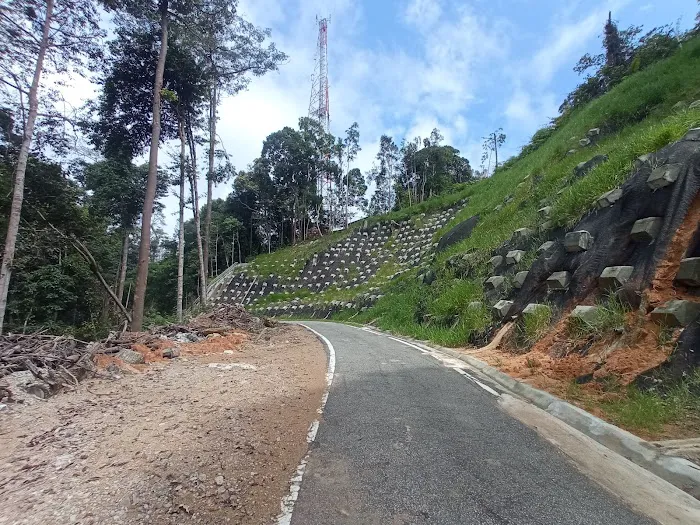
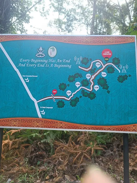
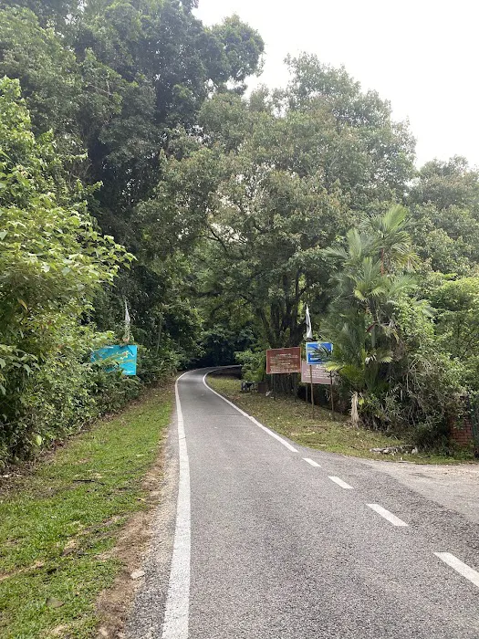
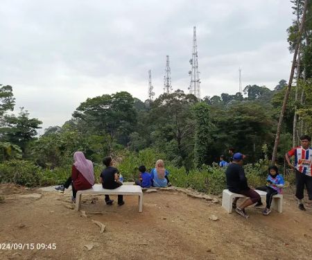
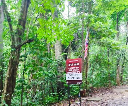
End Trail Bukit Pelindung refers to a specific, well-known hiking route leading up Bukit Pelindung, a prominent hill located in Kuantan, Pahang. It is characterized by a "short 1.4KM narrow tarred mountain road," making it a unique urban hiking experience. Unlike dense jungle trails, this route offers a relatively defined path, which is both its charm and its challenge. Despite being a paved road, it is described as a "nice cool uphill walk," indicating a pleasant environment, likely shaded by trees. It is a popular spot for locals seeking physical activity and a connection with nature within city limits. While the peak might not offer a traditional panoramic vista ("The peak has no panoramic view"), the journey itself is considered "quite rewarding," suggesting a sense of accomplishment and perhaps subtle natural beauty along the way. The presence of "many folks going up and down" indicates a lively and safe environment, ensuring hikers are "not lonely." This trail represents an accessible yet invigorating outdoor option for Kuantan residents.
End Trail Bukit Pelindung is conveniently located at 424, Pelindung Heights, 25250 Kuantan, Pahang, Malaysia. This address places it squarely within the residential area of Pelindung Heights, a well-known neighborhood in Kuantan.
Kuantan, as the state capital of Pahang, is a major urban center with excellent infrastructure. Bukit Pelindung itself is a prominent landmark, easily identifiable within the city. Its location within Pelindung Heights means that it is highly accessible for Kuantan residents, whether by car, motorcycle, or even bicycle for those living nearby.
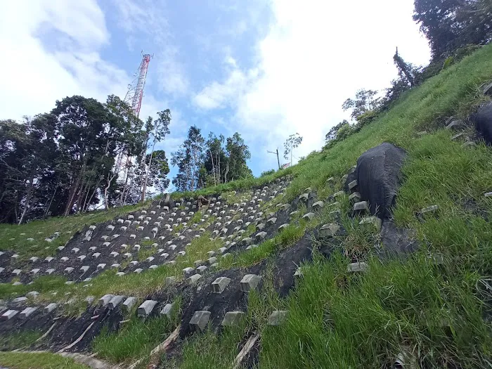
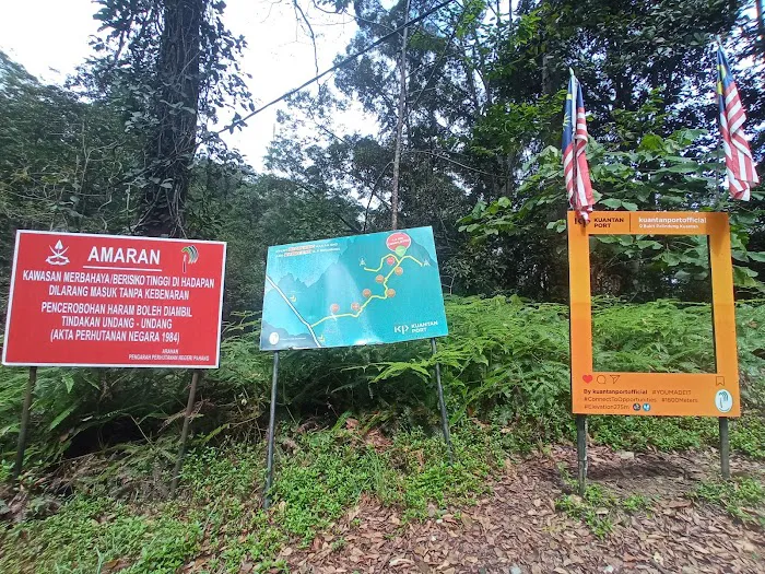
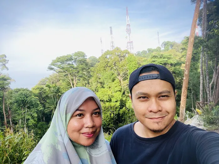
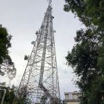
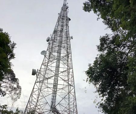
For those driving, Pelindung Heights is well-connected to Kuantan's main roads. There would typically be roadside parking available near the trail's starting point, though during peak hours, it might require a bit of searching due to its popularity. Using GPS or mapping applications with the provided address and postcode (25250) will lead visitors directly to the area. While public transport might not drop you directly at the trailhead, local taxi services or ride-hailing apps can easily get you to Pelindung Heights. The fact that it is a "narrow tarred mountain road" starting from a residential area suggests good initial access, although potential visitors should be aware that the road itself is for walking and not for vehicles other than official TM (Telekom Malaysia, likely for maintenance of their facilities on the hill) vehicles, as mentioned in a review. This ensures a relatively safe and dedicated path for hikers.
As a natural hiking area, End Trail Bukit Pelindung does not offer traditional commercial "services" but rather provides a natural environment and basic infrastructure for recreational activities. These inherent offerings are:
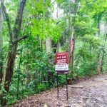
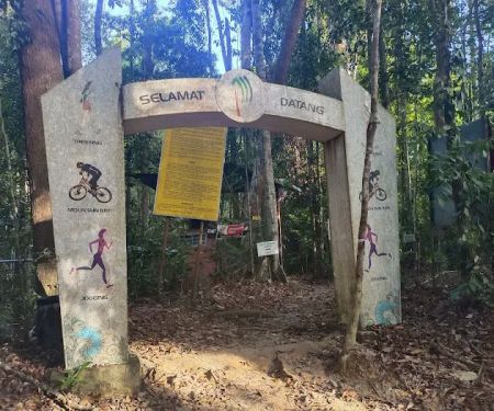
Designated Hiking Trail: A clear, albeit "narrow tarred mountain road" spanning 1.4 KM, providing a defined path for uphill walking and hiking.
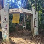
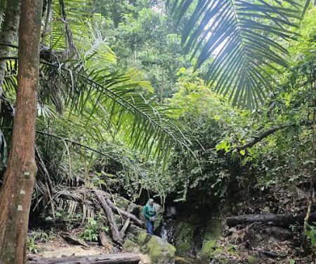
Nature Access: Provides direct access to a green, elevated natural environment within Kuantan, offering fresh air and a respite from urban settings.
Physical Activity Opportunity: Serves as an excellent outdoor venue for cardio exercise, brisk walking, or a challenging uphill trek, promoting physical fitness.
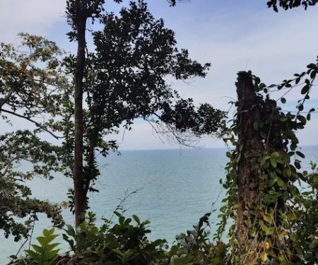
Scenic Views (Limited but Rewarding): While the peak might lack a panoramic view, the overall experience is described as "rewarding," suggesting pleasant sights along the way and a sense of accomplishment at the top.
Community Interaction: As a popular spot, it facilitates informal social interaction among hikers, creating a shared experience and sense of camaraderie ("many folks going up and down so you wouldn't be lonely").
Basic Natural Infrastructure: The tarred road offers a relatively stable and clear path, making it more accessible than rough jungle trails. Existing natural shade from trees contributes to a "cool" walking environment.
Mental Wellness Boost: Being outdoors and engaging in physical activity in a natural setting contributes significantly to mental well-being and stress reduction, offering a "healing" experience for some.
End Trail Bukit Pelindung stands out with several key features and highlights that contribute to its popularity and unique appeal for Kuantan locals:
Urban Accessibility: Its prime location in Pelindung Heights, Kuantan, makes it an incredibly convenient hiking spot for city dwellers, allowing for quick, refreshing escapes into nature without long travel times.
Manageable Length and Defined Path: The "short 1.4KM narrow tarred mountain road" provides a clear, non-jungle trail that is accessible and less daunting for casual hikers or those new to the activity. The tarred surface makes it suitable for all-weather walking (though caution is always advised).
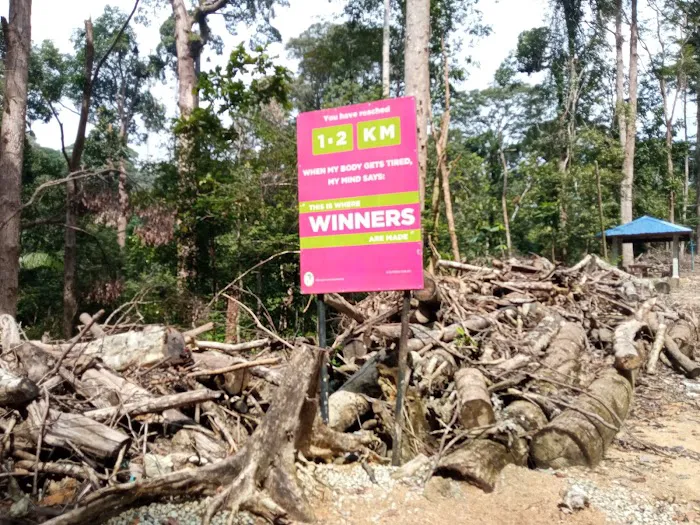
Consistent Uphill Challenge: The "uphill walk" provides a good cardiovascular workout, making it a "fine hiking experience" that is "tiring, and yet such a fine hiking experience," indicating a satisfying physical challenge for those looking to exert themselves.
"Nice Cool Uphill Walk": Despite the exertion, the environment is described as cool, likely due to shade, enhancing the comfort of the climb.
Safety in Numbers: The presence of "many folks going up and down" ensures that hikers "wouldn't be lonely," providing a sense of security, especially for solo hikers.
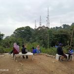
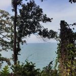
Rewarding Experience: Even without a traditional panoramic view at the absolute summit, the journey itself is "quite rewarding," and one review explicitly states, "The view up here is undoubtedly spectacular," suggesting there are indeed visually pleasing elements or vistas along the path or at certain points.
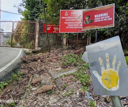
Natural Wildlife Encounter: The mention of "Beware of the monkeys" indicates the presence of local wildlife, adding a natural element to the urban hike. (Note: always practice responsible wildlife interaction and do not feed animals).
Ideal Timing Recommendation: The suggestion that "Best time is around 2pm it is quiet & not so crowded" provides valuable insider advice for those seeking a more tranquil experience.
As a public natural area, End Trail Bukit Pelindung does not offer commercial "promotions" or "special offers" in the typical business sense. Its "offerings" are primarily the free access to its natural environment and recreational opportunities. However, one can consider the inherent benefits it provides as its core "promotions" for public well-being:
Free Access to Nature: The most significant "offer" is the provision of a beautiful and challenging hiking trail completely free of charge, making outdoor recreation accessible to all members of the community.
Health & Wellness Benefits: It promotes physical fitness and mental well-being through vigorous exercise in a refreshing natural setting, contributing to a healthier lifestyle for locals.
Stress Relief and Relaxation: The opportunity to escape urban pressures and immerse oneself in a peaceful, natural environment offers invaluable stress relief without any cost.
Community Engagement: The shared experience of hiking often leads to informal social interaction and community bonding, creating a sense of camaraderie among regulars.
Achievement and Personal Growth: For many, completing the uphill climb provides a sense of accomplishment and self-satisfaction, a personal "reward" that motivates continued healthy habits.
Any community-organized events or clean-up drives at Bukit Pelindung would typically be announced through local community channels or social media groups.
As a natural hiking area and public amenity, End Trail Bukit Pelindung does not have a direct dedicated phone number for public inquiries, as its management typically falls under local government bodies or forestry departments. There is no publicly available phone number for End Trail Bukit Pelindung itself.
For general inquiries related to park maintenance, safety, or environmental concerns in the area, residents would typically contact the Kuantan City Council (Majlis Bandaraya Kuantan - MBK) or the Pahang State Forestry Department.
The physical address is key for locating the trailhead:
Address: 424, Pelindung Heights, 25250 Kuantan, Pahang, Malaysia
For specific safety guidelines or information on trail conditions, it is always advisable to check local community groups or online forums dedicated to hiking in Kuantan, where experienced hikers often share up-to-date information.
End Trail Bukit Pelindung is an exceptionally suitable and highly valued natural asset for the locals of Kuantan, Pahang, offering a unique blend of accessibility, challenge, and natural beauty right at their doorstep. Its suitability stems from several key attributes that cater directly to the needs and preferences of urban residents seeking outdoor recreation.
Firstly, its prime location within Pelindung Heights means that a refreshing and invigorating hike is just a short drive or even walk away for many Kuantan residents. This easy access is crucial for integrating physical activity into busy urban lives, providing an escape to nature without requiring extensive travel planning. The 1.4 KM "narrow tarred mountain road" makes it approachable for a wide range of fitness levels, from casual walkers seeking a "cool uphill walk" to more seasoned hikers looking for a "fine hiking experience" that is "tiring, and yet such a fine hiking experience."
Secondly, the vibrant community aspect is a significant draw. The presence of "many folks going up and down" ensures that hikers are "not lonely," fostering a sense of security and camaraderie. This social element transforms a simple hike into a shared experience, strengthening community bonds. While the peak might not offer a grand panoramic vista in the traditional sense, the journey itself is "quite rewarding," and the explicit mention of a "spectacular" view by some suggests that there are undoubtedly visually pleasing moments along the trail, offering a valuable connection to nature's beauty.
Furthermore, the clear path and manageable length make it an ideal choice for regular exercise, promoting a healthier lifestyle among locals. The tranquility offered, especially during less crowded times like "around 2pm," provides a perfect opportunity for mental unwinding and rejuvenation. In essence, End Trail Bukit Pelindung is more than just a hiking path; it is a community resource that provides a vital outlet for physical activity, spiritual solace, and social connection, making it an indispensable and cherished part of Kuantan's local landscape.
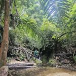
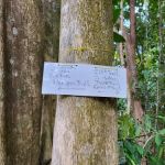
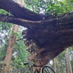
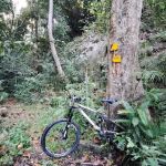
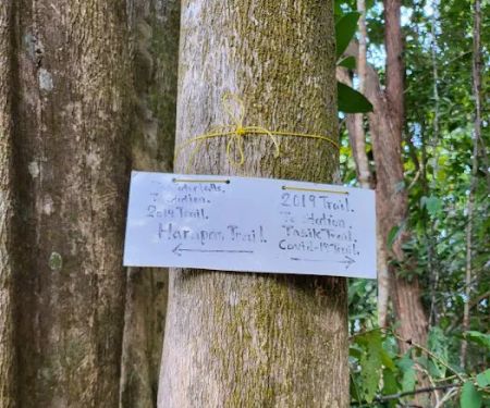
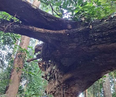
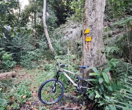
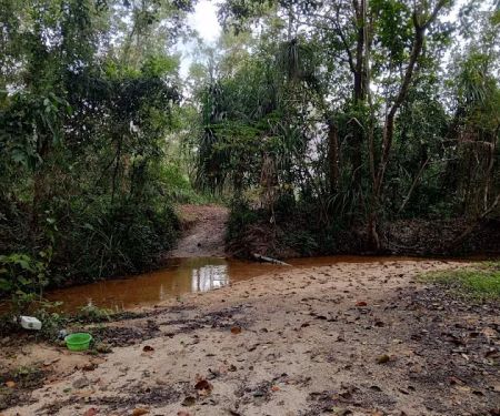
End Trail Bukit Pelindung Photos
End Trail Bukit Pelindung Location
End Trail Bukit Pelindung
424, Pelindung Heights, 25250 Kuantan, Pahang, Malaysia
 End Trail Bukit Pelindung
424
 Bukit Pelindung (Puncak Kiri)
424
 Bukit Pelindung (Puncak Kanan)
R9J7+GR
 Halfway Trail Bukit Pelindung
424
 Bukit Pelindung (Pondok Rehat)
424
 Starting Trail Bukit Pelindung
11459
 Pelindung Beach Trail
Pelindung Hills
 Bukit Pelindung D Embassy Hiking Trail
81
 Flying Roots
R9F9+7Q
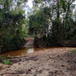
 Trailhead of Pelindung mini waterfall
R9HF+6P
 End Trail Pantai Pelindung
Pantai Pelindung
 Sea turtle mural
R9MG+VG
 Trailhead of Denai Tembeling
35
End Trail Bukit Pelindung Reviews
A short 1.4KM narrow tarred mountain road, unless there are TM vehicles passing, otherwise it is indeed a nice cool uphill walk. Bring a walking stick as ascending road can be quite challenging for some. Beware of the monkeys. The peak has no panoramic view but quite rewarding. Best time is arround 2pm it is quiet & not so crowded.
Jul 27, 2024 · Steven NgFinally...I make it up here after 2 hours or so. It was tiring, and yet such a fine hiking experience. There are many folks going up and down so you wouldn't be lonely. The view up here is undoubtedly spectacular, though be mindful of the ravines. And also, if you make it this far, then congratulations!
Dec 16, 2023 · Arisa- Aug 15, 2023 · POQJAQ
- Jun 01, 2025 · foto zam
- Jul 04, 2023 · sssb98
More Adventure
 Bukit Pelindung (Puncak Kiri)0.0 (0 reviews)
424, Pelindung Heights, 25250 Kuantan, Pahang, Malaysia
 Bukit Pelindung (Puncak Kanan)3.0 (1 reviews)
R9J7+GR, 25250 Kuantan, Pahang, Malaysia
 Halfway Trail Bukit Pelindung0.0 (0 reviews)
424, Pelindung Heights, 25250 Kuantan, Pahang, Malaysia
 Bukit Pelindung (Pondok Rehat)4.0 (10 reviews)
424, Pelindung Heights, 25250 Kuantan, Pahang, Malaysia
 Starting Trail Bukit Pelindung4.0 (325 reviews)
11459, Jalan Pelindung 2, Pelindung Heights, 25250 Kuantan, Pahang, Malaysia
 Pelindung Beach Trail5.0 (1 reviews)
Pelindung Hills, 26100 Kuantan, Pahang, Malaysia
 Bukit Pelindung D Embassy Hiking Trail5.0 (4 reviews)
81, Lorong Pelindung 101, Taman Sri Pelindung Satu, 25250 Kuantan, Pahang, Malaysia
 Flying Roots3.0 (1 reviews)
R9F9+7Q, 25050 Kuantan, Pahang, Malaysia
 Trailhead of Pelindung mini waterfall3.0 (1 reviews)
R9HF+6P, 26100 Kuantan, Pahang, Malaysia
 End Trail Pantai Pelindung0.0 (0 reviews)
Pantai Pelindung, 25150 Kuantan, Pahang, Malaysia
 Sea turtle mural4.0 (45 reviews)
R9MG+VG, 26100 Kuantan, Pahang, Malaysia
 Trailhead of Denai Tembeling3.0 (1 reviews)
35, Jalan Telok Cempedak, 25050 Kuantan, Pahang, Malaysia
Categories
Popular
 Teratak Healing - Urut Saraf4.0 (4 reviews)
 HOME SWEET HOMESTAY3.0 (4 reviews)
 Cikgu Zahari Homestay5.0 (7 reviews)
 Restaurant MY Friend小食馆3.0 (26 reviews)
 Cik nor guest house0.0 (0 reviews)
 Faizal Koch Trading5.0 (1 reviews)
Must-Read Blog Posts
Most Searched
Trending Blog Posts
 Exploring the Architectural Beauty of Mosques in Malaysia: A Journey Through Islamic Architecture
 Exploring the Unique Designs of Mosques in Malaysia: A Journey Through Islamic Architecture
 How to Get to the Famous Mosques in Kuala Lumpur by Public Transport: A Complete Travel Guide
 Visiting Malaysia’s Most Famous Mosques During Eid: A Unique Cultural Experience
 Top Mosques to Visit During Ramadan in Malaysia: A Traveler's Guide
 Discover the History of Masjid Titiwangsa in Kuala Lumpur: A Cultural and Architectural Gem