
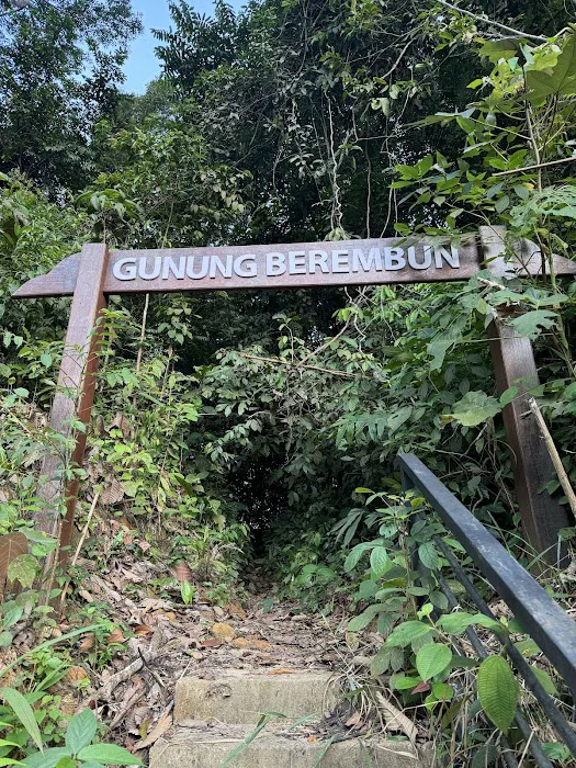
Gunung Berembun Trailhead Introduce
Calling all adventurous spirits and nature lovers in Negeri Sembilan! If you’ve conquered Gunung Angsi and Gunung Datuk and are now seeking a longer, more challenging, and truly rewarding hiking experience, then the Gunung Berembun Trailhead in Pantai is your next destination. Nestled amidst the lush primary rainforest of Negeri Sembilan, Gunung Berembun offers an immersive jungle trekking adventure that promises not just a physical challenge but also a journey through natural beauty and a touch of history.
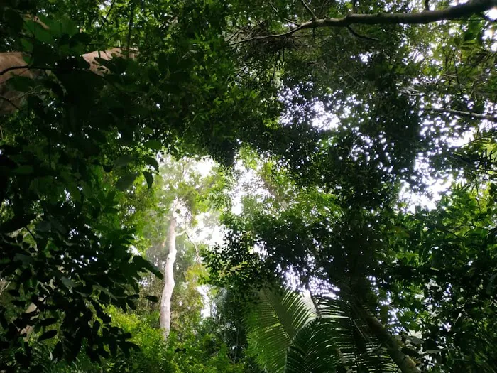
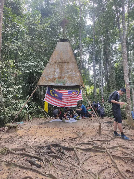
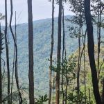
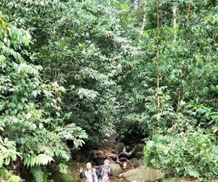
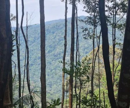
Standing at 1,014 meters (3,327 feet), Gunung Berembun is a significant peak in our state, providing a rigorous climb that serves as excellent training for more ambitious treks. Unlike some peaks that offer sweeping panoramic views from the summit (though there are glimpses through the vegetation), Gunung Berembun's main allure lies in the journey itself. Hikers are treated to the raw beauty of a protected primary forest, with towering trees, refreshing stream crossings, and the captivating sounds of the jungle. It’s a place where you can truly disconnect from the urban grind and reconnect with nature’s untouched grandeur.
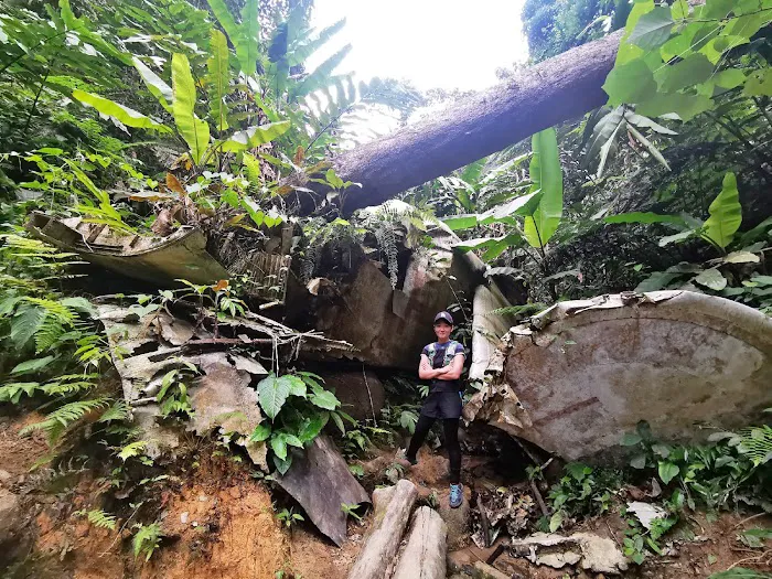
What makes the Gunung Berembun Trailhead particularly fascinating for locals is the unique combination of natural wonders and a historical landmark. Many choose to extend their hike beyond the summit to visit the intriguing World War II plane crash site, adding a layer of historical exploration to their outdoor adventure. This combination of challenging terrain, refreshing waterfalls like Lata Berembun, and a piece of wartime history makes Gunung Berembun a truly multifaceted hiking experience, highly recommended for those who are physically fit and eager to explore the deeper parts of Negeri Sembilan's natural heritage. It's a full-day commitment, but the rewards are immeasurable – a sense of accomplishment, breathtaking natural encounters, and a story to tell.
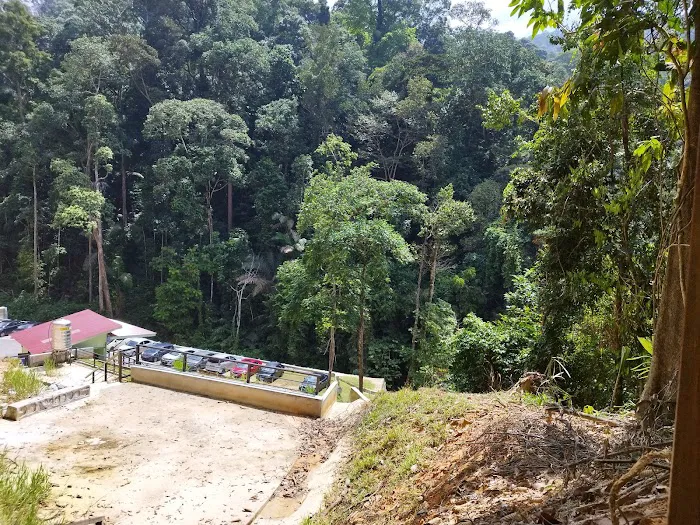
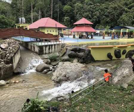
The Gunung Berembun Trailhead is located at Loji Rawatan Air Pantai, Mukim Pantai, 71770 Pantai, Negeri Sembilan, Malaysia. This spot is situated in Kampung Pantai, a charming village area that provides a serene start to your adventure.
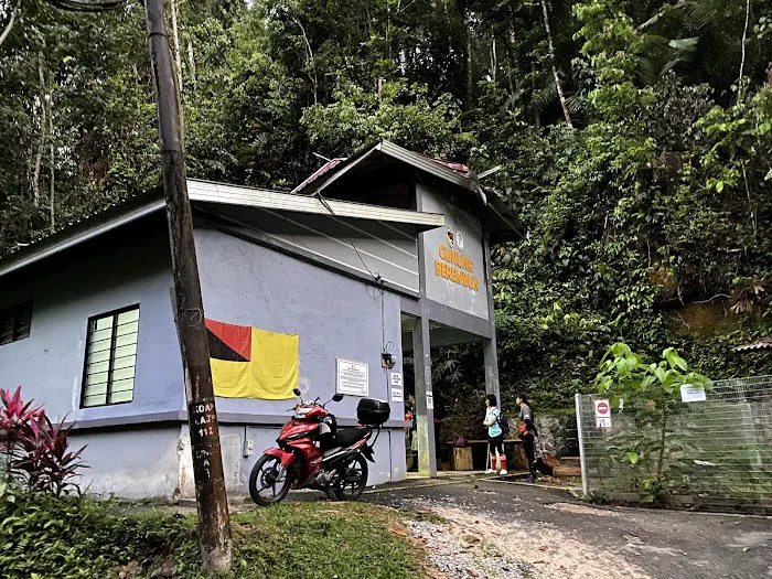
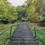
Getting to the trailhead is quite straightforward for those driving. From Seremban, you can head towards Kuala Klawang via Federal Route 86. Upon reaching Kampung Pantai, look out for signs leading to the Loji Rawatan Air (Water Treatment Plant). The trailhead is typically found near the entrance of this facility, often marked by a ranger station or a registration counter. While there isn't formal designated parking with fixed fees, hikers usually find space to park along the roadside near the trailhead. It's advisable to arrive early, especially on weekends or public holidays, as parking can fill up quickly. Public transportation directly to the trailhead might be limited, so driving or arranging a ride is the most practical way to reach this beautiful hiking spot. The drive itself is scenic, passing through local villages and offering a glimpse into the rural charm of Negeri Sembilan before you plunge into the dense rainforest. There's a proper ranger station built around 2017 to manage the increasing number of hikers, ensuring a more regulated and safer experience.
- Trail Access: The primary service is access to the well-established hiking trails leading up Gunung Berembun and to various points of interest along the way.
- Permit Registration: Hikers are required to register and obtain a permit at the trailhead. There is a nominal fee (RM5 for Malaysians) which contributes to trail maintenance and safety initiatives. This ensures a controlled and safer environment for hikers.
- Ranger Presence: A ranger station is usually located at the trailhead, where staff can provide information, collect permit fees, and manage visitor logs.
- Informal Parking: While not a dedicated parking facility, ample space is generally available along the road near the trailhead for hikers' vehicles.
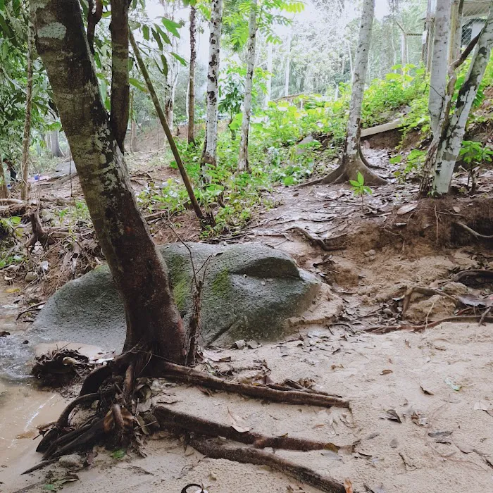
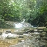
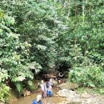
- Natural Water Sources: Along the trail, especially in the earlier sections and at places like Lata Berembun and Gua Kambing, natural water sources (streams, waterfalls) are available for refilling water bottles, though it is always recommended to carry sufficient water.
- Challenging Terrain: Gunung Berembun offers a significant challenge, with sections becoming very steep, particularly after Gua Kambing, requiring ropes for assistance. This makes it ideal for experienced hikers seeking a rigorous workout.
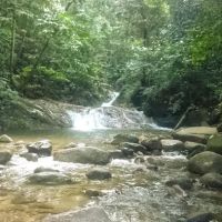
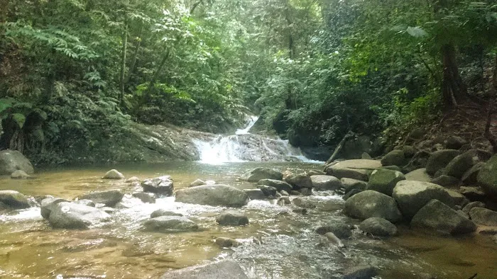
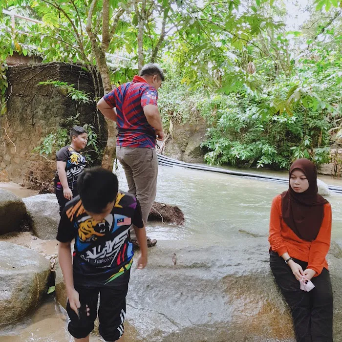
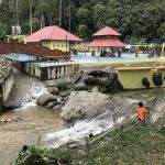
- Lata Berembun Waterfall: Approximately 30-45 minutes from the trailhead, hikers will reach Lata Berembun, a beautiful waterfall and a popular spot for a refreshing dip or a short break. It also serves as a campsite for those planning overnight stays.
- WWII Plane Crash Site: A unique historical highlight, located about 45 minutes to an hour from the summit, is the wreckage of a British Royal Air Force B-24 Liberator bomber that crashed in August 1945. This site offers a poignant reminder of history amidst the jungle.
- Primary Rainforest Experience: The trail traverses a protected primary forest, offering rich biodiversity, massive trees, and the chance to spot various flora and fauna, including potential glimpses of local wildlife and a variety of bird species.
- Strategic Training Ground: As noted by a real customer review, this trail is "Recommended for those that require a longer hike for training as Angsi and Datuk have shorter trails." This makes it an excellent choice for hikers preparing for more demanding expeditions.
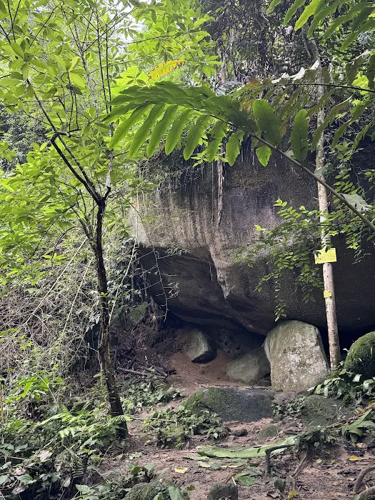
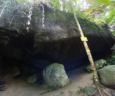
- Gua Kambing: A significant resting point and campsite located further up the trail, offering a sheltered area and serving as the last reliable water source before the final ascent to the peak.
As Gunung Berembun Trailhead is a natural reserve managed by the state forestry department, it typically does not offer commercial "promotions" or "special offers" in the retail sense. The standard permit fee of RM5 for Malaysians and RM20 for international visitors applies. However, the value offered by Gunung Berembun lies in its accessibility and the rich, natural experience it provides at a minimal cost.
Local hiking groups in Negeri Sembilan often organize group excursions to Gunung Berembun, which can sometimes come with shared transportation costs or group-led guiding services. While not a "promotion" from the site itself, these organized trips can make the experience more affordable and enjoyable, especially for those new to the trail. Keep an eye on local outdoor activity Facebook groups or community boards for announcements of such events. Sometimes, during special environmental awareness campaigns or forestry department initiatives, there might be temporary fee waivers or guided tours, but these are infrequent. The main "offer" is the consistent availability of a challenging and beautiful natural environment for public enjoyment and recreation.
For information regarding Gunung Berembun Trailhead, including permit requirements and current trail conditions, you would typically refer to the Negeri Sembilan Forestry Department or the ranger station at the trailhead.
Address: Loji Rawatan Air Pantai, Mukim Pantai, 71770 Pantai, Negeri Sembilan, Malaysia
Phone: While there isn't a direct public phone number specifically for the trailhead, you may try contacting the Negeri Sembilan Forestry Department for general inquiries. Local sources and hiking communities often share practical tips and updates. It’s always a good practice to check for any advisories before heading out, especially during or after heavy rainfall, as trails can become very slippery and challenging.
Gunung Berembun Trailhead is an ideal destination for locals in Negeri Sembilan who seek a profound and invigorating connection with nature. For our community, it represents more than just a mountain to climb; it’s a vital training ground for experienced hikers looking to push their limits beyond shorter trails like Angsi and Datuk. The varied terrain, with its initial flat sections and challenging steep ascents, provides a comprehensive workout that genuinely prepares one for more demanding treks. As one local review rightly pointed out, it's perfect for those who "require a longer hike for training."
Beyond the physical challenge, Gunung Berembun offers a truly immersive experience in a pristine primary rainforest. The opportunity to witness the beauty of Lata Berembun waterfall mid-hike provides a refreshing respite and a picturesque spot for a well-deserved break. Furthermore, the historical significance of the WWII plane crash site adds a unique cultural dimension to the trek, making it not just about physical endurance but also about exploration and reflection. This blend of natural beauty, challenging trails, and historical intrigue makes Gunung Berembun a standout choice for Negeri Sembilan residents. It's a place where you can dedicate a full day to adventure, breathing in fresh jungle air, pushing your physical boundaries, and creating lasting memories right here in our backyard. It's a testament to the diverse natural wonders our state has to offer, a true gem for the adventurous local spirit.
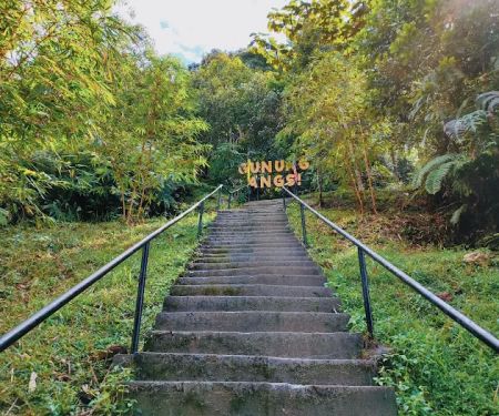
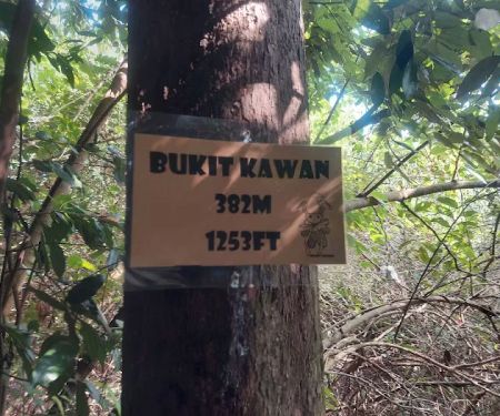
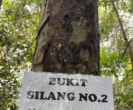
Gunung Berembun Trailhead Photos
Gunung Berembun Trailhead Location
Gunung Berembun Trailhead
Loji Rawatan Air Pantai, Mukim Pantai,, 71770 Pantai, Negeri Sembilan, Malaysia
 Gunung Berembun Trailhead
Loji Rawatan Air Pantai
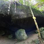 Gua Kambing
R23X+XV
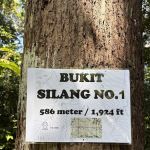 Bukit Silang Nombor 1
VX2R+VV
 Bukit Kelinchi
Terachi
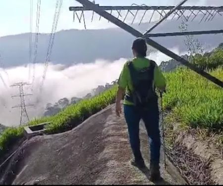
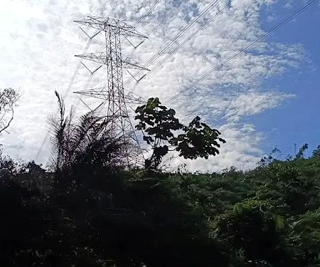
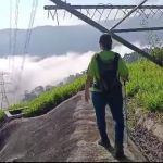 TNB tower 550M elevation
71600 Ulu Klawang
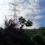 TNB tower 600M elevation
71600 Ulu Klawang
 Bukit Hosapa
Seremban
 Bukit Putus (Gunung Angsi Trailhead)
Jalan Kuala Pilah
 Wakaf Rehat Air Tok Embah
P29R+RV
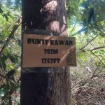 Bukit Kawan
QWVM+7V
 Gunung Angsi midway viewpoint
Bukit Putus-Angsi Trail
 Ulu Bendul-Angsi trailhead
2.727418N
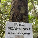 Bukit Silang Nombor 2
Ulu Klawang
Gunung Berembun Trailhead Reviews
Recommended for those that require a longer hike for training as Angsi and Datuk have shorter trails. 4-5h minimum back n forth peak, 6-7h if go to the plane crash site. Can also enjoy Lata Berembun mid hike.
May 04, 2025 · gazendazeThis hike has two parts, the first easy and almost flat and the second when from 700m height goes to1100m in 1km.I don't recommend it for beginners, because it is hard but can be done.
Mar 02, 2025 · javier infante meraThis is not a jungle wood, but a jungle forest. Good hike, clear signs on path, the closeness to "real" jungle very good. Why not 5 stars? Litter
Mar 22, 2025 · Jake FisherGreat place for training, well maintain trail.
Apr 14, 2025 · Huey Min TehModerate hiking. Good to train stamina.
Jun 03, 2025 · Ain 91
More Adventure
 Gua Kambing3.0 (1 reviews)
R23X+XV, Pantai, Negeri Sembilan, Malaysia
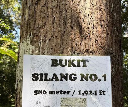 Bukit Silang Nombor 15.0 (1 reviews)
VX2R+VV, 71600 Pantai, Negeri Sembilan, Malaysia
 Bukit Kelinchi4.0 (1 reviews)
Terachi, Negeri Sembilan, Malaysia
 TNB tower 550M elevation0.0 (0 reviews)
71600 Ulu Klawang, Negeri Sembilan, Malaysia
 TNB tower 600M elevation0.0 (0 reviews)
71600 Ulu Klawang, Negeri Sembilan, Malaysia
 Bukit Hosapa0.0 (0 reviews)
Seremban, Negeri Sembilan, Malaysia
 Bukit Putus (Gunung Angsi Trailhead)4.0 (782 reviews)
Jalan Kuala Pilah, Seremban, Negeri Sembilan, Malaysia
 Wakaf Rehat Air Tok Embah0.0 (0 reviews)
P29R+RV, Seremban, Negeri Sembilan, Malaysia
 Bukit Kawan0.0 (0 reviews)
QWVM+7V, Seremban, Negeri Sembilan, Malaysia
 Gunung Angsi midway viewpoint5.0 (2 reviews)
Bukit Putus-Angsi Trail, Seremban, Negeri Sembilan, Malaysia
 Ulu Bendul-Angsi trailhead4.0 (271 reviews)
2.727418N ,102.0758E, Tanjung Ipoh, Negeri Sembilan, Malaysia
 Bukit Silang Nombor 20.0 (0 reviews)
Ulu Klawang, Negeri Sembilan, Malaysia
Categories
Popular
 Homestay Dahlia Gua Musang4.0 (12 reviews)
 Lubuk Mecu4.0 (74 reviews)
 Kedai sampah0.0 (0 reviews)
 Thai Odyssey @ Tropicana Golf & Country Resort4.0 (29 reviews)
 Ilham Homestay Banting4.0 (5 reviews)
 Amni Homestay0.0 (0 reviews)
Must-Read Blog Posts
Most Searched
Trending Blog Posts
 Exploring the Architectural Beauty of Mosques in Malaysia: A Journey Through Islamic Architecture
 Exploring the Unique Designs of Mosques in Malaysia: A Journey Through Islamic Architecture
 How to Get to the Famous Mosques in Kuala Lumpur by Public Transport: A Complete Travel Guide
 Visiting Malaysia’s Most Famous Mosques During Eid: A Unique Cultural Experience
 Top Mosques to Visit During Ramadan in Malaysia: A Traveler's Guide
 Discover the History of Masjid Titiwangsa in Kuala Lumpur: A Cultural and Architectural Gem