

Bukit Lagong Peak (Trig Station) Introduce
For many of us in Selangor, the allure of escaping the urban sprawl and reconnecting with nature is a powerful one. Whether you're a seasoned hiker seeking a new challenge or a beginner looking to dip your toes into the world of trekking, Selangor offers a diverse range of natural escapes. Among these, Bukit Lagong Peak (Trig Station) stands out as a rewarding destination, offering a genuine jungle experience right on the fringes of our bustling city.
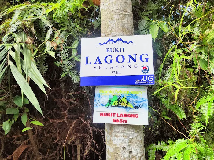
Bukit Lagong, with its peak marked by an old trig station, presents a unique blend of accessibility and adventure. It’s a place where you can immerse yourself in the lush greenery of the Malaysian rainforest, push your physical limits, and enjoy a sense of accomplishment upon reaching its 572-meter summit. This isn't just another walk in the park; it’s a proper hiking trail that promises to challenge and rejuvenate you.
This article is crafted especially for you, our fellow Selangor residents, to provide a comprehensive and practical guide to Bukit Lagong Peak (Trig Station). We'll cover everything you need to know, from how to get there and what facilities are available, to what to expect on the trail itself. Our aim is to equip you with the knowledge to safely and enjoyably explore this fantastic local hiking spot. So, put on your hiking shoes, prepare your spirit of adventure, and let's delve into what makes Bukit Lagong Peak a must-visit for nature lovers in Selangor.
Location and Accessibility
Bukit Lagong Peak (Trig Station) is nestled in the vicinity of Sungai Buloh, specifically at 47000 Sungai Buloh, Selangor, Malaysia. Its location offers a convenient escape for residents not just from Sungai Buloh itself, but also from surrounding areas within Selangor and even Kuala Lumpur, given its proximity to the city's fringes.
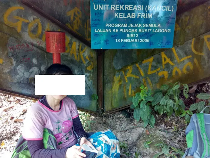
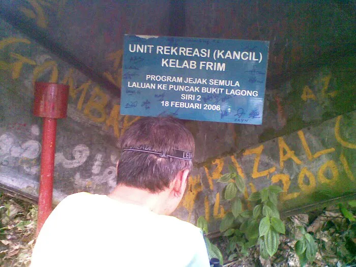
Accessing Bukit Lagong often involves a combination of driving and then proceeding on foot. Many hikers typically begin their journey from within the Forest Research Institute Malaysia (FRIM) area, though there are also other access points. If you are driving, there are parking areas available, often near the beginning of trailheads like Jalan Symington within FRIM. For instance, to reach the starting points from the main entrance of FRIM, you would navigate through the internal roads until you reach designated parking spots. It's advisable to use a navigation app to pinpoint the exact trailhead you plan to use, as Bukit Lagong has multiple routes leading to the peak.
While the exact primary access point may vary based on the trail chosen, the general vicinity of Sungai Buloh makes it quite accessible via major roads in Selangor. Public transport options might require a bit more planning, possibly involving a combination of KTM Komuter to Sungai Buloh station and then a short taxi or ride-sharing service to the trailhead. Given the nature of hiking, having your own transport or carpooling with friends is often the most convenient way to reach the various starting points.
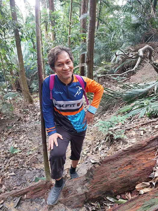
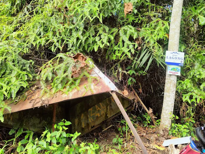
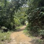
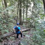
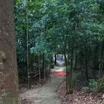
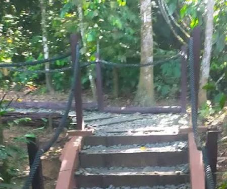
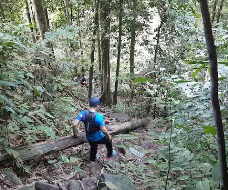
It's important to note that while some trails might be clearer than others, hikers have reported that certain paths, especially closer to the peak, can be raw and may require navigating around fallen logs and dense vegetation. This adds to the adventure but also emphasizes the need for proper preparation and awareness of your surroundings. The varied access points and trail conditions contribute to Bukit Lagong's reputation as a diverse and engaging hiking destination in Selangor.
Services Offered
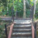
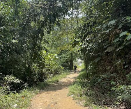
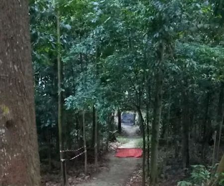
- Well-Marked Hiking Trails: While some sections can be challenging, key routes often feature trail markers (e.g., ribbon markers, painted rings on trees) to guide hikers towards the peak and various viewpoints.
- Natural Forest Environment: Provides an opportunity to experience a pristine rainforest setting with diverse flora and fauna.
- Varying Difficulty Levels: Offers trails suitable for both beginners and more experienced hikers, ranging from relatively easy sections to steep and challenging ascents.
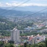
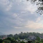
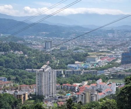
- Panoramic Viewpoints (along certain trails): Some routes pass by lookout points offering glimpses of the surrounding landscape, including distant city views on clear days, though the peak itself might not offer extensive views due to vegetation.
- Rest Areas (informal): Along some popular trails, there might be natural clearings or spots suitable for a quick rest and hydration.
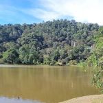
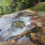
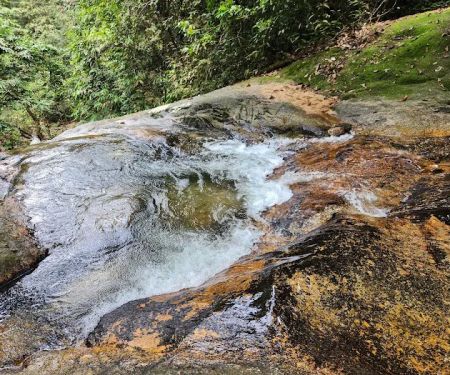
- Stream Access: Certain trails may lead past or cross streams, offering opportunities for a refreshing dip after the hike, particularly near some carpark areas.
- Basic Parking Facilities: Designated or informal parking areas are available near common trailheads, particularly within the FRIM vicinity.
Features / Highlights
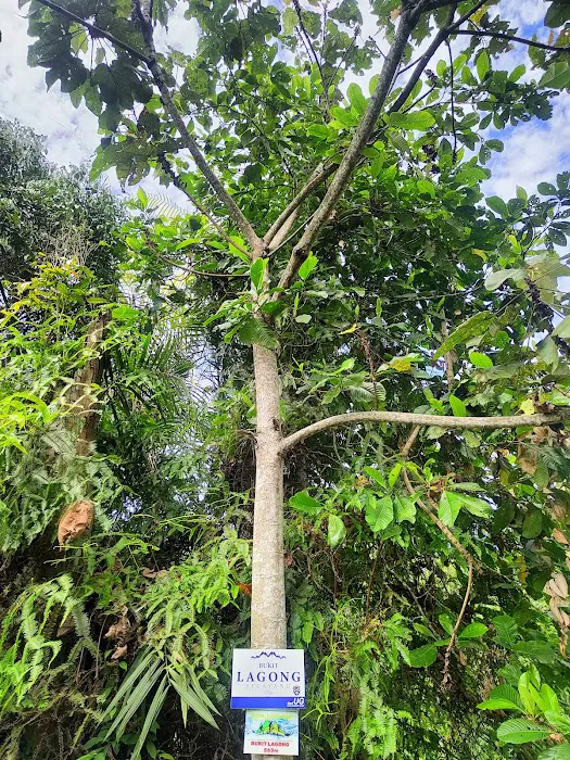
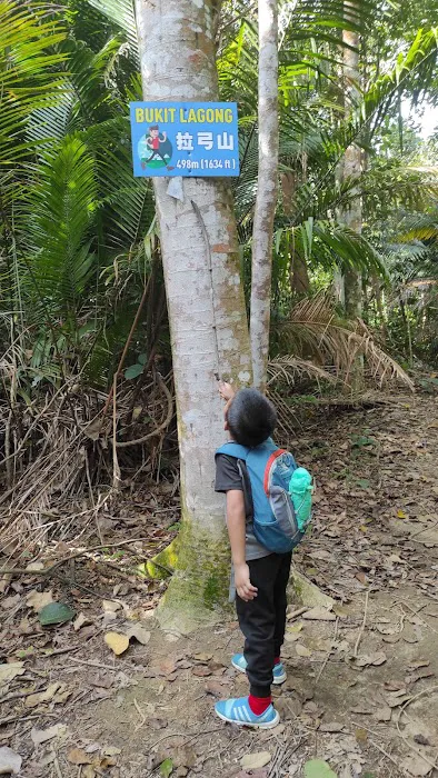
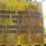
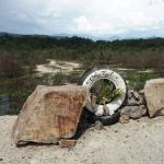
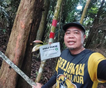
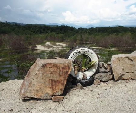
- Trig Station at the Peak: The 572-meter summit is marked by an old, often weathered, trig station, a unique landmark that signifies the achievement of reaching the highest point.
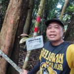
- Challenging Ascent: As noted by hikers, the trail to the peak can be "quite stiff" and "raw," making it a rewarding challenge for those seeking a proper workout and an adventurous hike.
- Estimated Hiking Duration: Typically takes around 2.5 to 3 hours to reach the peak, making it a manageable half-day activity for many, while return trips can also take similar time or slightly less depending on descent speed.
- Diverse Trail Conditions: Hikers will experience a variety of terrains, from wide, relatively flat paths (like sections of the Pipeline trail) to steep, narrow jungle paths with fallen logs and dense undergrowth, providing a varied and engaging hiking experience.
- Beginner-Friendly Sections: Despite its challenging peak, some parts of the trail are considered safe and suitable for beginners, allowing for a gradual progression in difficulty.
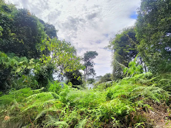
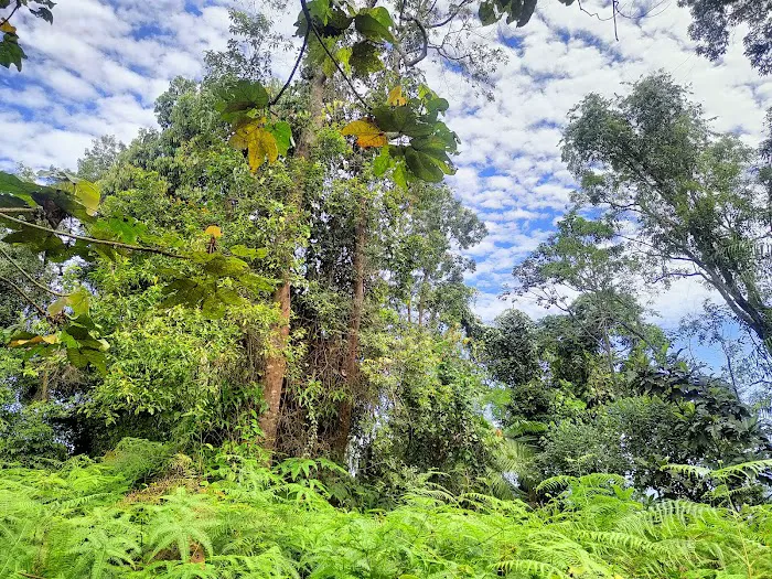
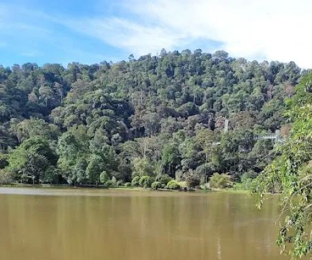
- Lush Greenery and Biodiversity: The area is rich in natural beauty, offering a refreshing escape into the rainforest with opportunities to observe local plant life and potentially wildlife.
- Sense of Accomplishment: Reaching the summit of Bukit Lagong Peak is a significant achievement for hikers, offering a rewarding feeling of conquering a local Selangor peak.
Promotions or Special Offers
As a natural hiking area, Bukit Lagong Peak (Trig Station) does not typically offer commercial promotions or special offers in the traditional sense, like discounts or package deals found at commercial attractions. Its appeal lies in the inherent value of experiencing nature and the physical challenge it provides. There are no entrance fees directly associated with hiking Bukit Lagong Peak itself, although if you access the trails via the Forest Research Institute Malaysia (FRIM) grounds, you might be subject to FRIM's standard entry fees or vehicle charges, if applicable to your chosen access point. However, this is distinct from a direct charge for the hiking trail to Bukit Lagong Peak.
Instead of commercial promotions, the "offer" here is the consistent availability of a natural, accessible, and challenging hiking experience for the local community. The value is in the free access to trails (outside of any potential FRIM gate fees), the physical and mental benefits of hiking, and the opportunity to connect with Selangor's natural landscape. Hikers are encouraged to check for any permit requirements from the Selangor Forestry Department, as some regulated forest reserves in Selangor may require an e-Permit (often a nominal fee of RM5 per person), although many hikers for Bukit Lagong report no specific permit needed for this particular peak.
Any "special offers" would likely come in the form of community-led trail maintenance days, guided hikes organized by local hiking groups, or informal tips shared within the hiking community about new shortcuts or clearer paths. These are not commercial promotions but rather contributions to the overall hiking experience by the community itself. Therefore, prepare for a natural experience without expecting any commercial discounts.
Contact Information
Address: 47000 Sungai Buloh, Selangor, Malaysia
For a natural hiking area like Bukit Lagong Peak (Trig Station), a direct phone number for the "hiking area" itself is not typically available, as it is an open natural space rather than a managed commercial entity with customer service lines. Most information regarding the trails, access points, and conditions is usually disseminated through online hiking communities, forums, or local forestry department advisories, if any.
If you require general information about forest reserves or permits in Selangor, the relevant authority would be the Jabatan Perhutanan Negeri Selangor (Selangor Forestry Department). Their official website or general contact numbers (which can be found through a general web search for "Jabatan Perhutanan Negeri Selangor") would be the appropriate channels for such inquiries.
For specific details about the trails of Bukit Lagong, the most reliable and up-to-date information often comes from fellow hikers who have recently visited. Online platforms, hiking groups on social media, and dedicated hiking blogs frequently share tips, route maps, and current trail conditions. Before planning your visit, it is highly recommended to consult these community resources for the latest on accessibility, trail clarity, and any advice from experienced trekkers.
Conclusion: Why this place is suitable for locals
Bukit Lagong Peak (Trig Station) is exceptionally well-suited for locals in Selangor for a multitude of reasons, making it a highly cherished natural asset right on our doorstep. Its prime location in Sungai Buloh means it's incredibly accessible for many residents across the state, offering a convenient escape from the urban environment without requiring extensive travel.
For Selangorians, the ability to reach a proper hiking trail within a relatively short drive is a significant advantage. This allows for spontaneous weekend adventures or even a quick morning hike before the heat sets in, fitting seamlessly into busy schedules. Unlike more remote peaks, Bukit Lagong offers a true wilderness experience that is still within reach, making it ideal for regular outdoor activity and fostering a healthier, more active lifestyle among the community.
Furthermore, Bukit Lagong caters to a wide spectrum of hiking enthusiasts. Whether you are a seasoned hiker looking for a challenging ascent to test your endurance, or a beginner keen on experiencing jungle trekking, the varied trails here offer something for everyone. The feedback from locals themselves confirms this versatility, with remarks highlighting it as suitable for "beginner's hiking safely" while also acknowledging its "quite stiff" and rewarding sections. This inclusive nature means families, groups of friends with mixed fitness levels, and solo adventurers can all find a suitable path to enjoy.
The natural environment itself is a major draw. In a rapidly developing state like Selangor, preserving and accessing green spaces is crucial. Bukit Lagong provides a vital lung for the region, offering fresh air, lush greenery, and an opportunity to reconnect with nature's tranquility. The physical benefits of the hike, from improved cardiovascular health to mental well-being derived from spending time outdoors, are invaluable for our local community.
Finally, the sense of accomplishment that comes with reaching the Trig Station at the 572-meter peak is a powerful motivator and a source of local pride. It’s a local landmark that encourages outdoor activity and a deeper appreciation for Selangor’s natural heritage. Bukit Lagong Peak is not just a hiking destination; it's a community asset that promotes health, well-being, and a connection to the beautiful natural landscape that defines our home in Selangor.
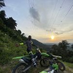
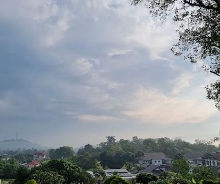
Bukit Lagong Peak (Trig Station) Photos
Bukit Lagong Peak (Trig Station) Location
Bukit Lagong Peak (Trig Station)
47000 Sungai Buloh, Selangor, Malaysia
 Bukit Lagong Peak (Trig Station)
47000 Sungai Buloh
 Bukit Lapo
68100 Selayang
 Bukit Lagong Trail Viewpoint
Bukit Lagong
 Hiking Trail
Taman Botani Frim
 Junction to skywalk
1146
 Bukit Lagong Trail Head
Jalan Bukit Lagong
 Bukit samak
7JM4+29
 Falls Commonwealth Rawang
7JR7+C6
 Mozzie Trail
Baru Selayang
 Taman Eko Rimba Kanching Trailhead
Taman Eko Rimba Kaching
 Kanching Waterfall Top
8J49+RW
 Damansara Damai Urban Park 2 ( Bike Park )
Damansara Damai
 Bukit Tadun kuang
Kuang
Bukit Lagong Peak (Trig Station) Reviews
572m to peak. Estimate time 2.5- 3hr to the peak. Please bring food and enough water to avoid exhaustion. Good trail and quite stiff.
Nov 16, 2024 · Norman MJGreat experience, beginner's hiking safely
Jul 17, 2024 · WTF DraculAGood
Feb 13, 2023 · Elvis- Mar 26, 2023 · Zhi Yong260
More Adventure
 Bukit Lapo5.0 (1 reviews)
68100 Selayang, Selangor, Malaysia
 Bukit Lagong Trail Viewpoint4.0 (16 reviews)
Bukit Lagong, 68100 Batu Caves, Selangor, Malaysia
 Hiking Trail4.0 (8 reviews)
Taman Botani Frim, 68100 Kuala Lumpur, Wilayah Persekutuan Kuala Lumpur, Malaysia
 Junction to skywalk5.0 (1 reviews)
1146, Jalan E 4/15, Taman Ehsan, 52100 Kuala Lumpur, Selangor, Malaysia
 Bukit Lagong Trail Head4.0 (99 reviews)
Jalan Bukit Lagong, Bukit Lagong, 68100 Batu Caves, Selangor, Malaysia
 Bukit samak0.0 (0 reviews)
7JM4+29, 48000 Rawang, Selangor, Malaysia
 Falls Commonwealth Rawang5.0 (2 reviews)
7JR7+C6, 48000 Rawang, Selangor, Malaysia
 Mozzie Trail2.0 (2 reviews)
Baru Selayang, 68100 Selayang, Selangor, Malaysia
 Taman Eko Rimba Kanching Trailhead4.0 (5 reviews)
Taman Eko Rimba Kaching, 48000 Rawang, Selangor, Malaysia
 Kanching Waterfall Top4.0 (110 reviews)
8J49+RW, 48000 Rawang, Selangor, Malaysia
 Damansara Damai Urban Park 2 ( Bike Park )5.0 (3 reviews)
Damansara Damai, 47810 Petaling Jaya, Selangor, Malaysia
 Bukit Tadun kuang0.0 (0 reviews)
Kuang, 47000 Rawang, Selangor, Malaysia
Categories
Popular
 Checheamat0.0 (0 reviews)
 myNEWS (Maru Kafe) @ Suria Jelutong 1 (G Floor)1.0 (5 reviews)
 karnox My Gaming Chair5.0 (1 reviews)
 Mangga Homestay0.0 (0 reviews)
 Ceria Eye Wear5.0 (3 reviews)
 Homestay Machang Sentral4.0 (30 reviews)
Must-Read Blog Posts
Most Searched
Trending Blog Posts
 Exploring the Unique Designs of Mosques in Malaysia: A Journey Through Islamic Architecture
 Exploring the Architectural Beauty of Mosques in Malaysia: A Journey Through Islamic Architecture
 How to Get to the Famous Mosques in Kuala Lumpur by Public Transport: A Complete Travel Guide
 Visiting Malaysia’s Most Famous Mosques During Eid: A Unique Cultural Experience
 Top Mosques to Visit During Ramadan in Malaysia: A Traveler's Guide
 Discover the History of Masjid Titiwangsa in Kuala Lumpur: A Cultural and Architectural Gem