

Kem Permatang Introduce
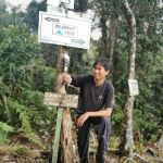
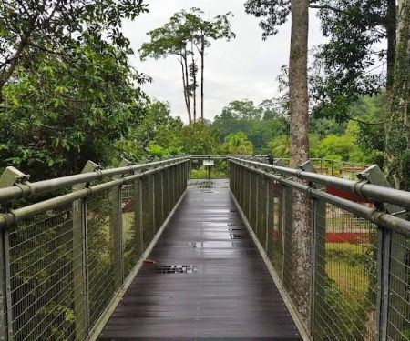
For avid hikers and adventure enthusiasts in Pahang, the name Gunung Tahan conjures images of challenging trails, pristine rainforests, and the ultimate Peninsular Malaysian summit conquest. Along the famed Merapoh route to this majestic peak, there are several key waypoints, and among them is Kem Permatang. More than just a camping ground, Kem Permatang serves as a vital rest stop and, crucially, a last reliable water source for trekkers embarking on one of Malaysia's most demanding hiking expeditions. While it might not be a leisurely "campground" in the typical sense with extensive facilities, its strategic importance and raw natural beauty make it an indispensable part of the Gunung Tahan experience for locals.
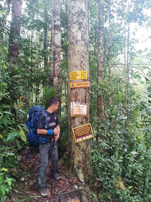
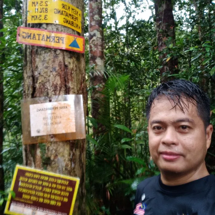
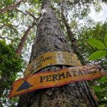
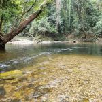
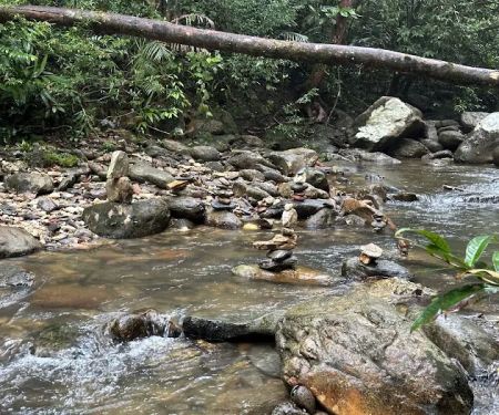
As one reviewer aptly put it, "Last water point available before heading up to Kem Kubang. Please fill up your bottle..your nightmare 3.5km hike start here. Good luck!" This colourful description perfectly encapsulates the role of Kem Permatang: a point of no return for hydration, signaling the imminent beginning of a truly arduous, yet incredibly rewarding, section of the hike. It’s a place where hikers gather their strength, mentally prepare for the challenging ascent, and ensure they have enough water to sustain them through the next gruelling leg of their journey towards the summit.
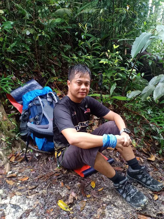
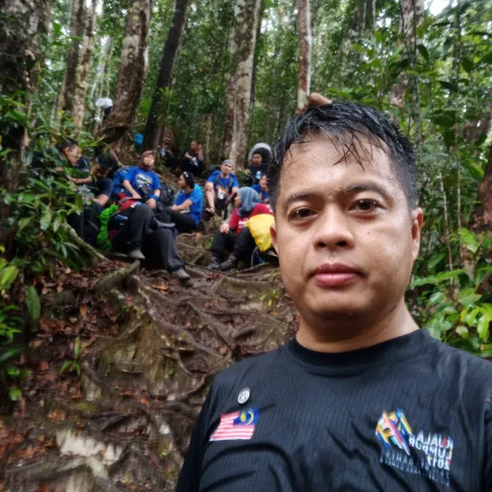
Beyond its practical function, Kem Permatang offers a moment to truly "hang out here to relax," as another reviewer noted. Surrounded by the dense, ancient rainforest of Taman Negara, it provides a brief respite where trekkers can appreciate the sounds and sights of nature. This is where the camaraderie among hikers often strengthens, as shared challenges foster bonds. For locals from Pahang, who understand the gravitas and allure of Gunung Tahan, Kem Permatang is a familiar and respected marker on a journey that tests limits and builds resilience. It’s a raw, authentic jungle experience, far removed from modern comforts, connecting hikers directly with the untamed heart of Malaysia's natural heritage.
Location and Accessibility
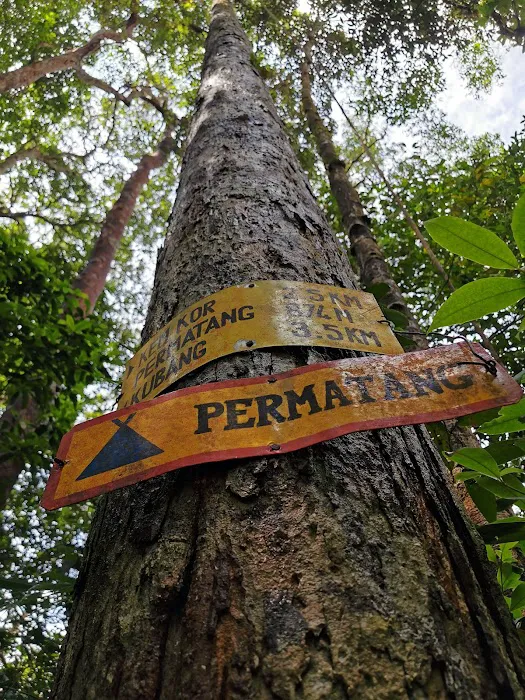
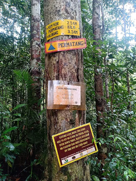
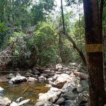
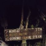
Kem Permatang is situated along the challenging Sungai Relau-Kuala Tahan route to Gunung Tahan, within the vast Taman Negara National Park in Pahang, Malaysia. Its address is generally referred to as an "Unnamed Road, Pahang, Malaysia," reflecting its remote, jungle location. More precisely, it is located between Kem Kor and Kem Kubang on the Merapoh (Sungai Relau) trail, at an altitude of approximately 874 meters.
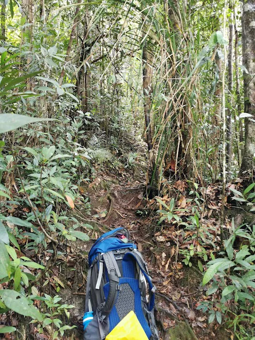
For locals in Pahang, accessing Kem Permatang means embarking on the multi-day trek to Gunung Tahan from the Merapoh entrance of Taman Negara. The journey typically begins from Merapoh town in Kuala Lipis, Pahang. From Merapoh, hikers usually take a 4x4 transfer to Kuala Juram, which serves as the trailhead and official registration point for the Gunung Tahan climb. From Kuala Juram, the trek to Kem Permatang involves several hours of hiking through the rainforest. The exact distance from Kuala Juram to Kem Permatang is approximately 16km, including the initial 4x4 transfer distance. Public transportation to Merapoh is available via bus, but a private car or organised transport is almost essential to get from Merapoh town to the Sungai Relau National Park entrance at Kuala Juram. Once at Kuala Juram, all hikers must be accompanied by a mandatory licensed guide and have the necessary permits from the Forestry Department. This ensures safety and adherence to park regulations. The remote nature of Kem Permatang means it is not accessible by casual day-trippers but is exclusively for serious trekkers undertaking the Gunung Tahan expedition.
Services Offered
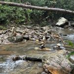
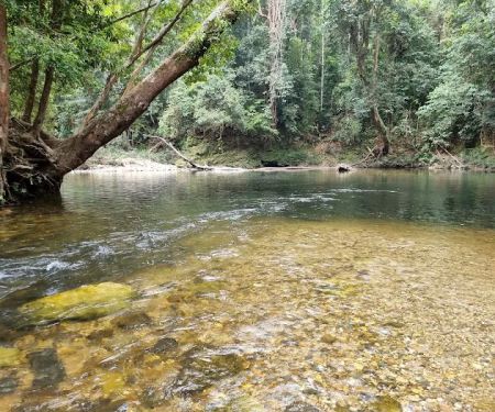
- Water Source: Crucially, Kem Permatang is known as one of the last reliable water points before more challenging and drier sections of the Gunung Tahan trail, specifically before the ascent to Kem Kubang. Hikers depend on this for refilling water bottles and preparing for the next leg.
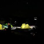
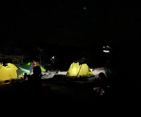
- Basic Camping Area: While not equipped with amenities, it serves as a designated, albeit basic, flat area suitable for pitching tents. Hikers carry their own camping gear.
- Rest Stop: It functions as a critical rest stop for hikers undertaking the multi-day Gunung Tahan trek, allowing them to recuperate, eat, and prepare for the arduous journey ahead.
- Designated Trail Marker: For trekkers following the Merapoh route, Kem Permatang serves as an important landmark and progress indicator on their journey to the summit.
- Emergency Shelter (unofficial): In unexpected heavy rain or emergencies, the relatively flat ground and surrounding trees might offer some natural shelter, though proper tents are always recommended.
Features / Highlights
- Strategic Location: Its primary highlight is its strategic location as a crucial water point and rest area on the Gunung Tahan Merapoh trail. It marks a significant transition point before the steeper and more challenging ascents.
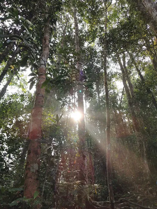
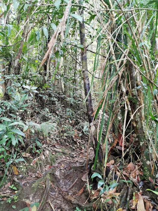
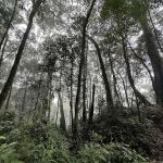
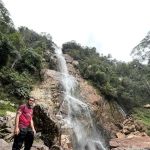
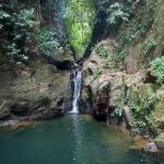
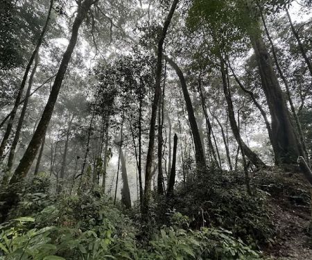
- Natural Forest Environment: Nestled deep within Taman Negara National Park, Kem Permatang offers an authentic, immersive experience in one of the world's oldest rainforests. The surrounding environment is pristine and rich in biodiversity.
- Tranquil Ambiance (for a brief moment): Despite its function as a high-traffic hiker's stop, the natural setting allows for moments of tranquility, where trekkers can truly appreciate the sounds and sights of the jungle, offering a brief mental and physical recharge.
- Sense of Accomplishment: Reaching Kem Permatang signifies progress on the challenging Gunung Tahan trek, offering a sense of accomplishment for hikers before they embark on the next difficult section.
- Part of an Iconic Trek: Being a segment of the Gunung Tahan expedition, a trek renowned for its difficulty and natural beauty, makes Kem Permatang a notable feature for any serious Malaysian hiker.
Promotions or Special Offers
As Kem Permatang is a basic, remote campsite and water point within Taman Negara National Park, there are no commercial promotions or special offers in the traditional sense. Access to the campsite itself is implicitly covered by the fees and permits required to enter Taman Negara and undertake the Gunung Tahan climb. These fees typically include:
- National Park Entry Permit: A mandatory permit required for all visitors entering Taman Negara.
- Camping Fee: A per-person, per-night fee that applies to all designated campsites within the park, including Kem Permatang.
- Guide Fee: A mandatory licensed guide must accompany all Gunung Tahan trekkers, and their fees would be part of the overall expedition cost, usually arranged through tour operators.
Any "special offers" would typically come from tour operators or trekking agencies organising Gunung Tahan expeditions, which might bundle permits, guide services, transportation, and equipment rental into a single package. It's advisable for locals interested in the Gunung Tahan trek to inquire with registered tour operators for comprehensive packages that cover all necessary permits and services.
Contact Information
Address: Unnamed Road, Pahang, Malaysia (Specifically, along the Gunung Tahan Merapoh trail, between Kem Kor and Kem Kubang).
Since Kem Permatang is a remote campsite within a national park and not a commercial establishment, there is no direct phone number or email address specifically for Kem Permatang itself. All official inquiries and arrangements for visiting this site (as part of the Gunung Tahan trek) must be made through:
- Taman Negara National Park Headquarters (Sungai Relau / Merapoh Office): This is the starting point for permits and guide arrangements.
- Department of Wildlife and National Parks (PERHILITAN): The overarching authority for the national park.
- Licensed Tour Operators/Trekking Agencies: These agencies handle bookings, guides, permits, and logistics for Gunung Tahan expeditions. They would be the primary point of contact for anyone planning a trek that includes Kem Permatang.
For the most accurate and up-to-date information regarding permits, guide requirements, and park regulations, locals should directly contact the Taman Negara Sungai Relau office or a reputable tour operator specialising in Gunung Tahan treks.
Conclusion: Why this place is suitable for locals
Kem Permatang, while not a conventional campground, is uniquely suitable and highly recommended for locals in Pahang who are serious about jungle trekking and aspire to conquer Gunung Tahan. Its suitability stems from its critical role in the arduous Merapoh trail and the authentic wilderness experience it offers.
For Pahang's adventure seekers, Kem Permatang represents a tangible step forward on a challenging personal journey. It’s a place where physical and mental endurance are tested, and where the raw beauty of Taman Negara is fully experienced. The fact that it's the "last water point" before a particularly strenuous section imbues it with a sense of importance and provides a crucial challenge that locals, known for their resilience, often relish. This isn't just about camping; it's about being part of an epic Malaysian adventure.
The experience at Kem Permatang, and indeed the entire Gunung Tahan trek, fosters deep connections with Malaysia's natural heritage. It's an opportunity to disconnect from urban life, push personal boundaries, and immerse oneself in one of the world's oldest rainforests. For local hiking communities, reaching Kem Permatang is a marker of progress and a shared experience that strengthens bonds and creates lasting memories. While lacking modern amenities, its very rawness is its appeal, offering an unadulterated taste of jungle life that resonates with those who truly seek adventure and a profound connection to Pahang's spectacular wilderness. It’s an essential rite of passage for many serious hikers, making it a truly iconic and relevant "campground" for locals.
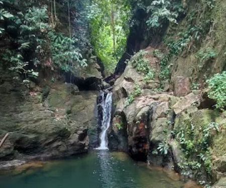
Kem Permatang Photos
Kem Permatang Location
Kem Permatang
Unnamed Road, Pahang, Malaysia
 Kem Permatang
Unnamed Road
 Kem Kor
Sungai Relau
 Kem Kubang
Unnamed Road
 Kem Belumut
Unnamed Road
 Kuala Luis
Unnamed Road
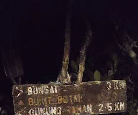
 Kem Bonsai
Unnamed Road
 Bukit Botak
Unnamed Road
 Kelah Sanctuary, Sungai Juram
Pahang
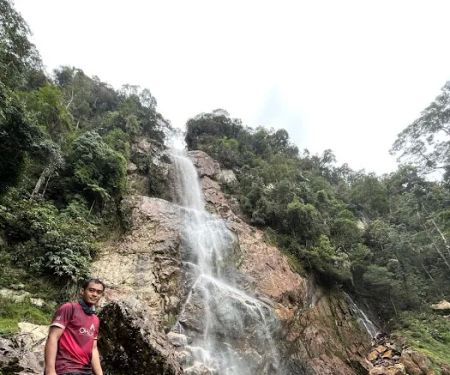
 4 Steps Waterfall
Kuala Tahan
 Taman Negara Sungai Relau
Taman Negara Sungai Relau
 Camp Teku
Pahang
 Amadi Kelah Sanctuary
R6X9+65
 Kolam 7 Tahun Gunung Rabong
Chiku
Kem Permatang Reviews
Last water point available before heading up to Kem Kubang. Please fill up your bottle..your nightmare 3.5km hike start here. Good luck ! 😅😍🧗
Apr 12, 2019 · flyYou can hang out here to relax
Nov 05, 2019 · Syed Abdullah Albaiti
More Theme Parks
 Kem Kor4.0 (12 reviews)
Sungai Relau, Pahang, Malaysia
 Kem Kubang4.0 (7 reviews)
Unnamed Road, Pahang, Malaysia
 Kem Belumut0.0 (0 reviews)
Unnamed Road, Kelantan, Malaysia
 Kuala Luis4.0 (3 reviews)
Unnamed Road, Pahang, Malaysia
 Kem Bonsai5.0 (3 reviews)
Unnamed Road, Pahang, Malaysia
 Bukit Botak5.0 (6 reviews)
Unnamed Road, Pahang, Malaysia
 Kelah Sanctuary, Sungai Juram4.0 (19 reviews)
Pahang, Malaysia
 4 Steps Waterfall5.0 (1 reviews)
Kuala Tahan, Pahang, Malaysia
 Taman Negara Sungai Relau4.0 (266 reviews)
Taman Negara Sungai Relau, Kampung Merapuh Lama, 27210 Kuala Lipis, Pahang, Malaysia
 Camp Teku5.0 (1 reviews)
Pahang, Malaysia
 Amadi Kelah Sanctuary0.0 (0 reviews)
R6X9+65, 18300 Kampong Batu, Kelantan, Malaysia
 Kolam 7 Tahun Gunung Rabong0.0 (0 reviews)
Chiku, 18300, Kelantan, Malaysia
Categories
Popular
 Kolam 7 Tahun Gunung Rabong0.0 (0 reviews)
 Restoran Fenomena Nasi Ulam Ayam Kampung4.0 (271 reviews)
 Homestay Fikrah Taman Marida Senawang (Muslim Only)5.0 (23 reviews)
 Al-Hidayah Mosque (Town Mosque)4.0 (130 reviews)
 Homestay Tok Mak D'Baruh5.0 (2 reviews)
 HOME STAY TOK AYAH MACHANG4.0 (4 reviews)
Must-Read Blog Posts
Most Searched
Trending Blog Posts
 Exploring the Architectural Beauty of Mosques in Malaysia: A Journey Through Islamic Architecture
 Exploring the Unique Designs of Mosques in Malaysia: A Journey Through Islamic Architecture
 How to Get to the Famous Mosques in Kuala Lumpur by Public Transport: A Complete Travel Guide
 Visiting Malaysia’s Most Famous Mosques During Eid: A Unique Cultural Experience
 Top Mosques to Visit During Ramadan in Malaysia: A Traveler's Guide
 Discover the History of Masjid Titiwangsa in Kuala Lumpur: A Cultural and Architectural Gem