
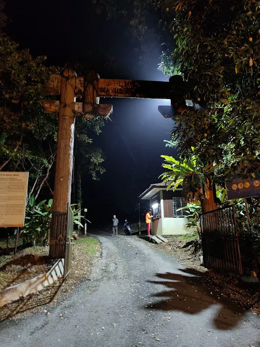
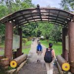
Nuang trailhead Introduce
For seasoned hikers and ambitious beginners in Selangor, Gunung Nuang stands as a formidable yet highly rewarding challenge. Towering at 1,493 meters, it's one of the highest peaks in Selangor and a popular training ground for those eyeing even loftier summits. The journey begins at the Nuang Trailhead in Hulu Langat, a gateway to an exhilarating adventure that tests both physical endurance and mental fortitude. As locals, we are incredibly fortunate to have such a magnificent natural wonder within our reach, offering a profound connection with Selangor's lush rainforests.
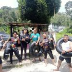
Gunung Nuang is not a hike for the faint-hearted. It’s an "almost 13-hour hike," a testament to its difficulty and the sheer distance covered. Reviewers consistently describe it as "Hard," requiring significant preparation. However, the recurring sentiment is that with the right mindset and preparation, it is achievable. As one hiker aptly put it, "if I can do it, you can too." This encouragement reflects the spirit of the hiking community in Selangor – a supportive environment that champions personal growth through challenging outdoor pursuits.
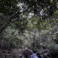
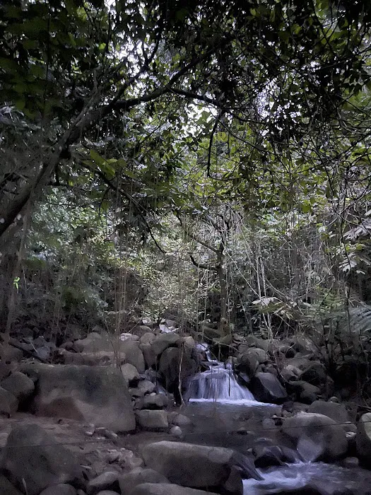
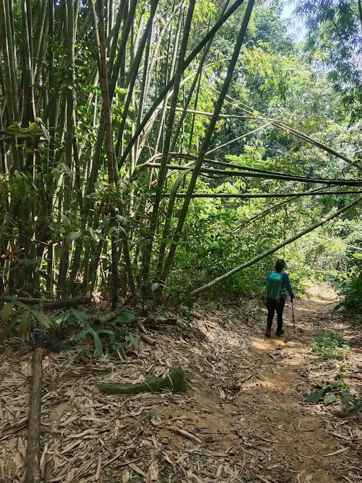
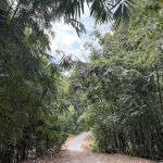
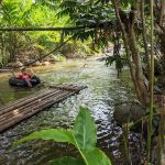
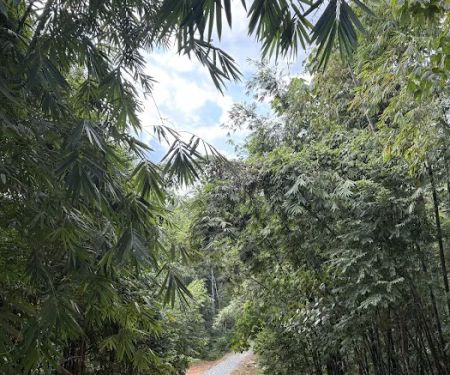
Beyond the physical exertion, the hike through Gunung Nuang offers an immersive experience in Selangor's rich biodiversity. From the initial "never-ending-winding-road" to the dense jungle trails, you'll be surrounded by nature's symphony. While the trail can be notoriously muddy, particularly from Kem Pengasih to the peak, this is part of the raw, unfiltered experience of rainforest trekking. For those in Selangor seeking not just a hike, but an epic adventure that pushes boundaries and offers unparalleled satisfaction upon reaching the peak, Nuang Trailhead promises an unforgettable journey.
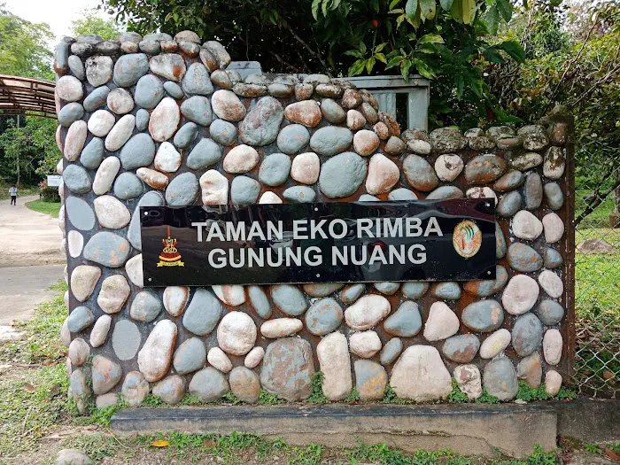
The Nuang Trailhead is located at B52, Kampung Kuala Pansoon, 43100 Hulu Langat, Selangor, Malaysia. This places it deep within the scenic Hulu Langat district, an area well-known to Selangor residents for its natural beauty, including rivers, waterfalls, and lush rainforests. It’s a popular spot for those seeking an escape from the urban environment.
Accessibility to the Nuang Trailhead is primarily by private vehicle. From various parts of Selangor, you'll drive into Hulu Langat via well-maintained roads, which become more winding and rural as you approach Kampung Kuala Pansoon. While the journey is picturesque, it's essential to use a GPS or navigation app for precise directions to the trailhead, as signage might not always be prominent in these natural areas. The trailhead is described as having "Sufficient parking spaces available," which is a significant convenience for hikers planning to spend a full day (or more) on the mountain.
Public transport options are very limited for reaching such a remote hiking area. While buses serve the main towns in Hulu Langat, getting directly to the Nuang Trailhead would likely require a taxi, ride-hailing service, or pre-arranged private transport. Most hikers coming to Gunung Nuang typically arrange their own transport or join hiking groups that organise shared transportation. The trailhead's location near Kampung Kuala Pansoon means you're truly entering a natural reserve, a feature highly valued by those in Selangor seeking an authentic and immersive hiking experience. Its proximity to other popular nature spots in Hulu Langat, such as Sungai Congkak and Air Terjun Sungai Lepoh, also adds to its appeal as a comprehensive outdoor destination.
The Nuang Trailhead, while primarily a starting point for a challenging hike, offers essential services and facilities that are crucial for hikers embarking on the extensive journey to Gunung Nuang's summit. Based on direct customer reviews and common practices for managed forest reserves, here’s what you can expect:
Services Offered:
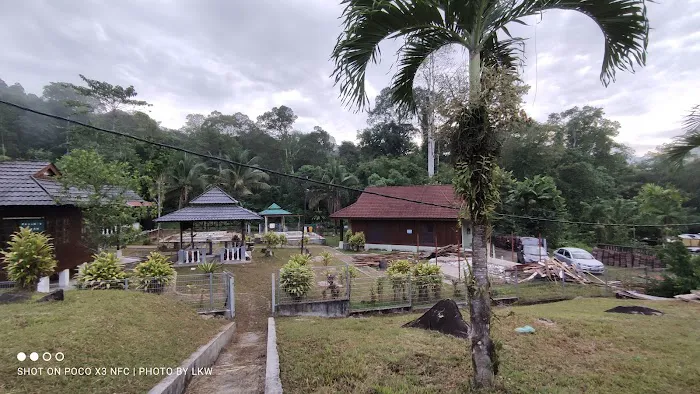
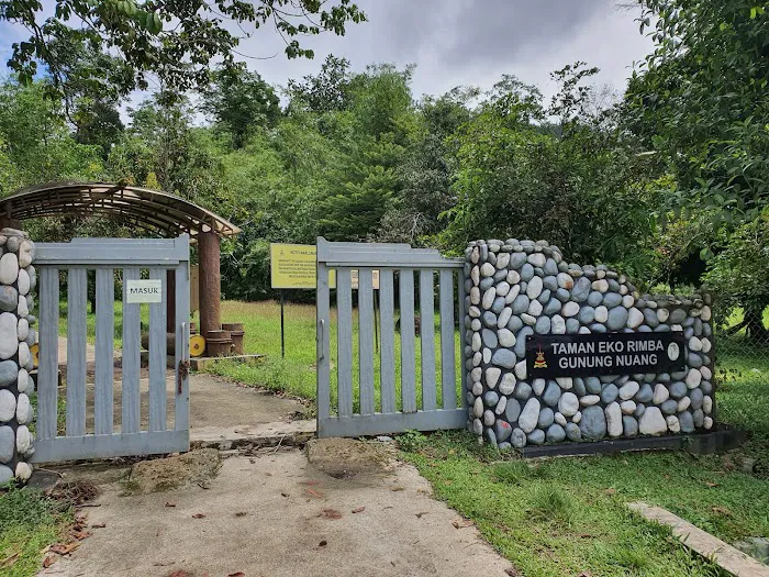
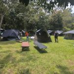
- Toilet/Dressing Rooms: Available right at the trailhead/entrance. This is a critical facility for hikers before and after their long trek, allowing for preparation and a refresh.
- Parking Spaces: "Sufficient parking spaces available at the trailhead," ensuring convenience for visitors arriving by private vehicle.
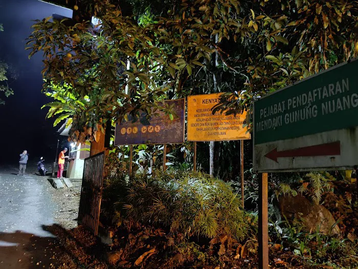
- Permit Application Process (Online): As of April 1, 2025, permits for hiking in Selangor's Permanent Reserve Forests, including Gunung Nuang, must be applied for online via the Selangor Forestry e-Permit System (SeForest). Applications must be submitted at least 48 hours before the visit, and payment completed within 24 hours of approval. (Note: Previously, permits were not available for purchase at the trailhead itself, and this online system is a recent update).
- Requirement for Malim Gunung (Mountain Guide): For hiking Gunung Nuang, it is often required to have a certified Malim Gunung (mountain guide) with your group. These guides typically handle the permit application process for their groups. This service, though not provided directly by the trailhead, is an essential part of accessing the hike safely and legally.
- Water Source Access: The last reliable water source on the trail is explicitly noted at Kem Lolo. Hikers can refill their bottles here.
- Basic Information/Ranger Station: While not explicitly detailed, trailhead entrances to Permanent Reserve Forests usually have a ranger station where visitors register (though permit purchase is now online) and may receive basic information or safety briefings.
These services, particularly the on-site amenities and crucial permit/guide requirements, are vital for anyone in Selangor planning to tackle the demanding Nuang hike, ensuring a degree of preparedness and compliance with regulations.
Gunung Nuang, accessed via the Nuang Trailhead, offers a range of features and highlights that make it a compelling destination for serious hikers in Selangor. The insights from actual hikers provide a realistic view of what to expect on this challenging journey.
Features / Highlights:
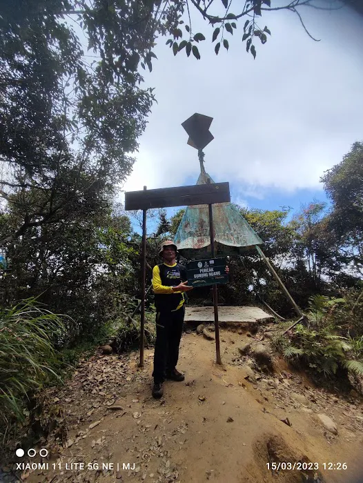
- Challenging Difficulty: Categorised as "Hard," Gunung Nuang is a true test of endurance and mental strength. This makes it an ideal objective for experienced hikers seeking a significant challenge or ambitious beginners looking to push their limits after proper training.
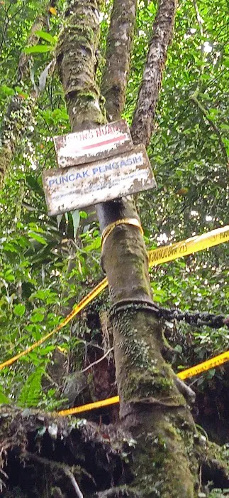
- Clear Trail Markings (Mostly): Despite the difficulty, the "trail is easy to follow except for maybe after the first river crossing." Awareness of "markings left on the trees" is key, indicating a maintained but rugged path.
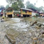
- Diverse Terrain: The hike encompasses varied terrain, from the "undulating stony track" (the "never-ending road") at the start, to multiple river crossings, and incredibly "steep and challenging" sections like from Kem Pacat to Kem Pengasih. The path also includes notorious "very muddy" stretches from the middle part to the peak area, especially if it has rained, adding to the adventure.
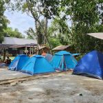
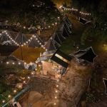
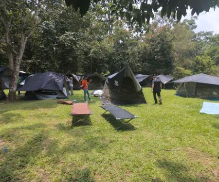
- Strategic Campsites/Rest Points: Key checkpoints like Kem Lolo (with a last water source and a lovely waterfall nearby, approx. 2-3 hours from the entrance) and Kem Pacat (approx. 3 hours from entrance) serve as crucial rest or overnight camping spots, allowing hikers to break up the arduous journey.
- Significant Elevation Gain: As one of Selangor's highest peaks, the hike involves substantial elevation gain, offering a rigorous physical workout and a rewarding sense of accomplishment upon reaching the summit.
- Cold Peak Conditions: The summit can get "really really cold," even in Malaysia’s tropical climate, indicating a dramatic change in temperature that adds to the unique experience of reaching the top of a high mountain.
- Immersive Nature Experience: The trail winds through dense rainforest, offering an opportunity to be fully immersed in Selangor's natural environment, surrounded by the sights and sounds of the jungle.
These features collectively define the Gunung Nuang experience – a demanding yet deeply satisfying trek that appeals to those in Selangor looking for a significant outdoor adventure.
As a designated Permanent Reserve Forest and a challenging hiking trail, Nuang Trailhead does not typically offer "promotions" or "special offers" in the commercial sense. Access is regulated by permits and official requirements, rather than through discounts or marketing incentives.
However, from the perspective of a local hiker in Selangor, the "offers" come in the form of crucial access and regulatory support:
- Regulated Access through e-Permit System: The implementation of the Selangor Forestry e-Permit System (SeForest) as of April 1, 2025, can be seen as a "promotion" of efficiency and convenience for hikers. This online system simplifies the permit application process, making it "more accessible, efficient, and environmentally friendly by reducing paperwork," compared to previous manual methods. The permit fee is a standard RM5 per head, a nominal charge for access to a protected natural resource.
- Mandatory Malim Gunung (Mountain Guide) Guidance: While an additional cost, the requirement for a certified Malim Gunung provides a "special offer" of enhanced safety, expert navigation, and adherence to regulations, which is invaluable for such a demanding hike. These guides are essential for preparing permit applications and ensuring a safe journey.
- Well-Maintained Basic Facilities: The consistent availability of clean toilets/dressing rooms at the trailhead and sufficient parking spaces are valuable "offers" of convenience that significantly improve the overall hiking experience, ensuring hikers start and end their journey comfortably.
It's important for hikers to understand that the focus here is on regulated access and safety for a challenging natural environment, rather than commercial promotions. The "value" lies in the ability to safely and legally experience one of Selangor's most iconic and demanding hiking trails. Always check the latest requirements and fees via the Selangor Forestry Department's official channels or through your registered Malim Gunung.
For those in Selangor planning to conquer Gunung Nuang, here is the essential contact and permit information. Direct contact for the trailhead itself is limited, as it is managed as part of a Permanent Reserve Forest. However, inquiries are directed to the relevant forestry department and certified guides.
Contact Information:
- Trailhead Address: B52, Kampung Kuala Pansoon, 43100 Hulu Langat, Selangor, Malaysia
- Permit Application (from April 1, 2025):
- Platform: Selangor Forestry e-Permit System (SeForest)
- Website: Official Selangor Forestry Department website (check for the e-Permit application link)
- Requirement: Apply at least 48 hours before your planned visit.
- Malim Gunung (Mountain Guide):
- It is generally required to hike Gunung Nuang with a certified Malim Gunung. They can assist with permit applications and provide essential guidance.
- You can find lists of certified guides through associations like the Malim Gunung Perhutanan (MGP) or by searching online for reputable hiking groups/agencies in Selangor that organise Gunung Nuang treks.
- Selangor Forestry Department (for general inquiries on forest reserves/permits):
- General Contact Number: For inquiries regarding Permanent Reserve Forests in Selangor, you might find general contact numbers for the Selangor State Forestry Department (Jabatan Perhutanan Negeri Selangor) on their official website.
It is crucial for all hikers to adhere to the permit requirements and engage a certified guide for safety and compliance. This information ensures you are well-prepared for your adventure at Nuang Trailhead.
For locals in Selangor, the Nuang Trailhead offers an unparalleled opportunity for a challenging yet incredibly rewarding hiking experience, making it highly suitable for specific types of outdoor enthusiasts.
Firstly, its location in Hulu Langat means it's relatively accessible for many residents of Selangor. While the hike itself is long, the drive to the trailhead is manageable for a day trip or a planned overnight stay for those wanting to break up the ascent. This convenience allows us to access a significant mountain experience without needing to travel far out of state. For individuals and groups keen on pushing their physical and mental limits, Gunung Nuang provides an ideal and formidable training ground right in our backyard.
Secondly, despite its difficulty, the clear trail markings (with awareness) and the presence of essential facilities like toilets at the trailhead and water sources at Kem Lolo contribute to a safer and more organised experience. This attention to basic hiker needs, coupled with the mandatory requirement of a certified Malim Gunung and the streamlined online permit system, ensures that the trek is undertaken with a level of professionalism and safety that is vital for such a demanding journey. This is particularly appealing to those who value structured and secure outdoor adventures.
Furthermore, for the adventurous souls and those seeking a true sense of accomplishment, conquering Gunung Nuang offers immense satisfaction. The journey through challenging, muddy terrain and steep ascents culminates in reaching one of Selangor's highest peaks, a feat that builds resilience and provides memorable bragging rights. The insights from seasoned hikers highlight the mental fortitude required, emphasizing that this isn't just about physical strength but also about pushing through personal barriers. For our community in Selangor that thrives on outdoor challenges and personal growth, Nuang Trailhead presents an ultimate test and a deeply fulfilling connection with the majestic natural landscapes of our state.
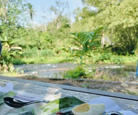
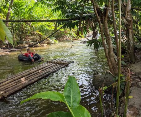
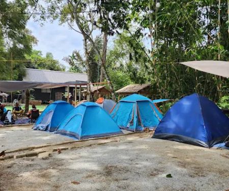
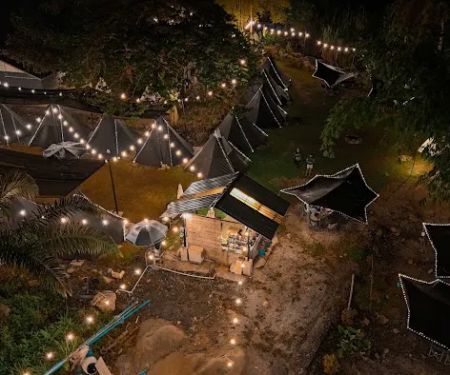
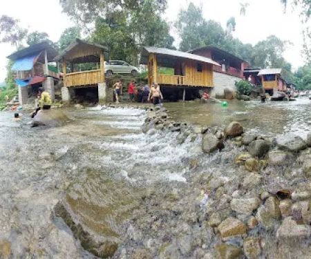
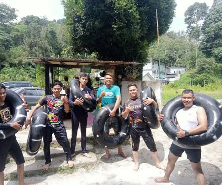
Nuang trailhead Photos
Nuang trailhead Location
Nuang trailhead
B52, Kampung Kuala Pansoon, 43100 Hulu Langat, Selangor, Malaysia
 Nuang trailhead
B52
 Taman Eko Rimba Nuang
Nuang trailhead
 Gunung Nuang Recreational Forest
Kampung Pungsun
 Koibito Campsite
B52
 Jerinis Dusun Campsite
Batu 22 1/2
 Suraya Riverside
TNB Pangsun
 D pangsun river
11599
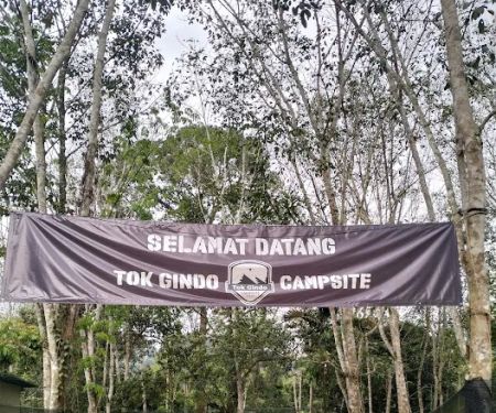
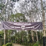 Tok Gindo Campsite
Batu 22 Kampung Orang Asli Kuala Pomsom
 Last Exit @Pangsun
Lot 13555 Batu 22 1/2
 Skycamp by Skytrex
Lot 3637
 Campsite atok am
Lot 3460
 Kem Idaman Nurani 2
43100 Hulu Langat
 Teratak Epul Pelampung
Batu 21 Jalan hulu Langat
Nuang trailhead Reviews
Trail: Trail is easy to follow except for maybe after the first river crossing especially in the dark, it seems like there are a couple of trails to be followed. Be aware of the markings left on the trees and you should be fine. If it didn't rain the night before, the trail will be fairly dry except from Kem Pengasih to the peak. The muddiest trail I've ever hiked in.Difficulty: Hard. If you’re a beginner and you’re wondering if you can hike Nuang, I’m a beginner myself and if I can do it, you can too. Try hike a couple of hills/mountains or climb the stairs every day a week or two before the hike and you should be okay. The most important thing is to prepare mentally. Know what to expect and prepare accordingly. I made a mistake of bringing too many snacks and in the end, I only ate a small amount of it. If I were to do it again, I’d bring about 2-2.5 litres of water, a couple of apples, energy bars and sandwiches. And a first-aid kit. That’s all. I started around 5am and ended the hike at around 5:50pm, so it’s an almost 13-hour hike so prepare accordingly.Facilities: Toilet/dressing rooms only available at the trailhead/entrance. Last water source is at Kem Lolo. We did our Subuh and Zohor there. Sufficient parking spaces available at the trailhead.Permit: Not available to purchase at the trailhead. I think you must apply a week before the hike. Most hikers came with a group, and I believe to hike Nuang, you are required to have a Malim Gunung with you, so they’re the one who prepares the application. A fee of RM5 per head for the permit.Others: Hiking pole helped me tremendously and so does gloves. Kem Pacat to Kem Pengasih is very very steep and challenging so be careful of your surroundings so as not to fall. Take it easy, rest when you need to and good luck! Oh and it gets really really cold at the peak so bring a jacket.Not proofread so grammar mistakes abound!
Feb 26, 2024 · I. Ibrahim12 Hours hike😅 don't play play, this is not for the weak ones. Very muddy from middle part to peak area. Mental power must be kuat 💪Bring: gloves, Food, enough small bites, minimum 2 to 3 litre of water & softdrinks, painkiller cream/spray/medicine, hiking stick and lastly bring your smile when reach the peak 😄
Jul 31, 2022 · Ray ChongThis trail is 20km return trip, elevation about 1600EG. Normal time 8 to 12 hours to complete.Do your due diligence before conquering this mountain.Easier trail to complete Gunung Nuang is via Janda Baik which you can complete it within 8 hours.Before conquer Gunung Rajah, please complete this trail first.Trailhead -> 6 huts -> start hike Camp Lolo -> Camp Pacat (make sure you're not damn tired here) rest and eat -> Puncak Pengasih -> Puncak Nuang 😀Recommended 4L of water, 2 meals, 3 snacks, 2 powerbars, 2 powergels, hiking pole&raincoat(this trail most of the time is muddy), hiking glovesBeware of rainy season, the trail will be muddy and it's slippery. Must be aware of the pouring water from the Hill top if it's raining.Camp Lolo waterpoint if you're lack of water.Camp Pacat does not have water point.
Jun 12, 2022 · Mike TehMake sure bring more than 3 litres, bring enough food and energy bar. Go with friends with well training, no newbie for this hill. minimum 8 hours go and return for medium level hiker
May 01, 2022 · Neskson Tan Chong HaoToilet provided ✅Parking ✅Hiking Permit from office ✅
Oct 09, 2022 · Qila MinionsFamily
More Theme Parks
 Taman Eko Rimba Nuang5.0 (3 reviews)
Nuang trailhead, B52, Kampung Kuala Pansoon, 43100 Hulu Langat, Selangor, Malaysia
 Gunung Nuang Recreational Forest4.0 (499 reviews)
Kampung Pungsun, 43100 Hulu Langat, Selangor, Malaysia
 Koibito Campsite0.0 (0 reviews)
B52, Kampung Kuala Pansoon, 43100 Hulu Langat, Selangor, Malaysia
 Jerinis Dusun Campsite0.0 (0 reviews)
Batu 22 1/2, Kampung Kuala Pansoon, 43100 Hulu Langat, Selangor, Malaysia
 Suraya Riverside4.0 (12 reviews)
TNB Pangsun, Jalan, Kampung Kuala Pansoon, 43100 Hulu Langat, Selangor, Malaysia
 D pangsun river4.0 (5 reviews)
11599, B52, Kampung Kuala Pansoon, 43100 Hulu Langat, Selangor, Malaysia
 Tok Gindo Campsite4.0 (20 reviews)
Batu 22 Kampung Orang Asli Kuala Pomsom, Kampung Lepok, 43100 Hulu Langat, Selangor, Malaysia
 Last Exit @Pangsun3.0 (23 reviews)
Lot 13555 Batu 22 1/2, Kuala Pangsun, Kampung Lepok, 43100 Hulu Langat, Selangor, Malaysia
 Skycamp by Skytrex4.0 (44 reviews)
Lot 3637, Jln Sungai Lepoh, Kampung Orang Asli, 43100 Hulu Langat, Selangor, Malaysia
 Campsite atok am4.0 (15 reviews)
Lot 3460, batu 22 sungai lopo, 43100 Hulu Langat, Selangor, Malaysia
 Kem Idaman Nurani 24.0 (9 reviews)
43100 Hulu Langat, Selangor, Malaysia
 Teratak Epul Pelampung1.0 (1 reviews)
Batu 21 Jalan hulu Langat,kuala pansoon, Kampung Lubuk Manggis, 43100 Hulu Langat, Selangor, Malaysia
Categories
Popular
 The White Bricks Kota Bharu5.0 (1 reviews)
 Luminor Co Living Space0.0 (0 reviews)
 Hidayah Duke3.0 (2 reviews)
 taman tas5.0 (2 reviews)
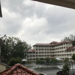 Asrama Blok A ILKAP3.0 (14 reviews)
 BUNDLES.MY KLANG3.0 (21 reviews)
Must-Read Blog Posts
Most Searched
Trending Blog Posts
 Exploring the Architectural Beauty of Mosques in Malaysia: A Journey Through Islamic Architecture
 Exploring the Unique Designs of Mosques in Malaysia: A Journey Through Islamic Architecture
 How to Get to the Famous Mosques in Kuala Lumpur by Public Transport: A Complete Travel Guide
 Visiting Malaysia’s Most Famous Mosques During Eid: A Unique Cultural Experience
 Top Mosques to Visit During Ramadan in Malaysia: A Traveler's Guide
 Discover the History of Masjid Titiwangsa in Kuala Lumpur: A Cultural and Architectural Gem