
TRAIL HEAD GUNUNG LIANG Introduce
Perak, with its lush landscapes and towering peaks, offers an abundance of opportunities for nature enthusiasts and adventure seekers. Among these, TRAIL HEAD GUNUNG LIANG stands out as a formidable, yet incredibly rewarding, destination for hikers looking to push their limits and immerse themselves in the pristine beauty of Malaysia's natural environment. This comprehensive guide is crafted to provide local users in Perak with all the essential information needed to plan an unforgettable hiking expedition to Gunung Liang.
Gunung Liang, with its twin peaks, Gunung Liang East and Gunung Liang West, reaches an impressive height of 1933 meters (6342 feet) above sea level. It is widely considered a challenging hike, demanding good physical fitness, mental fortitude, and proper preparation. Unlike some other mountains, Gunung Liang is known for its continuous climbs and steep ascents, making it a true test of endurance. Many hikers compare its difficulty to that of Gunung Nuang from Camp Lolo to Camp Pacat, or even tougher than Gunung Semangkok. The journey to the summit typically takes an average of 5 to 7 hours for ascent and 4 to 6 hours for descent, with the entire out-and-back trail being approximately 18.3 km to 22 km long, depending on the specific route and whether both peaks are attempted.
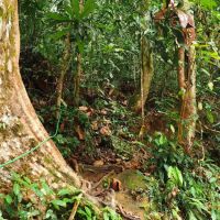
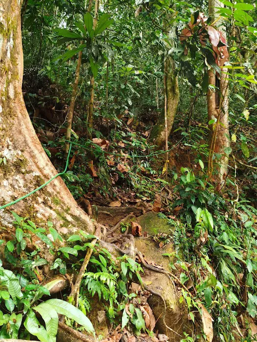
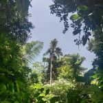
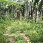
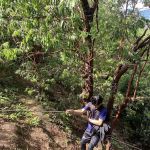
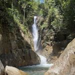
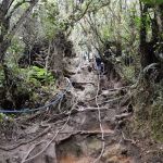
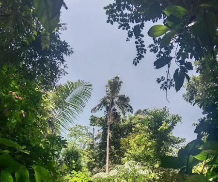
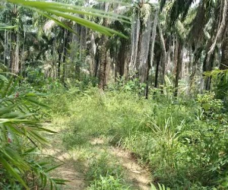
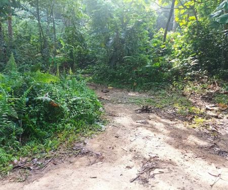
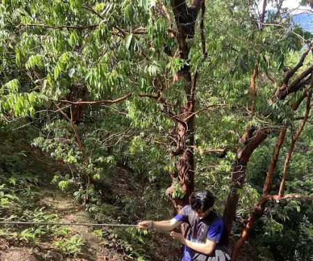
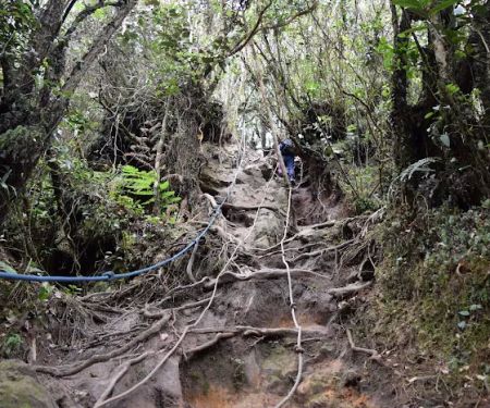
The trail itself is a marvel of natural beauty, transitioning from steady climbs to more technical sections with plenty of tree roots to navigate. Hikers will encounter varying landscapes, including beautiful narrow bamboo alleys that evoke an autumnal feel, and eventually, the mystical mossy forest near the peaks. The rewarding panoramic views from the summit, especially on a clear day, are nothing short of breathtaking and make every challenging step worthwhile. It's a truly immersive experience that allows you to disconnect from the urban hustle and reconnect with nature.
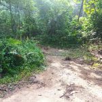
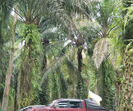
TRAIL HEAD GUNUNG LIANG is nestled in Behrang Ulu, Perak, making it a relatively accessible, albeit challenging, destination for those residing in and around the Perak region. The exact address for the trailhead is QGCC+8Q, 35900 Behrang Ulu, Perak, Malaysia. For navigation, some hikers use the GPS coordinates 3.796894,101.527167, which point to the car park area near the trailhead. Another useful landmark for locating the area is "Kebun Behrang, Slim River, Perak." Once you reach Kebun Behrang, continue straight along the road until you spot the trailhead.
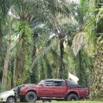
For those traveling by car, the trailhead is about 1.5 hours' drive from Kuala Lumpur, making it a feasible day trip or a weekend adventure for many. While there is limited car park space available, carpooling is highly recommended to alleviate congestion and ensure sufficient parking for all hikers. It's important to note that the immediate trailhead does not have extensive public facilities, so it's advisable to be self-sufficient with your preparations.
While TRAIL HEAD GUNUNG LIANG is primarily a natural, undeveloped hiking area, there are a few important aspects to consider regarding available services and necessary arrangements:
- Permit Application: A permit is definitely needed from the Forestry Department before embarking on your hike. This can often be arranged through the Pejabat Hutan Daerah Perak Selatan or via online application through the Forestry Department of Malaysia website (ecotourism.perakforestry.gov.my). It is strongly advised to secure your permit in advance to avoid any issues.
- Guide Recommendation: While a guide is not strictly required for the hike itself, for those unfamiliar with the terrain or seeking an added layer of safety, engaging a local guide is a good option. They can also assist with permit arrangements.
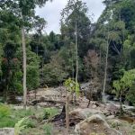
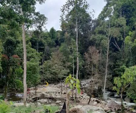
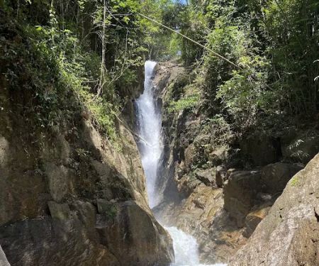
- Water Sources: Hikers will find water sources along the trail, notably at Camp 7E, which is a popular last water point before the final ascent to the peak. There are also rivers for washing up, particularly at Lubuk Hantu, but caution is advised, especially during the night or if water levels are high due.
- Campsites: There are designated (though basic) campsites such as Lubuk Hantu and Camp 7E. Lubuk Hantu, while near a river, is known for leeches, especially during wet seasons. Camp 7E offers a larger space and is generally preferred for overnight stays due to fewer leeches and proximity to a water source.
Gunung Liang offers a wealth of natural features and highlights that make the challenging ascent worthwhile:
- Dual Peaks: The mountain boasts two distinct peaks, Gunung Liang East and Gunung Liang West, each offering a unique experience. Liang East has a more tropical feel with a grassy path, while Liang West is renowned for its enchanting mossy forest, which provides a temperate and mystical ambiance.
- Diverse Terrain: The trail is a dynamic mix of steady climbs, challenging steep sections, and areas requiring hikers to use tree roots and even their upper body strength to pull themselves up. This variety keeps the hike engaging and tests different aspects of a hiker's abilities.
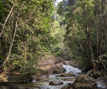
- Natural Water Crossings: The early parts of the trail involve a couple of river crossings, adding to the adventure. These can be slippery, so proper footwear and caution are essential.
- Campsites with Character: Lubuk Hantu and Camp 7E offer different experiences for those planning an overnight trek. Lubuk Hantu provides a riverside setting, while Camp 7E is a more spacious and popular resting point.
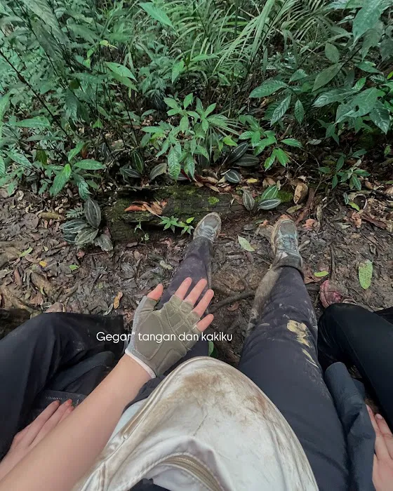
- Rich Biodiversity: The dense jungle environment is home to various sounds of nature, from the shrill hum of cicadas to the calls of gibbons and hornbills. The untouched paths highlight the pristine nature of the forest.
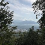
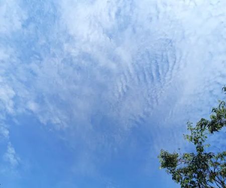
- Panoramic Summit Views: On clear days, the view from the peaks, especially from Liang East, is truly spectacular, offering sweeping vistas of the surrounding Perak landscape.
As a natural hiking area managed by the Forestry Department, TRAIL HEAD GUNUNG LIANG does not typically offer commercial promotions or special offers in the traditional sense. The entry fees for permits are standard and regulated by the relevant authorities. However, opportunities for group discounts or package deals may arise if you engage with local hiking clubs or tour operators that organize trips to Gunung Liang. These groups often consolidate permit applications and arrange transportation, potentially offering a more cost-effective and convenient way to experience the trail.
It is always recommended to check with the Perak Forestry Department directly or consult reputable local hiking communities for the most up-to-date information on any fees or special arrangements for larger groups.
For inquiries related to permits and regulations:
- Pejabat Hutan Daerah Perak Selatan: This is the primary office for obtaining permits for Gunung Liang. While a specific direct public contact number is not widely available, you can usually find general contact details for the Forestry Department offices in Perak online.
- Online Permit Application: For convenience, permits can often be applied for through the official Forestry Department of Malaysia website: ecotourism.perakforestry.gov.my.
Physical Address of Trailhead:
- QGCC+8Q, 35900 Behrang Ulu, Perak, Malaysia
Please note that there isn't a direct phone number for the trailhead itself as it is an undeveloped natural area. For general emergencies or to inform authorities of your hiking plans, it is advisable to contact the nearest police station in Behrang, which is often recommended for hikers to report their intentions before embarking on the trail.
TRAIL HEAD GUNUNG LIANG is more than just a hiking trail; it's an exhilarating challenge and a profound connection with nature, perfectly suited for the adventurous spirits of Perak locals. While the ascent to Gunung Liang is undeniably tough, as echoed by previous visitors who advise serious training, the sense of accomplishment upon reaching the peaks is immense. One reviewer aptly put it: "Pls train before hiking here! Don't play around with training if you want to enjoy the journey to the top." This highlights that the enjoyment of Gunung Liang is directly proportional to your preparation.
For locals, Gunung Liang offers an accessible yet demanding escape from daily routines, fostering physical and mental resilience. It provides a unique opportunity to explore the rich biodiversity of Perak’s rainforests, witness stunning natural landscapes, and experience the satisfaction of conquering a significant peak within their own state. It's a perfect venue for seasoned hikers to hone their skills or for dedicated individuals to embark on a transformative outdoor adventure. The sheer beauty of the mossy forests and the panoramic views from the summit serve as a powerful reminder of the natural treasures right on our doorstep here in Perak. Embrace the challenge, prepare thoroughly, and discover the unmatched rewards that await you at TRAIL HEAD GUNUNG LIANG.
TRAIL HEAD GUNUNG LIANG Photos
TRAIL HEAD GUNUNG LIANG Location
TRAIL HEAD GUNUNG LIANG
QGCC+8Q, 35900 Behrang Ulu, Perak, Malaysia
 TRAIL HEAD GUNUNG LIANG
QGCC+8Q
 Strata waterfall
QG7X+JP
 Lata Perangin
PGWX+WH
 Trailhead Lata Perangin
Jalan Pc10
 Bukit Perangin MUALLIM
Ulu Bernam Timur
 Sungei Bernam
PHCH+69
 Bukit Asa Trailhead
Jalan Lambak 4
 Kem North Face
MGP6+73
 Bukit Kg Hassan, Hulu Bernam
MGG5+RG
 CCHPalmView
JH86+97
 Air Terjun Batu Bertenggek
Jalan kolam air panas
 Trail Head to Batu Bertenggek Waterfall
22a
 Pine Tree Trail - Entrance
49000 Fraser's Hill
TRAIL HEAD GUNUNG LIANG Reviews
Pls train before hiking here! Don't play around with training if you want to enjoy the journey to the top
May 01, 2025 · Elvy Olivia Ray
More Adventure
 Strata waterfall3.0 (3 reviews)
QG7X+JP, Tanjong Malim, Perak, Malaysia
 Lata Perangin4.0 (12 reviews)
PGWX+WH, 35900 Tanjong Malim, Perak, Malaysia
 Trailhead Lata Perangin5.0 (2 reviews)
Jalan Pc10, 35900 Tanjong Malim, Perak, Malaysia
 Bukit Perangin MUALLIM5.0 (1 reviews)
Ulu Bernam Timur, 35900, Perak, Malaysia
 Sungei Bernam5.0 (1 reviews)
PHCH+69, 44000 Kerling, Selangor, Malaysia
 Bukit Asa Trailhead4.0 (17 reviews)
Jalan Lambak 4, 35900 Tanjong Malim, Perak, Malaysia
 Kem North Face5.0 (1 reviews)
MGP6+73, 35900 Kerling, Selangor, Malaysia
 Bukit Kg Hassan, Hulu Bernam4.0 (2 reviews)
MGG5+RG, Hulu Bernam, 44020 Kerling, Selangor, Malaysia
 CCHPalmView2.0 (1 reviews)
JH86+97, 44000 Kerling, Selangor, Malaysia
 Air Terjun Batu Bertenggek4.0 (51 reviews)
Jalan kolam air panas, Taman Lembah Damai, 44100 Kerling, Selangor, Malaysia
 Trail Head to Batu Bertenggek Waterfall4.0 (64 reviews)
22a, Jalan Berlian 4b2, Taman Lembah Damai, 44100 Kerling, Selangor, Malaysia
 Pine Tree Trail - Entrance4.0 (244 reviews)
49000 Fraser's Hill, Pahang, Malaysia
Categories
Popular
 Homestay Maran RJ5.0 (10 reviews)
 Rumah Sewa Makcik Ani5.0 (1 reviews)
 Restoran Nasi Dagang Hulu Langat4.0 (96 reviews)
 Victoria Home Office Headquarter3.0 (6 reviews)
 Batu Arang Stele4.0 (7 reviews)
 Taman Bunga Raya by Belkron4.0 (7 reviews)
Must-Read Blog Posts
Most Searched
Trending Blog Posts
 Exploring the Architectural Beauty of Mosques in Malaysia: A Journey Through Islamic Architecture
 Exploring the Unique Designs of Mosques in Malaysia: A Journey Through Islamic Architecture
 How to Get to the Famous Mosques in Kuala Lumpur by Public Transport: A Complete Travel Guide
 Visiting Malaysia’s Most Famous Mosques During Eid: A Unique Cultural Experience
 Top Mosques to Visit During Ramadan in Malaysia: A Traveler's Guide
 Discover the History of Masjid Titiwangsa in Kuala Lumpur: A Cultural and Architectural Gem