
View Point Gunung Tebu Introduce
Terengganu, known for its pristine beaches and vibrant cultural heritage, also holds a hidden gem for adventure enthusiasts: View Point Gunung Tebu. Nestled in the heart of Jerteh, this majestic mountain offers a truly immersive experience into the lush biodiversity of Malaysia’s rainforests and rewards hikers with some of the most spectacular panoramic views imaginable. Whether you're a seasoned trekker or simply looking for a refreshing escape into nature, Gunung Tebu promises an unforgettable journey. This article is your local guide to everything you need to know about planning your next adventure to this incredible hiking area.
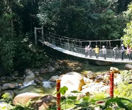
Standing tall at approximately 1,039 meters (3,408 feet) above sea level, Gunung Tebu is one of Terengganu's highest peaks, presenting a moderate yet challenging climb. The ascent typically takes around 4 to 6 hours for most hikers, though this can vary depending on individual pace and fitness levels. The trail itself is well-marked in many sections, making it navigable for those with some hiking experience. Along the way, you'll be enveloped by the dense tropical rainforest, a vibrant ecosystem teeming with diverse flora and fauna. The changing temperatures from the lowland to the higher altitudes create a misty, mossy environment that adds to the mountain's mystique. Many local climbers consider Gunung Tebu a regular destination for group expeditions, and its fabled "natural bonsai garden" near the summit is a sight not to be missed.
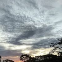
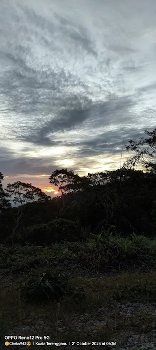
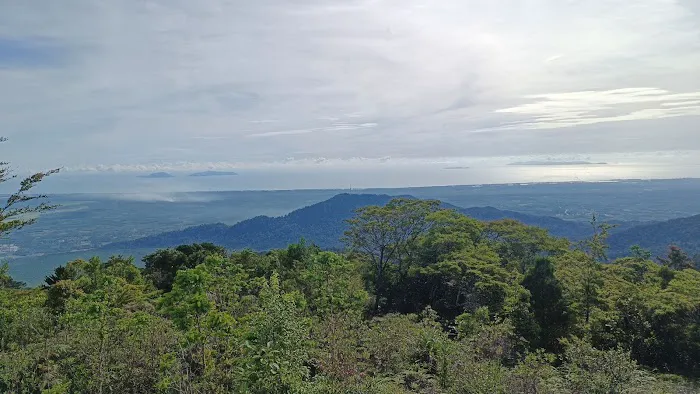
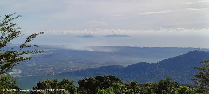
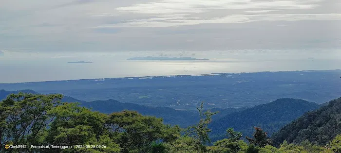
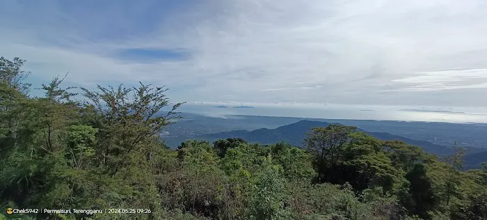
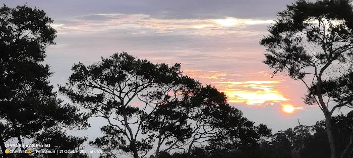
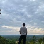
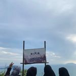
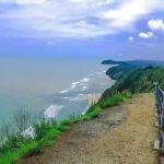
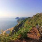
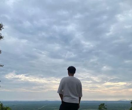
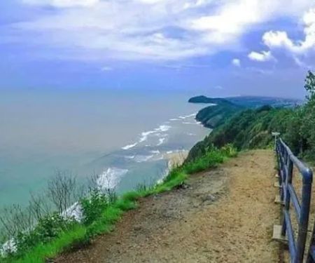
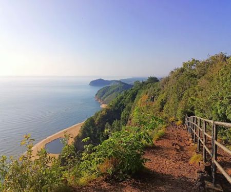
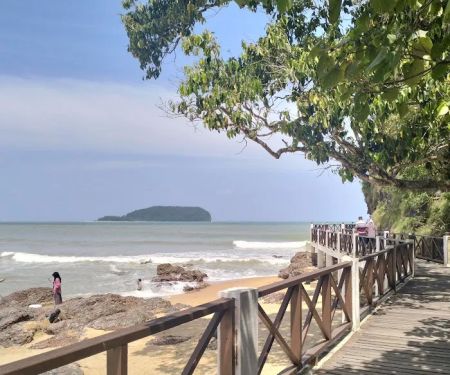
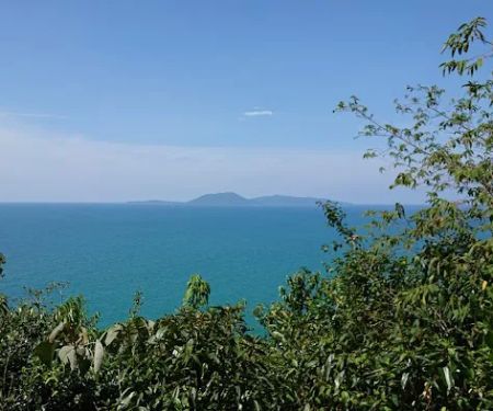
Many who have ventured to View Point Gunung Tebu speak of the sheer exhilaration of reaching its summit. The effort is immensely rewarded by the breathtaking vistas, especially during sunrise. Imagine standing atop the mountain, watching the first golden rays of the sun paint the sky, illuminating the distant islands and the vast, open ocean – a truly magical moment that leaves a lasting impression. Beyond the sunrise, the views extend to include Pulau Perhentian, Bukit Keluang, and Kuala Besut on clear days, providing a stunning backdrop to your achievement. The mountain's unique geological formations, primarily composed of granite, contribute to its rugged beauty, with steeply tilted slopes and sandstone outcrops along the rivers. This unique landscape, combined with the rich biodiversity, makes Gunung Tebu a significant conservation area and a prime spot for ecotourism.
View Point Gunung Tebu is strategically located in Jerteh, Terengganu, Malaysia. The main entrance and starting point for many hikers is through the Lata Belatan Recreational Forest, which is situated about 24 km from Bandar Jertih via Jalan Kuala Terengganu – Jertih. For those traveling from further afield, it's approximately 118 km from Kuala Terengganu via Jalan Kuala Terengganu – Kota Bharu. While accessing Gunung Tebu is feasible by personal vehicle, public transport options like taxis can also get you to the trailhead from nearby towns. The development of the East Coast Rail Link (ECRL), expected to be completed by December 2026, will further enhance accessibility, with a station at Jerteh being the closest point to Hutan Lipur Lata Belatan, making it even easier for visitors from the Klang Valley and other regions to reach this natural wonder.
- Guided hiking tours: Local guides are highly recommended and often required, especially for those unfamiliar with the terrain. These guides, often part of Community-Based Ecotourism (CBET) initiatives, offer valuable insights into the local environment and ensure a safe and enjoyable climb.
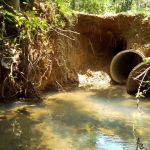
- Camping facilities: There is a camping ground near the summit that can accommodate a significant number of tents, providing an option for multi-day treks. Fresh water is easily obtainable from nearby brooks.
- Basic amenities at Lata Belatan Recreational Forest: The trailhead area at Lata Belatan offers essential facilities for hikers, including stalls selling snacks and drinks, toilets, showers, and changing rooms.
- Porter services: For those carrying heavier gear or requiring assistance, porter services may be available through local tour operators.
- Permit application assistance: As permits are required for hiking Gunung Tebu, many tour operators and local cooperatives can assist with the application process, ensuring all regulations are met.
- Spectacular Sunrise Views: As many past visitors attest, witnessing the sunrise from the peak, with views stretching across the islands and the South China Sea, is a truly unforgettable experience.
- Rich Biodiversity: Gunung Tebu is home to a diverse range of flora and fauna, including various plant species, insects, and wildlife, making it a paradise for nature photographers and enthusiasts.
- "Natural Bonsai Garden": Near the summit, hikers will discover an area characterized by stunted trees and unique plant formations, giving it the appearance of a natural bonsai garden – a distinctive highlight of the trek.
- Mossy and Misty Forest: The higher altitudes are often shrouded in mist, creating a mystical atmosphere and contributing to the growth of mossy landscapes, offering a different kind of beauty compared to the lowland rainforest.
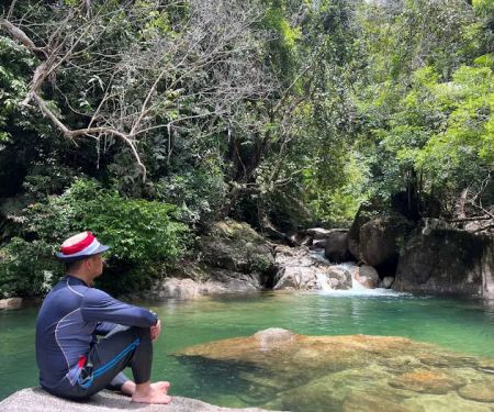
- Water Sources: Several points along the trail, such as "Punca Air," provide natural water sources, which are crucial for hikers on longer expeditions.
- Challenging but Rewarding Trails: The hike is categorized as moderate to long, with some challenging sections, but the clear signage in parts and the overall well-maintained trail make the climb achievable and deeply satisfying upon completion.
While specific, ongoing promotions for individual hikers may vary, it is advisable to check with local tour operators and ecotourism cooperatives, such as the Sahabat Gunung Tebu Cooperative. These groups often offer package deals that include guide services, permits, and sometimes even accommodation or food. For instance, events like the "Mount Tebu Climbathon Challenge" in the past have featured varying entry fees based on categories (e.g., CENGAL, MERANTI, NYATOH) and early bird registrations, providing opportunities for competitive hikers to participate at a reduced cost. Keep an eye on local tourism boards and social media pages for announcements on upcoming events or discounts tailored for group bookings or specific seasons. Entrance permits for hiking Gunung Tebu typically cost RM5 per person, which is a standard fee to support the upkeep of the forest reserve.
Address: View Point Gunung Tebu, Jerteh, Terengganu, Malaysia.
For more specific information regarding permits, guided tours, or camping, it is best to contact the Terengganu State Forestry Department (Jabatan Perhutanan Negeri Terengganu) or reputable local tour operators and cooperatives specializing in Gunung Tebu expeditions. Their Recreational Forest and Recreation Unit would be the primary point of contact for official inquiries related to access and regulations.
For the residents of Terengganu, View Point Gunung Tebu is more than just a hiking trail; it's a natural heritage and an accessible adventure right at their doorstep. Its proximity to Jerteh makes it a convenient day trip or a weekend getaway for families and friends looking to reconnect with nature. The moderate difficulty level of the hike ensures that it is challenging enough to provide a sense of accomplishment, yet accessible to individuals with varying fitness levels, from experienced trekkers to active beginners. The well-maintained trails and basic facilities at the base make the experience comfortable and enjoyable. Furthermore, supporting local guides and ecotourism initiatives contributes directly to the well-being of the surrounding communities, fostering a sustainable relationship between visitors and the natural environment. The opportunity to witness a breathtaking sunrise, explore a diverse rainforest ecosystem, and achieve the summit makes Gunung Tebu a perfect destination for locals to embrace an active lifestyle, create lasting memories, and truly appreciate the natural beauty that Terengganu has to offer.
View Point Gunung Tebu Photos
View Point Gunung Tebu Location
View Point Gunung Tebu
Jerteh, Terengganu, Malaysia
 View Point Gunung Tebu
Jerteh
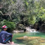 Emerald Pool Terengganu
22100 Permaisuri
 Bukit Besar, kampung bukit kemudu
GQW8+JQ
 Sungai kapeh
Sungai kapeh ulu Besut Sungai kapeh
 Sungai kapeh
Kampung Tanduk
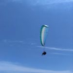 Bukit Bubus (Taman Luncur Udara)
Jalan Pantai Dendong
 Bukit Keluang Trail Head (short)
22200 Kampung Raja
 Puncak Bukit Keluang
22200 Kampung Raja
 Bukit Keluang Trail Head.
Unnamed Road
 Laluan Berjalan Kaki Pesisir Pantai Bukit Keluang
RJ24+Q2
 Bukit Pulau Rhu South Peak
Terengganu
 Miraj Afridi 11
RGH7+MW
 Jambatan Gantung Payong
jalan lata payong
View Point Gunung Tebu Reviews
If you're lucky, you'll get a beautiful sunrise view. The view of the islands and the wide open ocean..
Oct 20, 2024 · Cheks ManWhat will it be like in 2025?
May 15, 2025 · Sabri Ibrahim ZKM
More Adventure
 Emerald Pool Terengganu4.0 (3 reviews)
22100 Permaisuri, Terengganu, Malaysia
 Bukit Besar, kampung bukit kemudu5.0 (1 reviews)
GQW8+JQ, 22120 Permaisuri, Terengganu, Malaysia
 Sungai kapeh0.0 (0 reviews)
Sungai kapeh ulu Besut Sungai kapeh, 22010 Jerteh, Terengganu, Malaysia
 Sungai kapeh4.0 (1 reviews)
Kampung Tanduk, 22000 Jerteh, Terengganu, Malaysia
 Bukit Bubus (Taman Luncur Udara)4.0 (44 reviews)
Jalan Pantai Dendong, 22200 Besut, Terengganu, Malaysia
 Bukit Keluang Trail Head (short)4.0 (18 reviews)
22200 Kampung Raja, Terengganu, Malaysia
 Puncak Bukit Keluang4.0 (15 reviews)
22200 Kampung Raja, Terengganu, Malaysia
 Bukit Keluang Trail Head.4.0 (87 reviews)
Unnamed Road, 22200 Kampung Raja, Terengganu, Malaysia
 Laluan Berjalan Kaki Pesisir Pantai Bukit Keluang4.0 (6 reviews)
RJ24+Q2, 22200 Kampung Raja, Terengganu, Malaysia
 Bukit Pulau Rhu South Peak5.0 (1 reviews)
Terengganu, Malaysia
 Miraj Afridi 110.0 (0 reviews)
RGH7+MW, 16700 Cherang Ruku, Kelantan, Malaysia
 Jambatan Gantung Payong5.0 (2 reviews)
jalan lata payong, 21500 Sungai Tong, Terengganu, Malaysia
Categories
Popular
 Forest Reserve (BK5B)0.0 (0 reviews)
 Homestay Ketereh (Desa Permai)4.0 (7 reviews)
 One World Lodging BENTONG Pahang3.0 (160 reviews)
 Loong Rest House3.0 (8 reviews)
 Fadly5.0 (1 reviews)
 Kampung Binjai, Kuala Lipis, Pahang5.0 (1 reviews)
Must-Read Blog Posts
Most Searched
Trending Blog Posts
 Exploring the Architectural Beauty of Mosques in Malaysia: A Journey Through Islamic Architecture
 Exploring the Unique Designs of Mosques in Malaysia: A Journey Through Islamic Architecture
 How to Get to the Famous Mosques in Kuala Lumpur by Public Transport: A Complete Travel Guide
 Visiting Malaysia’s Most Famous Mosques During Eid: A Unique Cultural Experience
 Top Mosques to Visit During Ramadan in Malaysia: A Traveler's Guide
 Discover the History of Masjid Titiwangsa in Kuala Lumpur: A Cultural and Architectural Gem