
Gunung Angsi Peak Introduce
For those of us in Negeri Sembilan with a passion for the outdoors and a desire for exhilarating challenges, our state is home to a magnificent natural landmark that beckons adventurers: Gunung Angsi Peak. Standing tall as the highest peak in Negeri Sembilan, Gunung Angsi offers not just a hike, but a true test of endurance rewarded with breathtaking panoramic views. It's a rite of passage for many local hikers and a highly respected destination within the Malaysian hiking community.
This article is crafted specifically for the people of Negeri Sembilan, from our local perspective, aiming to provide a clear, engaging, and informative guide to Gunung Angsi Peak. We’ll delve into its challenging trails, accessible location, essential tips for a successful climb, and why it remains a cherished and highly recommended outdoor pursuit for experienced locals and determined newcomers alike. Our tone will be friendly and professional, offering factual insights into this iconic Negeri Sembilan landmark.
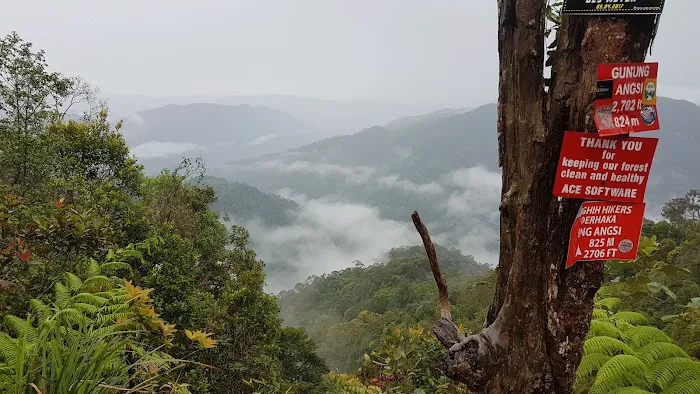
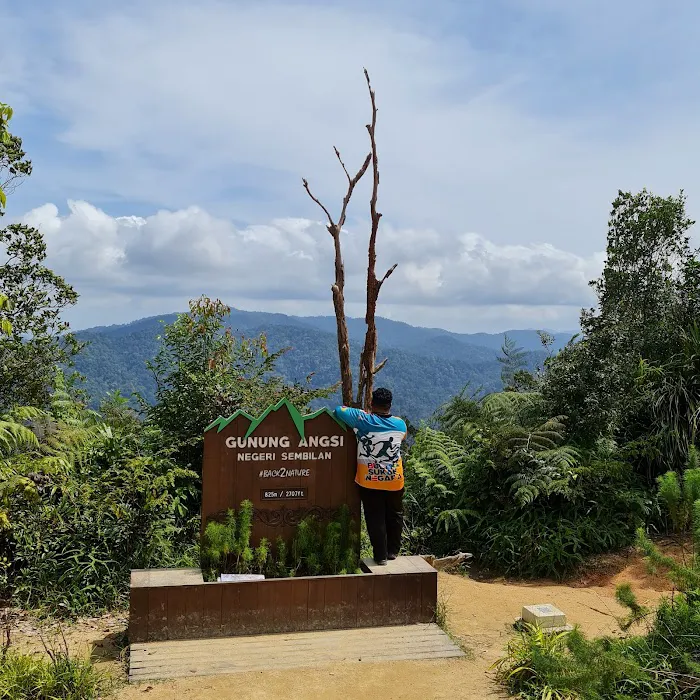
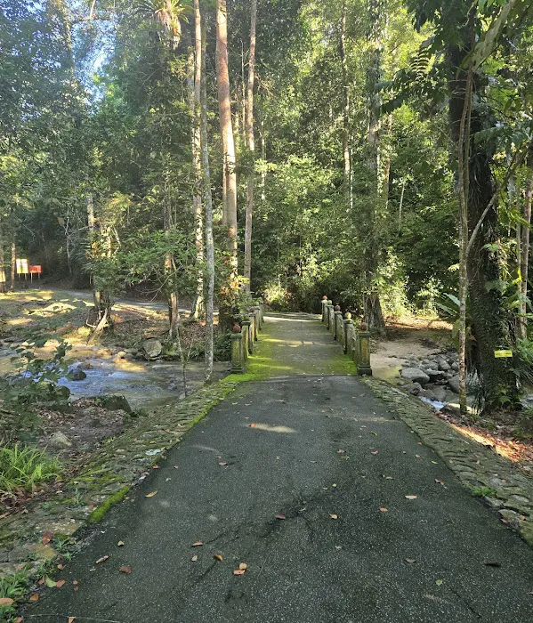
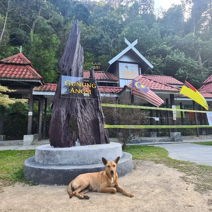
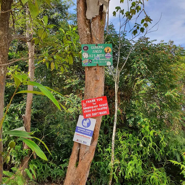
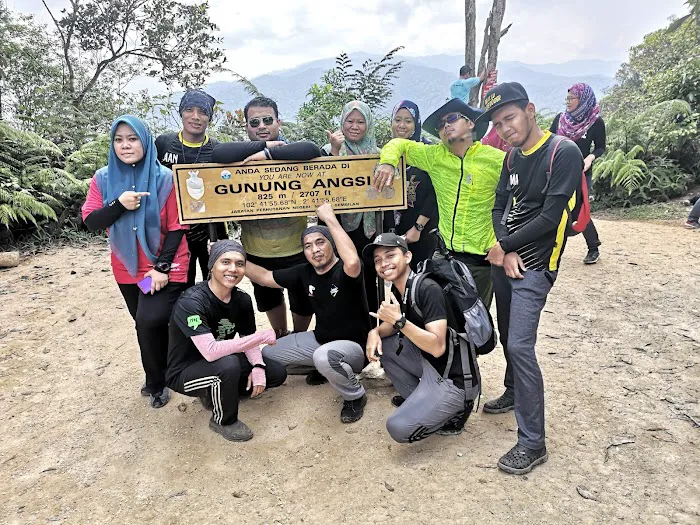
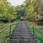
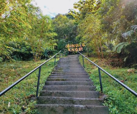
Gunung Angsi Peak, rising to an elevation of approximately 825 meters (2,707 feet) above sea level, is the highest point in Negeri Sembilan. Located within the Ulu Bendul Recreational Forest, it is a renowned destination for hikers seeking a challenging yet deeply rewarding experience. The most popular and well-known entry point for the summit is from the Bukit Putus Trailhead, which offers a direct and vigorous ascent to the peak.
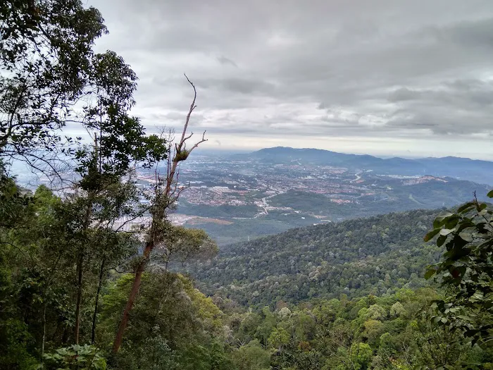
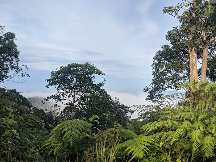
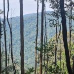
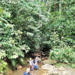
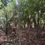
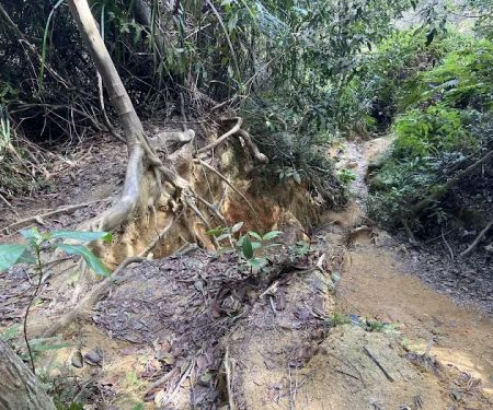
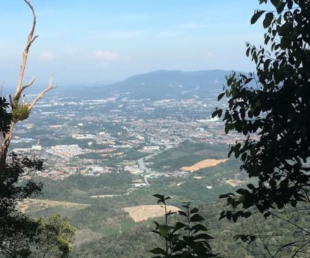
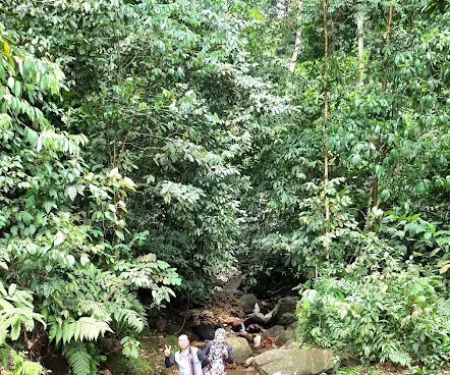
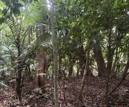
The trails on Gunung Angsi are known for their varied terrain, ranging from scenic river crossings in the initial stages to steep, sometimes slippery, and even vertical sections requiring ropes near the summit. As evidenced by real customer reviews, this is a hike that demands proper preparation, good physical fitness, and appropriate gear. One reviewer, an experienced climber, describes it as a "hard climb" with "very slippery and some areas vertical with very narrow passages and rope climb," indicating its true challenge level. However, the sense of accomplishment upon reaching the summit, coupled with the stunning views of the surrounding rainforest and potentially even parts of Seremban, makes every drop of sweat worthwhile. Gunung Angsi is not just a peak; it's an adventure that builds character and provides an unparalleled connection with Negeri Sembilan's majestic natural landscape.
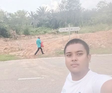
Gunung Angsi Peak is conveniently located in Seremban, Negeri Sembilan, Malaysia, with the most popular trailhead situated along Jln Bukit Putus. This strategic location makes it highly accessible for residents not only within Seremban but also from other parts of Negeri Sembilan and even neighboring states like Selangor and Melaka. Jln Bukit Putus is a well-known road that connects Seremban to Kuala Pilah, ensuring relatively straightforward navigation for those driving.
Access to the trailhead is primarily by private vehicle. There is typically a designated parking area near the starting point (often associated with the Ulu Bendul Recreational Forest entrance or a specific entry point for Gunung Angsi), though hikers should always aim to arrive early, especially on weekends, to secure a spot. Given the popularity of this peak, carpooling is often encouraged. While specific public transport options directly to the trailhead might be limited, ride-sharing services from Seremban town are a viable alternative. Before heading out, it's always wise to confirm the exact starting point and any latest access requirements or parking information, perhaps through local hiking groups or online forums, to ensure a smooth start to your challenging ascent.
As a natural hiking area and a prominent peak, Gunung Angsi operates more as an environmental attraction with necessary regulations rather than a commercial enterprise offering extensive services. Visitors should primarily be self-sufficient and prepared for a rugged outdoor experience.
Permit System: It is crucial to note that hiking Gunung Angsi typically requires a permit from the Negeri Sembilan Forestry Department (Jabatan Perhutanan Negeri Sembilan). This is a mandatory "service" or requirement for entry, ensuring hiker safety and environmental preservation. Hikers are usually advised to obtain this permit in advance, often at the trailhead office or a designated department office.
Designated Trailheads: The primary service is the well-marked (though challenging) trail system itself, maintained by the forestry department to guide hikers to the peak. The most popular being the Bukit Putus Trail.
Rope Aids: As highlighted by customer reviews, some challenging, vertical sections of the trail are equipped with ropes to assist climbers. While not a formal "service," these are crucial aids maintained for safety.
Basic Ranger/Guard Presence: At popular trailheads like Bukit Putus, there might be a ranger station or guard post to check permits, provide basic information, and ensure hikers adhere to entry and exit times (e.g., "no climbers allowed after 9am" and "back before 5pm").
Informal Parking: Parking areas are generally available near the trailhead, although these might be informal and fill up quickly during peak hours.
Visitors should bring all their own essentials, including sufficient water (at least 2-3 liters), high-energy snacks, a first-aid kit, appropriate hiking footwear (with good grip, as trails can be "very slippery"), and navigation tools. There are no facilities like restrooms or refreshment stalls on the trails or at the summit.
Gunung Angsi Peak stands out as a premier hiking destination in Negeri Sembilan, boasting several compelling features and highlights:
Highest Peak in Negeri Sembilan: Conquering Gunung Angsi offers the unique satisfaction of reaching the highest point in the state, providing a significant sense of accomplishment for any hiker.
Challenging and Diverse Trails: The hike is renowned for its varied and demanding terrain. As noted by a seasoned climber, it includes "river crossings," "hard climb up," "very slippery" sections, "vertical" areas, "very narrow passages," and "rope climb." This diversity keeps the hike engaging and provides a thorough physical challenge, making it suitable for intermediate to experienced hikers.
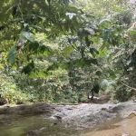
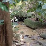
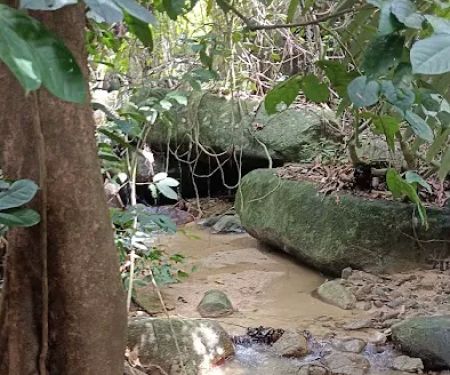
Scenic River Sections: The initial part of the trek, especially along the river from the Bukit Putus trailhead, is described as "nice and scenic." The presence of two river crossings adds an adventurous element and offers opportunities for refreshing breaks amidst lush greenery.
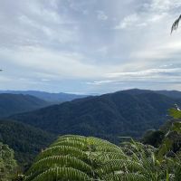
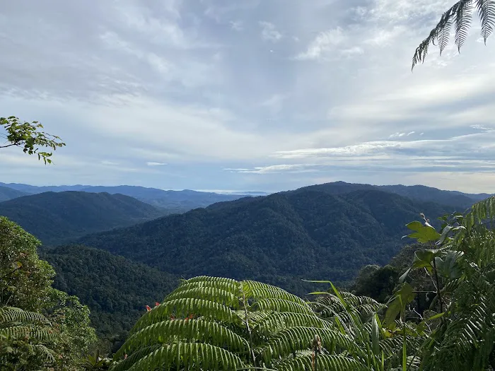
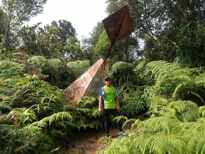
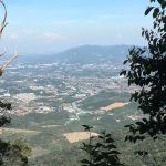
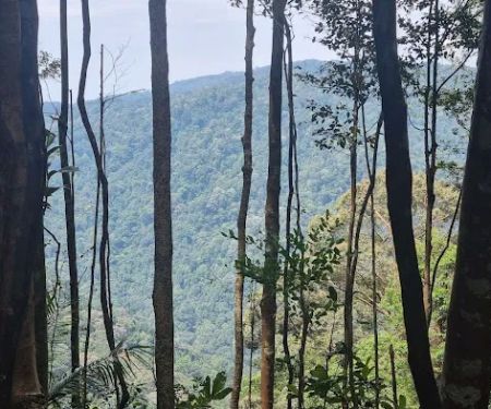
Rewarding Summit Views: Upon reaching the peak, hikers are rewarded with stunning panoramic views of the surrounding Negeri Sembilan landscape, including dense rainforests and potentially glimpses of Seremban on clear days. The sense of achievement combined with the expansive vista makes the strenuous climb entirely worthwhile.
Well-Defined Hiking Community: Gunung Angsi attracts a dedicated community of hikers, and this collective experience often contributes to well-trodden paths and informal shared knowledge (like rope aids or best practices for the trail). The presence of other hikers, particularly on weekends, can also provide a sense of security and camaraderie.
Strategic Location: Its accessibility from Seremban makes it a convenient option for a challenging day hike for many locals in Negeri Sembilan and even those from nearby states, reducing travel time and maximizing hiking time.
As a natural peak located within a forest reserve and managed by the Forestry Department, Gunung Angsi Peak does not offer commercial "promotions" or "special offers" in the way a business would. Its value lies in its natural features and the hiking experience itself.
The primary "cost" associated with hiking Gunung Angsi is the mandatory permit fee, which is a standard regulatory charge for entry into forest reserves. This fee is usually nominal and contributes to forest conservation and maintenance.
Therefore, hikers should expect:
Permit Fee: A small, mandatory fee will be required to obtain the hiking permit from the Negeri Sembilan Forestry Department. This is a standard procedure for most regulated peaks in Malaysia.
No Discounts or Packages: There are no commercial discounts, seasonal promotions, or bundled packages offered by the peak management itself. Any "packages" would be organized by independent tour operators or hiking groups that include their own service fees.
The true "promotion" of Gunung Angsi Peak is the unparalleled challenge and the magnificent sense of achievement it offers, culminating in breathtaking views, all for a minimal permit fee. The "special offer" is the opportunity to test one's limits and connect with the raw, untamed beauty of Negeri Sembilan's highest point.
As a natural peak within a forest reserve, Gunung Angsi Peak does not have a direct commercial contact number or email address. Information is typically handled by the relevant government department.
The primary contact for official inquiries, especially regarding permits and regulations, would be the Negeri Sembilan Forestry Department (Jabatan Perhutanan Negeri Sembilan).
Address: Jln Bukit Putus, Seremban, Negeri Sembilan, Malaysia (This is the general address for the trailhead/access point).
Forestry Department Contact: While a direct phone number for the Gunung Angsi trailhead office might not be publicly listed, contacting the main office of the Negeri Sembilan Forestry Department (a quick online search for "Jabatan Perhutanan Negeri Sembilan contact") would be the most reliable way to inquire about permit procedures, opening hours, or any specific rules and regulations.
For practical hiking advice, trail conditions, or to join group climbs, locals often rely on:
Local Hiking Groups and Online Forums: Facebook groups (e.g., "Negeri Sembilan Hikers" or "Malaysian Hiking Community") are excellent resources for real-time updates, trip reports, and connecting with experienced climbers.
Word-of-Mouth: Asking fellow hikers or locals familiar with the area.
Always ensure you have the necessary permit before starting your hike and adhere to the stipulated entry and exit times for your safety and to respect forest regulations.
Gunung Angsi Peak stands as an exceptionally suitable and highly recommended destination for locals in Negeri Sembilan for a multitude of compelling reasons. Firstly, its prime location in Seremban, easily accessible via Jln Bukit Putus, means that a challenging and rewarding outdoor adventure is right on their doorstep. This convenience reduces travel time, making it an ideal choice for a half-day or full-day hike without extensive logistical planning.
Secondly, for those seeking a genuine physical challenge and a sense of accomplishment, Gunung Angsi delivers. As evidenced by experienced hikers' reviews, it's a "hard climb" with diverse terrain, including river crossings, steep ascents, and even rope climbs. This makes it perfect for locals who have already tackled simpler trails and are ready to push their limits, or for seasoned hikers looking to maintain their fitness. The satisfaction of conquering the highest peak in Negeri Sembilan is a significant motivator and a point of pride for many.
Beyond the physical exertion, the reward is immense: stunning panoramic views from the summit. These vistas offer a refreshing perspective of our beautiful state, providing a profound connection to nature and a tranquil escape from urban life. It’s also an excellent opportunity for bonding with friends and family who share a love for the outdoors. While a permit is required, this nominal fee ensures the preservation and safety of this natural treasure for generations to come. For any Negeri Sembilan resident looking for an exhilarating, challenging, and deeply fulfilling outdoor experience that showcases the state's natural grandeur, Gunung Angsi Peak is an absolute must-climb.
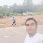
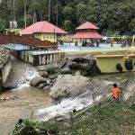
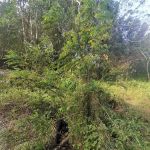
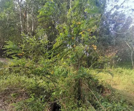
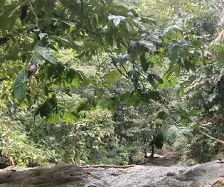
Gunung Angsi Peak Photos
Gunung Angsi Peak Location
Gunung Angsi Peak
Jln Bukit Putus, Seremban, Negeri Sembilan, Malaysia
 Gunung Angsi Peak
Jln Bukit Putus
 Cerun 90
P322+8J
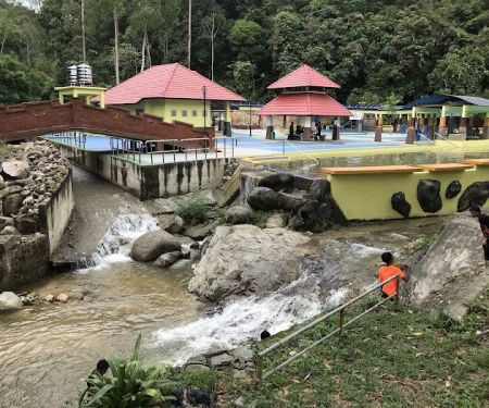
 Waterfall view
Jln Bukit Putus
 Kem Tangga Batu
P322+FR
 Gunung Angsi midway viewpoint
Bukit Putus-Angsi Trail
 Wakaf Rehat Air Tok Embah
P29R+RV
 Bukit Putus (Gunung Angsi Trailhead)
Jalan Kuala Pilah
 Starting Point Air Terjun Dara Taman Tuanku Jaafar (TTJ).
M2J9+QH
 Ulu Bendul-Angsi trailhead
2.727418N
 Bukit Kelinchi
Terachi
 Air Terjun Mini Tontong
Kampung Batang Penajis
 Port Stream Camping
Kampung Batang Penajis
 Bukit Segambut
P4FM+8P
Gunung Angsi Peak Reviews
Did the Treak 1 trail which is a hard one. The way up along the river is nice and scenic takes about 1. After 2 river crossings it's a hard climb up for 2.5 hours, very slippery and some areas vertical with very narrow passages and rope climb. Climbing down was as challenging, took 3 hrs, for a climber who did KK twice, mulu and most peaks in Malaysia. Pls ensure you start before 9am (no climbers allowed after 9am) and back before 5pm and anti wet and good grip hike shoe.
Apr 25, 2025 · aj dabBeen here a few times and this is my latest out-and-back hike (from Bukit Putus Trailhead) record on 22.02.2025 by Huawei Health app.Ascent : 1 hour 35 minsDescent : 1 hour 20 mins(Include brief stops for photo taking)Distance out-and-back : 8.48kmElevation Gained : 600mTrail Condition : Mostly dry/dampWeather : Misty/SunnyAn relaxing and enjoyable hike and looking forward to come back soon
Feb 23, 2025 · Low Lee LingStart of trail have to climb like 2 levels of stairs, then upslope like 40min. Then reach a more gradual up down for 40min and final 20min upslope. Coming down is easy.Total time around 4hrs, include like 20min stay at the peak.
Sep 25, 2024 · Sean Seanaverage time for hike is about 1H 45Min, good spot for training as the trail is easy to follow and good to train leg strength. The trail is a bit roller coaster when near the peak but more flat after a while. Consider to bring water along with you to rehydrate. The permit can be bought at the counter below as low as 5ringgit for malaysian and 20 ringgit for foreigners. It's crowded during weekend and less crowded on weekdays.
Jun 07, 2024 · Muhammad AyyazThe trailhead had a tree that fell across the path. The other trailhead is muddy, smelly and there was no rope whatsoever. Many hikers slipped and fell. It was terrible. The rest of the trail was fine until after the Bukit Putus. It was also soggy and sticky. You can feel your shoes sticking to the ground. There isn't much view points and at the peak there isn't much of a view except for the triangular station. A place for training ok la. If your are looking for views I would suggest other Mount.The rest rooms provided are not functioning. You also have to pay an entrance fee though..
Nov 27, 2022 · thai69girl
More Adventure
 Cerun 900.0 (0 reviews)
P322+8J, Seremban, Negeri Sembilan, Malaysia
 Waterfall view4.0 (79 reviews)
Jln Bukit Putus, Seremban, Negeri Sembilan, Malaysia
 Kem Tangga Batu5.0 (2 reviews)
P322+FR, Seremban, Negeri Sembilan, Malaysia
 Gunung Angsi midway viewpoint5.0 (2 reviews)
Bukit Putus-Angsi Trail, Seremban, Negeri Sembilan, Malaysia
 Wakaf Rehat Air Tok Embah0.0 (0 reviews)
P29R+RV, Seremban, Negeri Sembilan, Malaysia
 Bukit Putus (Gunung Angsi Trailhead)4.0 (782 reviews)
Jalan Kuala Pilah, Seremban, Negeri Sembilan, Malaysia
 Starting Point Air Terjun Dara Taman Tuanku Jaafar (TTJ).5.0 (2 reviews)
M2J9+QH, Senawang, Negeri Sembilan, Malaysia
 Ulu Bendul-Angsi trailhead4.0 (271 reviews)
2.727418N ,102.0758E, Tanjung Ipoh, Negeri Sembilan, Malaysia
 Bukit Kelinchi4.0 (1 reviews)
Terachi, Negeri Sembilan, Malaysia
 Air Terjun Mini Tontong5.0 (1 reviews)
Kampung Batang Penajis, 71300 Pedas, Negeri Sembilan, Malaysia
 Port Stream Camping5.0 (1 reviews)
Kampung Batang Penajis, 71300 Pedas, Negeri Sembilan, Malaysia
 Bukit Segambut0.0 (0 reviews)
P4FM+8P, 71500 Tanjung Ipoh, Negeri Sembilan, Malaysia
Categories
Popular
 My Gallery @ Al Khatiri Point5.0 (4 reviews)
 HealthLand @ Kota Kemuning4.0 (100 reviews)
 Muzium Sungai Lembing4.0 (1343 reviews)
 Kuantan Palm Court HomeStay4.0 (11 reviews)
 Madrasah Perwira Indah4.0 (11 reviews)
 Setia City Residences4.0 (173 reviews)
Must-Read Blog Posts
Most Searched
Trending Blog Posts
 Exploring the Architectural Beauty of Mosques in Malaysia: A Journey Through Islamic Architecture
 Exploring the Unique Designs of Mosques in Malaysia: A Journey Through Islamic Architecture
 How to Get to the Famous Mosques in Kuala Lumpur by Public Transport: A Complete Travel Guide
 Visiting Malaysia’s Most Famous Mosques During Eid: A Unique Cultural Experience
 Top Mosques to Visit During Ramadan in Malaysia: A Traveler's Guide
 Discover the History of Masjid Titiwangsa in Kuala Lumpur: A Cultural and Architectural Gem