
Kem Ultra Introduce
Hello, adventurers and nature lovers of Negeri Sembilan! If you’re seeking a unique outdoor experience, whether it's for a challenging hike, a serene camping trip, or just a refreshing dip in a natural setting, then you absolutely need to know about Kem Ultra in Tampin. This isn't your typical well-trodden recreational park; it's a distinctive spot, well-known among the hiking community, that offers a more rugged and authentic connection with nature.
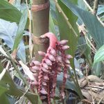
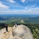
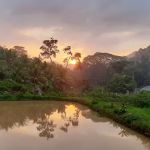
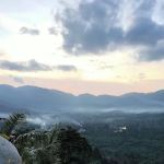
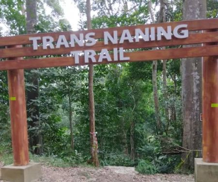
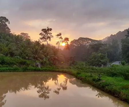
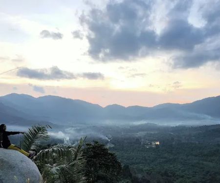
Kem Ultra is more than just a name; it signifies a pivotal point within the broader hiking landscape of Negeri Sembilan. Located strategically between the majestic Gunung Gagak and Gunung Tampin, it serves as a natural saddle point, making it a crucial stop for those undertaking the challenging Trans Naning trail. Its relatively low altitude provides a welcome respite for hikers, while the presence of a small, shallow river offers a vital water source and a refreshing spot to cool down. It’s a place where the sounds of the forest replace urban noise, and the clear river water promises a rejuvenating experience. While it may not offer manicured lawns or paved pathways, its natural beauty and strategic importance for outdoor enthusiasts make it a truly special place for those who appreciate raw, untouched nature. This article will delve into what makes Kem Ultra a unique and suitable destination for locals seeking an authentic outdoor adventure in Tampin, Negeri Sembilan.
Kem Ultra is situated in Tampin, Negeri Sembilan, Malaysia, specifically nestled in a low-lying area between Mount Gagak and Mount Tampin. Its address, 73100 Tampin, places it within the district, but its precise location is deep within the natural landscape, making it more of a destination for hikers and campers than a roadside attraction.
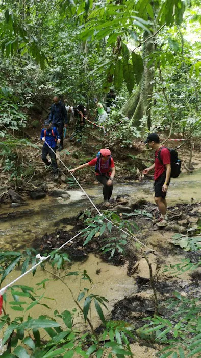
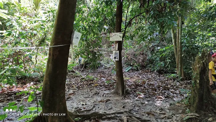
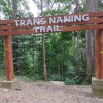
Access to Kem Ultra is primarily on foot, as it is an integral part of the hiking trails connecting Gunung Gagak and Gunung Tampin. It serves as a key checkpoint or resting point along the challenging "Trans Naning" trail, which traverses multiple peaks in the region. For those attempting the Trans Naning trail, Kem Ultra is encountered after descending from Mount Gagak (if coming from that direction) or before ascending Mount Tampin. Hikers would typically start their journey from the base of either Gunung Datuk or Gunung Tampin, where designated parking areas are available. From these starting points, reaching Kem Ultra involves several hours of trekking through forest trails. This means visitors need to be prepared for a genuine hiking experience to reach the area. While not directly accessible by car, its position within a well-known hiking network makes it discoverable for those seeking the adventure it offers. It's also noted that this area is relatively "close to the Batu Maloi cave forest," suggesting other natural attractions in the vicinity for those keen on extended exploration.
As a natural hiking area and camping spot, Kem Ultra does not offer commercial "services" in the conventional sense, like a managed park or facility. Instead, its "services" are naturally provided by the environment itself, and implicitly, by the hiking community and responsible outdoor practices. These include:
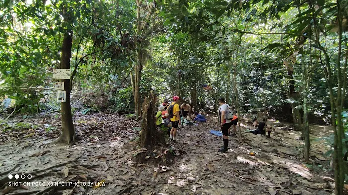
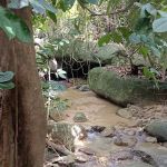
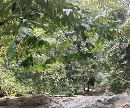
- Camping Area: Kem Ultra provides a natural, low-altitude flat ground suitable for setting up tents for camping. This is a primary draw for multi-day hikers or those looking for a secluded overnight experience.
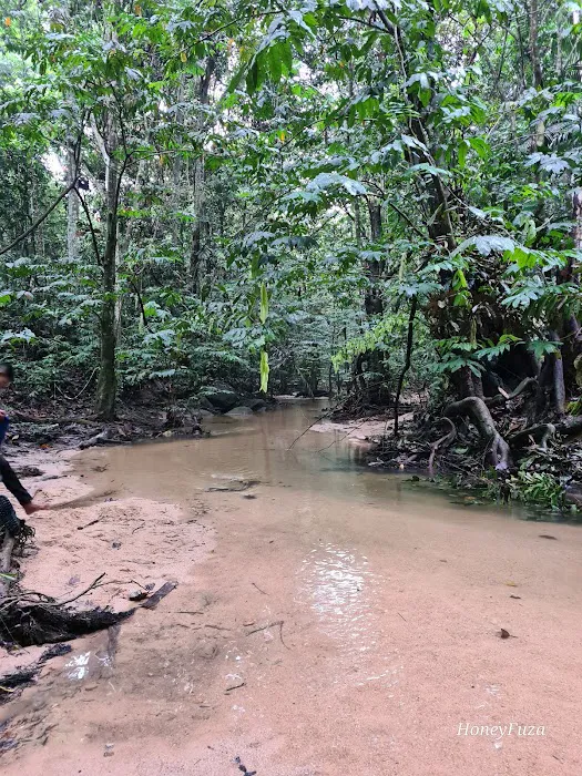
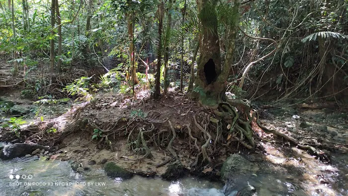
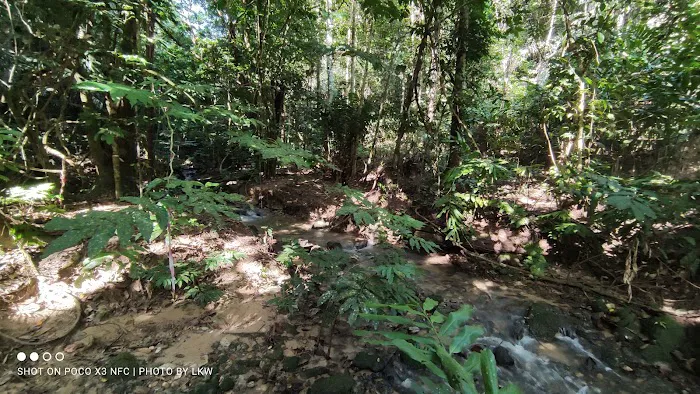
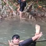
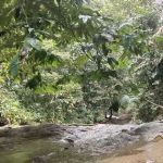
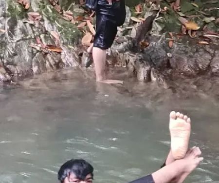
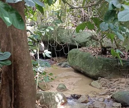
- Natural Water Source: A "small shallow river" flows next to the camping area. This serves as a vital natural water source for drinking and cooking (after proper purification, though one reviewer noted drinking it without issue).
- Resting Point for Hikers: Strategically located between two major peaks (Gunung Gagak and Gunung Tampin), it acts as a crucial mid-point or resting area for those undertaking the challenging Trans Naning trail.
- Natural Cooking Facilities: The environment allows for cooking, presumably with portable stoves or designated fire pits if allowed and managed responsibly.
It is important to remember that these are natural provisions, and visitors are expected to practice Leave No Trace principles, carrying out all their rubbish and respecting the natural environment. There are no man-made facilities like toilets or designated rest stops beyond what nature offers.
Kem Ultra stands out for its unique natural characteristics and its pivotal role within the local hiking scene:
- Strategic Location between Mountains: Its position as a "low area between Mount Gagak and Mount Tampin" makes it a significant waypoint for experienced hikers. It represents a brief descent and respite before the next ascent on the Trans Naning trail.
- Natural Camping Ground: The availability of flat terrain next to a river makes it an ideal spot for camping. This appeals to those who prefer wild camping or multi-day expeditions rather than designated campsites.
- Access to a Shallow River: The presence of a "small shallow river" is a major highlight. Not only does it provide a refreshing cool-down spot, but it's also a reliable natural water source, crucial for hikers and campers. The positive review regarding drinking the water without issues speaks to its natural purity (though personal judgment and purification are always recommended).
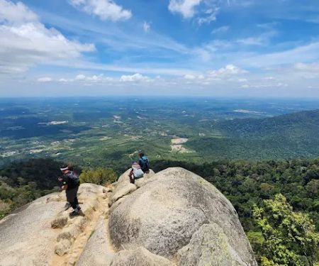
- Connection to Trans Naning Trail: Kem Ultra is an integral part of the renowned Trans Naning trail. This attracts serious hikers and ultra-trail runners looking to complete this challenging multi-peak journey. The area marks a demanding section of the trail, with "hardest climb from Kem Ultra, both side towards Tampin Hill and Gunung Datuk, with 500 meters gained on both up to 700 meter altitude."
- Relatively Low Altitude: Situated at an altitude of "200m-220m max," it offers a brief respite from the strenuous climbs to higher peaks, providing a relatively easier section of the trail.
- Proximity to Batu Maloi Cave Forest: Being "close to the Batu Maloi cave forest" suggests opportunities for combining hiking at Kem Ultra with exploration of the nearby caves, offering a more diverse adventure.
As a natural, undeveloped hiking and camping area, Kem Ultra does not have commercial promotions or special offers in the traditional sense. There are no entrance fees for Kem Ultra itself, as it is a natural part of the mountain trails. However, it is important to note that access to certain hiking trails within Negeri Sembilan, particularly those leading to peaks like Gunung Datuk or Gunung Tampin, may require permits from the Forestry Department of Negeri Sembilan.
- Free Access (Generally): The "promotion" is the free and unrestricted access to a pristine natural environment for hiking and camping (subject to forestry regulations and permits for the overall trail).
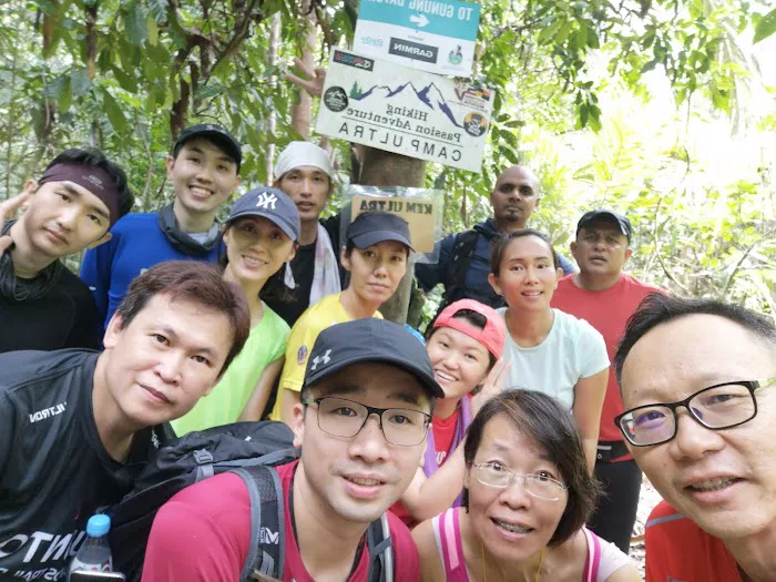
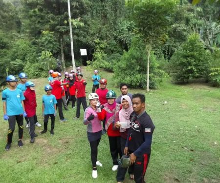
- Event Inclusion: Kem Ultra gains significant prominence during organized ultra-trail running events like the "Trans Naning Ultra Challenge." During such events, it functions as a crucial checkpoint or water station. Participation in these events involves registration fees, but these are for the event itself, not for access to Kem Ultra specifically.
Hikers should always check with the local Forestry Department for the most up-to-date information on permits required for accessing the broader Gunung Tampin and Gunung Gagak areas, especially if undertaking the full Trans Naning route.
As Kem Ultra is a natural landmark within a forest reserve, it does not have a direct contact number or dedicated on-site staff. Information about access, permits, or safety for this area falls under the purview of the relevant forestry department.
Address: 73100 Tampin, Negeri Sembilan, Malaysia
For inquiries related to hiking permits, trail conditions, or safety regulations in the Gunung Tampin and Gunung Gagak areas (which encompass Kem Ultra), you would typically contact the Jabatan Perhutanan Negeri Sembilan (Negeri Sembilan Forestry Department). Their contact details would be available through official government directories or websites.
For the adventurous and nature-loving residents of Negeri Sembilan, Kem Ultra in Tampin offers a uniquely suitable and rewarding outdoor experience. While it's not a family-friendly park with paved paths, its raw, natural charm and strategic location make it an ideal destination for those seeking a more immersive encounter with the region's lush rainforests.
Its primary suitability lies in its role as a vital resting and camping area for serious hikers embarking on the challenging Trans Naning trail, which connects prominent peaks like Gunung Gagak and Gunung Tampin. For local trekkers who are accustomed to moderate-to-hard trails, Kem Ultra provides a crucial mid-point with a reliable natural water source from its "small shallow river" – a significant convenience in the wilderness. The ability to "camp and cook" next to this refreshing water body offers an authentic wilderness experience, appealing to those who enjoy multi-day hikes or a truly rustic overnight stay.
Furthermore, its relatively low altitude (200m-220m) can provide a welcome respite after the strenuous climbs or before a challenging ascent. The proximity to the "Batu Maloi cave forest" also presents opportunities for combined adventures, adding another layer of exploration for the local community. While it demands preparation and respect for nature, Kem Ultra epitomizes the untouched beauty of Negeri Sembilan's highlands, making it a perfect spot for locals to push their limits, find solace, and reconnect with nature away from the urban bustle.
Kem Ultra Photos

Kem Ultra Location
Kem Ultra
73100 Tampin, Negeri Sembilan, Malaysia
 Kem Ultra
73100 Tampin
 Gua Batu Maloi
N113
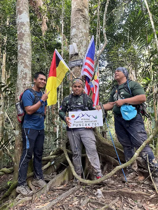
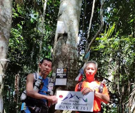
 Puncak 701
G6V4+C8
 Gunung Gagak
73100 Tampin
 Puncak Gunung Datuk
Kota
 Gunung Rembau
Rembau
 Trans Naning
71350 Kota
 Lot Bkt Miku
H4XW+F5
 Port Talan
J43F+VF
 Trailhead Bukit Sikai
M58F+XV
 Bukit Sikai
Unnamed Road
 Port Stream Camping
Kampung Batang Penajis
 Air Terjun Mini Tontong
Kampung Batang Penajis
Kem Ultra Reviews
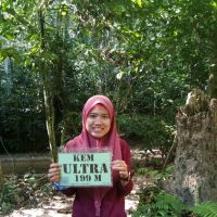
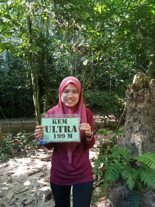
Ultra Camp is a low area between Mount Gagak and Mount Tampin. You can camp and cook, located next to a small shallow river. I have drunk water here and have no stomach ache.if you come down from Mount Gagak, walk against the current (right) to the trail up Mount Tampin.This area is close to the Batu Maloi cave forest. The altitude of this area is 200m-220m max
Dec 27, 2019 · zulhilmi kodir- Jul 19, 2024 · Rahizal Rahim
- Jun 26, 2022 · Shahrul Razali
More Adventure
 Gua Batu Maloi0.0 (0 reviews)
N113, 73100 Tampin, Negeri Sembilan, Malaysia
 Puncak 7010.0 (0 reviews)
G6V4+C8, 73100 Johol, Negeri Sembilan, Malaysia
 Gunung Gagak5.0 (2 reviews)
73100 Tampin, Negeri Sembilan, Malaysia
 Puncak Gunung Datuk4.0 (997 reviews)
Kota, Negeri Sembilan, Malaysia
 Gunung Rembau0.0 (0 reviews)
Rembau, Negeri Sembilan, Malaysia
 Trans Naning5.0 (10 reviews)
71350 Kota, Negeri Sembilan, Malaysia
 Lot Bkt Miku5.0 (5 reviews)
H4XW+F5, 73100 Rembau, Negeri Sembilan, Malaysia
 Port Talan5.0 (2 reviews)
J43F+VF, 71300 Rembau, Negeri Sembilan, Malaysia
 Trailhead Bukit Sikai4.0 (5 reviews)
M58F+XV, Kampung Tanjong Pilah, 71550 Kuala Pilah, Negeri Sembilan, Malaysia
 Bukit Sikai4.0 (67 reviews)
Unnamed Road, 71550, Kampung Pulau, 71550 Kuala Pilah, Negeri Sembilan, Malaysia
 Port Stream Camping5.0 (1 reviews)
Kampung Batang Penajis, 71300 Pedas, Negeri Sembilan, Malaysia
 Air Terjun Mini Tontong5.0 (1 reviews)
Kampung Batang Penajis, 71300 Pedas, Negeri Sembilan, Malaysia
Categories
Popular
 NaiBnB @ Sunsuria Forum Soho Suites0.0 (0 reviews)
 Homestay Ulfah Kuala Lipis4.0 (37 reviews)
 Richmoore Hotel Pudu3.0 (415 reviews)
 Homestay faridita4.0 (2 reviews)
 Sungai Kapar indah5.0 (4 reviews)
 Teratak NH Homestay Pengkalan Chepa5.0 (1 reviews)
Must-Read Blog Posts
Most Searched
Trending Blog Posts
 Exploring the Architectural Beauty of Mosques in Malaysia: A Journey Through Islamic Architecture
 Exploring the Unique Designs of Mosques in Malaysia: A Journey Through Islamic Architecture
 How to Get to the Famous Mosques in Kuala Lumpur by Public Transport: A Complete Travel Guide
 Visiting Malaysia’s Most Famous Mosques During Eid: A Unique Cultural Experience
 Top Mosques to Visit During Ramadan in Malaysia: A Traveler's Guide
 Discover the History of Masjid Titiwangsa in Kuala Lumpur: A Cultural and Architectural Gem