

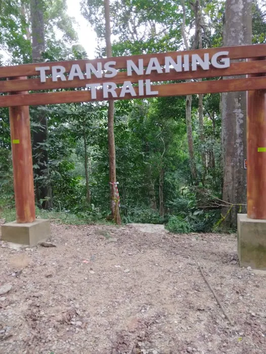
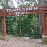
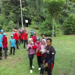
Trans Naning Introduce
For the adventurous souls and seasoned hikers among us in Negeri Sembilan, the name "Trans Naning" resonates with a sense of challenge, achievement, and raw natural beauty. This isn't your average leisurely stroll; Trans Naning is a prominent and demanding hiking trail that offers a true test of endurance, both physical and mental, through the lush tropical rainforests that grace our state. It's a journey that connects two well-known peaks, Gunung Tampin and Gunung Datuk, forming a significant traverse that has become a rite of passage for many in the local hiking community.
Often spoken about with a mix of reverence and a touch of trepidation, Trans Naning represents the pinnacle of hiking experiences in Negeri Sembilan for those looking to push their limits. While it demands respect and preparation, the rewards are immeasurable: breathtaking views, a deep immersion in nature, and the immense satisfaction of conquering a truly formidable trail. For locals seeking a serious outdoor adventure that offers more than just a scenic walk, Trans Naning stands as an unparalleled opportunity. This article will delve into the specifics of this remarkable hiking area, providing insights into its location, what to expect on the trail, and why it holds such a special place in the hearts of Negeri Sembilan's hiking enthusiasts.
Trans Naning is located in Negeri Sembilan, with its address generally cited as 71350 Kota, Negeri Sembilan, Malaysia. This indicates its general vicinity within the Kota district, which is situated near the border of Melaka. The trail is renowned for connecting two significant mountains: Gunung Tampin (the southern end) and Gunung Datuk (the northern end). Hikers typically choose to start from either end, with routes commonly referred to as "Datuk to Tampin" or "Tampin to Datuk."
To access the trail, hikers usually drive to the respective starting points, which are generally the base of Gunung Tampin or Gunung Datuk. For locals in Negeri Sembilan, particularly those from Seremban, Rembau, or Tampin, these trailheads are relatively accessible by private vehicle. Waze or Google Maps can be used to navigate to "Gunung Tampin" or "Gunung Datuk car park" for precise starting coordinates. Parking facilities are usually available at these popular entry points. Given the traverse nature of the hike, many groups arrange for vehicle transfers or have a two-car system (parking one car at each end) to facilitate their journey. While specific public transport options directly to the trailheads might be limited, ride-sharing services could potentially be arranged from nearby towns. The logistical planning for Trans Naning is part of the challenge, but its proximity to major towns in Negeri Sembilan makes it a feasible weekend adventure for the well-prepared local hiker.
- Challenging Hiking Trails: Trans Naning offers a strenuous and long-distance hiking experience, typically covering around 20-21 kilometres and traversing multiple peaks. It is known for steep ascents and descents, making it suitable for experienced hikers.
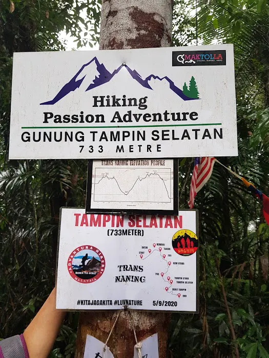
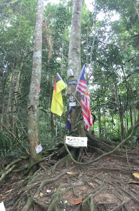
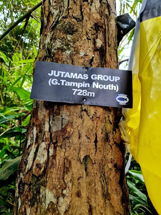
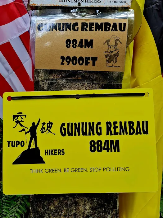
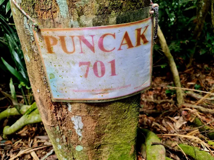
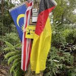
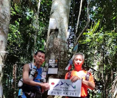
- Multi-Peak Ascent: The trail encompasses several peaks, including Gunung Tampin (North and South), Puncak 705, Puncak 701, Gunung Gagak, Gunung Rembau, and Gunung Datuk, providing a diverse and rewarding trekking experience.
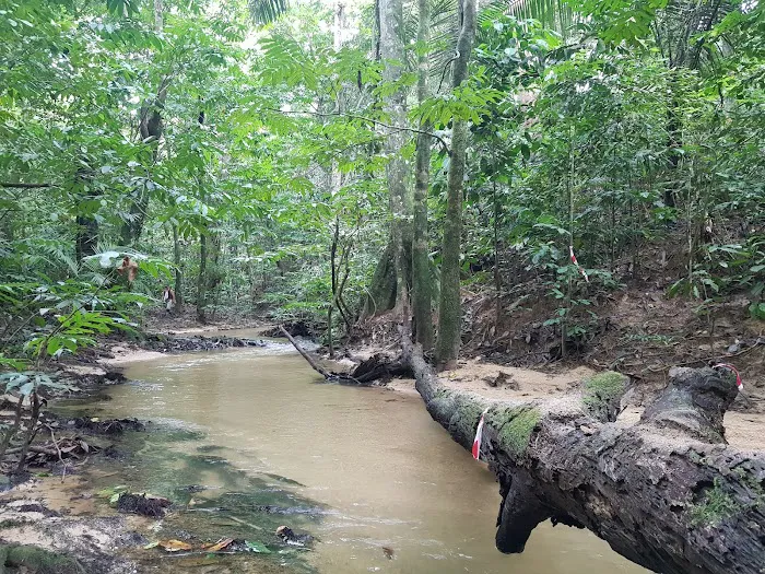
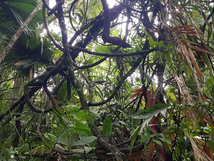
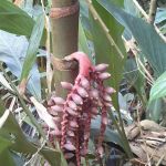
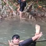
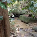
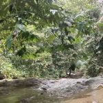
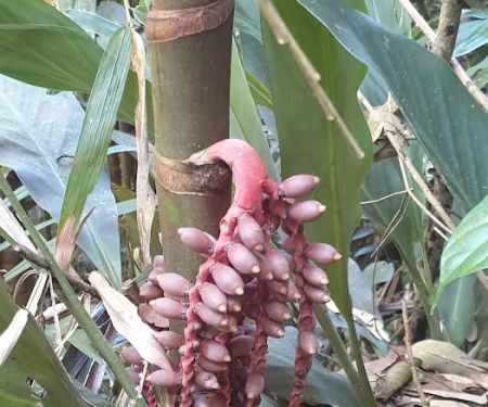
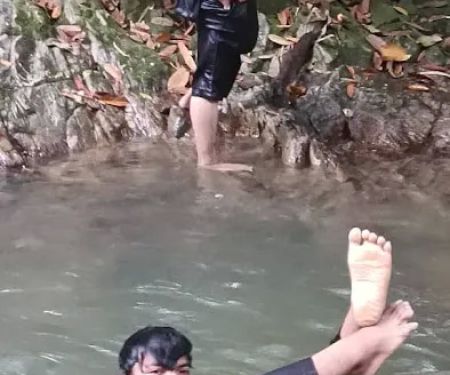
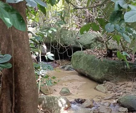
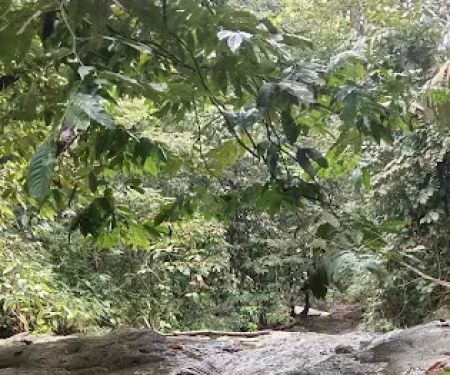
- Natural Environment Immersion: Hikers can immerse themselves in the lush, thick primary rainforest, experiencing rich flora and fauna, including areas where leeches might be present, particularly during wet seasons.
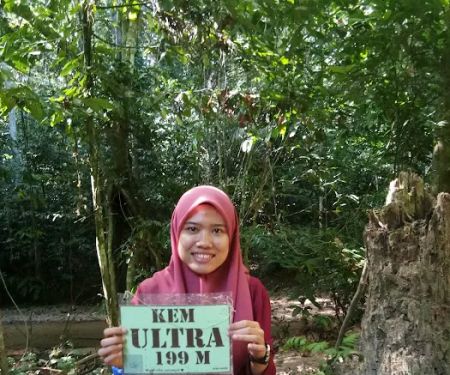
- River Access/Water Refill: There is at least one known water refill point at "Kem Ultra" (or Riverside Camp), where hikers can replenish their water supplies from a river or stream.
- Camping (Informal): While not formalized campsites, spots like "Kem Ultra" offer basic areas where hikers can take extended breaks or potentially set up camp if attempting the traverse over two days.
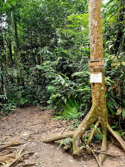
- Trail Marking (Generally Present): Based on reviews, the trail is generally well-maintained and marked, with reflective markers (like "cat's eyes") visible even in low light, aiding navigation.
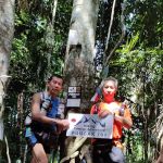
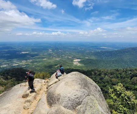
- The Ultimate Negeri Sembilan Hiking Challenge: Trans Naning is widely recognized as one of the most challenging and rewarding multi-peak traverses in Negeri Sembilan, offering a significant test of endurance and willpower for local hikers. Its length (approximately 20-21 km) and elevation gain make it a formidable feat.
- Seven Peaks Experience: The trail encompasses seven distinct peaks along the Titiwangsa Range, including Gunung Tampin (North and South), Puncak 705, Puncak 701, Gunung Gagak, Gunung Rembau, and Gunung Datuk. Conquering all seven offers a profound sense of accomplishment.
- Diverse Terrain: Hikers will encounter a variety of terrains, from bamboo thickets and deep gullies to incredibly steep inclines and steady descents. This diversity keeps the hike engaging and demands adaptability.
- Rich Tropical Rainforest Immersion: The trail plunges deep into the primary rainforest, offering a chance to experience the dense, humid jungle environment, complete with its unique sounds and a high chance of encountering leeches (especially in wet seasons), which is part of the authentic Malaysian jungle trekking experience.
- "Kem Ultra" Riverside Respite: The campsite at "Kem Ultra" (or by the river) serves as a crucial mid-point. It's a key spot for lunch breaks, regrouping, and refilling water bottles from the natural river source, offering a refreshing pause during the arduous journey.
- Mental Fortitude Builder: As highlighted by reviewers, Trans Naning is as much a mental challenge as it is a physical one. Successfully completing it instills a profound sense of resilience and confidence, often leaving hikers with a feeling of "it was okay, not much hard" once the pain subsides.
- Training Ground for Trail Runners: Its demanding nature and well-maintained (though challenging) paths make it a popular training ground for ultra-trail runners and competitive hikers in the region.
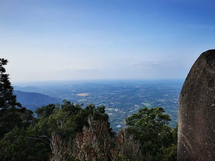
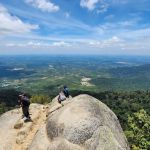
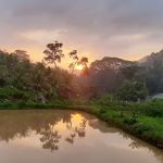
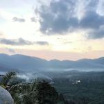
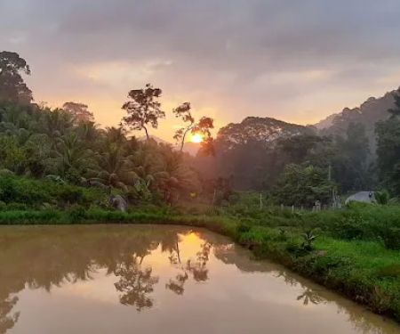
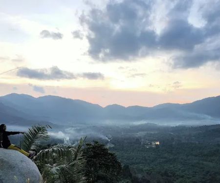
- Stunning Views (at selected peaks): While some peaks might be shrouded in forest, reaching the summit of Gunung Datuk often offers panoramic views that serve as a spectacular reward for the effort expended.
Trans Naning, being a natural forest trail managed by the state forestry department, does not typically offer commercial promotions or special discounts in the same way a private business would. Access to the trail, particularly from the Gunung Datuk side, usually requires a small permit fee (often around RM5.00), which goes towards trail maintenance and conservation efforts.
However, the "promotions" for Trans Naning often come in the form of organized ultra-trail running events or hiking challenges, such as the "TransNaning Ultra NS Challenge." These events, organized by external bodies in collaboration with local authorities, offer various race categories with different distances and elevation gains. While these events have registration fees, they often come with finisher medals, event t-shirts, and the prestige of participating in a recognized endurance race. These events are advertised through sports event platforms and social media. For the casual or independent hiker, the primary offer remains the consistent opportunity to experience a challenging and rewarding traverse through pristine rainforest at minimal cost. Any changes to permit fees or regulations would be communicated by the relevant government bodies.
- Address: 71350 Kota, Negeri Sembilan, Malaysia (This is a general address for the area; specific trailheads are at Gunung Tampin and Gunung Datuk).
- Phone: There is no specific public phone number for Trans Naning as a hiking area itself. For permit inquiries (if required, especially for Gunung Datuk), contact information for the Negeri Sembilan Forestry Department or the Gunung Datuk Recreational Forest management office would be most appropriate. For information related to organized events like the TransNaning Ultra, the organizers (e.g., Malatra Events) would have dedicated contact details.
Trans Naning is exceptionally well-suited for locals in Negeri Sembilan who are seasoned hikers or those looking to seriously challenge their physical and mental limits. Its primary appeal lies in providing a readily accessible, yet profoundly demanding, multi-peak trekking experience right in our backyard. For residents who have already conquered local hills and are yearning for a greater adventure, Trans Naning offers that next-level challenge without requiring extensive travel out of state.
The unique aspect of traversing seven peaks over a considerable distance (around 20-21 km) makes it a significant achievement. It's a fantastic training ground for endurance, stamina, and navigation skills, pushing hikers beyond their comfort zones. As noted by real customers, the sense of accomplishment after completing such a challenging route, even if it feels "not much hard" in retrospect, is immense. This deep satisfaction, combined with the opportunity to immerse oneself in the thick, beautiful primary rainforest – complete with its challenges like leeches and steep climbs – provides an authentic Malaysian jungle trekking experience.
Moreover, the existence of key features like the river at "Kem Ultra" for water refills and generally well-marked trails, while requiring self-sufficiency, makes the logistics manageable for experienced local groups. Trans Naning isn't just a hike; it's a journey of self-discovery and a testament to one's resilience. For the vibrant hiking community of Negeri Sembilan, Trans Naning stands as a proud local landmark, a proving ground, and an unforgettable adventure that truly embodies the spirit of outdoor exploration in our beautiful state.
Trans Naning Photos
Trans Naning Location
Trans Naning
71350 Kota, Negeri Sembilan, Malaysia
 Trans Naning
71350 Kota
 Puncak Gunung Datuk
Kota
 Gunung Rembau
Rembau
 Gunung Gagak
73100 Tampin
 Puncak 701
G6V4+C8
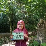 Kem Ultra
73100 Tampin
 Gua Batu Maloi
N113
 Lot Bkt Miku
H4XW+F5
 Port Talan
J43F+VF
 Trailhead Bukit Sikai
M58F+XV
 Port Stream Camping
Kampung Batang Penajis
 Air Terjun Mini Tontong
Kampung Batang Penajis
 Bukit Sikai
Unnamed Road
Trans Naning Reviews
About 20KM , 12 hours with enough breaks at every peak and regroup.We did it form Datuk to Tampin trail. There were arguments among us on which route is tough.It was real mental challenge if you are not doing 10-15KM always. Once you finish you will be relaxed and will have that feeling like it was ok not much hard.Actually 1st part until Campsite was going on a good pace. After lunch break at the Campsite , the real hard challenge came as you have to go up all way to punchak 705 ( that’s 705 meters as well). After 705 it was ok ok further 2 peaks.
Aug 05, 2022 · Suresh KThe trails is hard for a beginner like me. 17++ eg, 20+/-km. Please bring enough food & water. U only can refill your drinks at kem ultra by the RIVER 😁. Prepare to be attack by leeches 😂. Maybe will do it again. Reverse trans naning.
Sep 16, 2023 · Ahmad SyafiqGreat to have one direct trail with 9 check points 7 Summit across the whole trans, we managed to finished with 8.5 hours
Jan 16, 2021 · eclipse新不了情𝕀 𝕨𝕒𝕤 𝕙𝕒𝕡𝕡𝕪
Mar 21, 2022 · Nyein ChanGood experiance with 18 km on track
Jul 04, 2022 · Kerulz Ab Rahim
More Adventure
 Puncak Gunung Datuk4.0 (997 reviews)
Kota, Negeri Sembilan, Malaysia
 Gunung Rembau0.0 (0 reviews)
Rembau, Negeri Sembilan, Malaysia
 Gunung Gagak5.0 (2 reviews)
73100 Tampin, Negeri Sembilan, Malaysia
 Puncak 7010.0 (0 reviews)
G6V4+C8, 73100 Johol, Negeri Sembilan, Malaysia
 Kem Ultra4.0 (3 reviews)
73100 Tampin, Negeri Sembilan, Malaysia
 Gua Batu Maloi0.0 (0 reviews)
N113, 73100 Tampin, Negeri Sembilan, Malaysia
 Lot Bkt Miku5.0 (5 reviews)
H4XW+F5, 73100 Rembau, Negeri Sembilan, Malaysia
 Port Talan5.0 (2 reviews)
J43F+VF, 71300 Rembau, Negeri Sembilan, Malaysia
 Trailhead Bukit Sikai4.0 (5 reviews)
M58F+XV, Kampung Tanjong Pilah, 71550 Kuala Pilah, Negeri Sembilan, Malaysia
 Port Stream Camping5.0 (1 reviews)
Kampung Batang Penajis, 71300 Pedas, Negeri Sembilan, Malaysia
 Air Terjun Mini Tontong5.0 (1 reviews)
Kampung Batang Penajis, 71300 Pedas, Negeri Sembilan, Malaysia
 Bukit Sikai4.0 (67 reviews)
Unnamed Road, 71550, Kampung Pulau, 71550 Kuala Pilah, Negeri Sembilan, Malaysia
Categories
Popular
 Toneexcel Branch Sungai Besar5.0 (1 reviews)
 daddy's farm5.0 (2 reviews)
 3 Rooms Elegant Minimalist Design Setapak 15min KLCC5.0 (1 reviews)
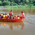 Agro Tourism Homestay Sg Sireh4.0 (190 reviews)
 Shisha Ummi Maluri5.0 (10 reviews)
 A Bar Above USJ0.0 (0 reviews)
Must-Read Blog Posts
Most Searched
Trending Blog Posts
 Exploring the Architectural Beauty of Mosques in Malaysia: A Journey Through Islamic Architecture
 Exploring the Unique Designs of Mosques in Malaysia: A Journey Through Islamic Architecture
 How to Get to the Famous Mosques in Kuala Lumpur by Public Transport: A Complete Travel Guide
 Visiting Malaysia’s Most Famous Mosques During Eid: A Unique Cultural Experience
 Top Mosques to Visit During Ramadan in Malaysia: A Traveler's Guide
 Discover the History of Masjid Titiwangsa in Kuala Lumpur: A Cultural and Architectural Gem