

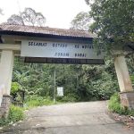
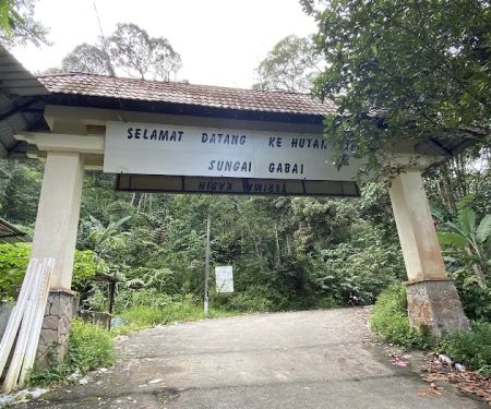
Nuang trailhead Introduce
Are you a hiking enthusiast in Selangor looking for your next big adventure? Or perhaps a curious beginner eager to test your limits amidst breathtaking natural beauty? Look no further than the iconic Nuang trailhead, your gateway to conquering Mount Nuang, one of Selangor’s most revered and challenging peaks. Nestled in the lush landscapes of Hulu Langat, Nuang offers an unforgettable trekking experience that combines demanding trails with rewarding views, making it a true gem for local adventurers.
Mount Nuang is widely regarded as a significant test of endurance and mental fortitude for hikers in the region. Its challenging terrain and considerable elevation gain provide a rigorous workout, attracting seasoned trekkers and ambitious beginners alike. This article aims to be your comprehensive guide to the Nuang trailhead, offering insights into what to expect, how to prepare, and what makes this hiking area a must-visit for anyone in Selangor seeking an exhilarating outdoor experience.
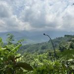
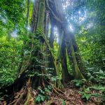
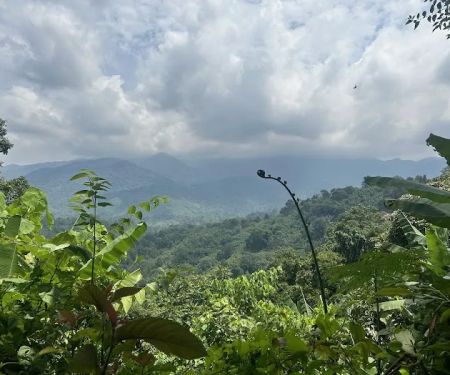
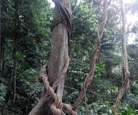
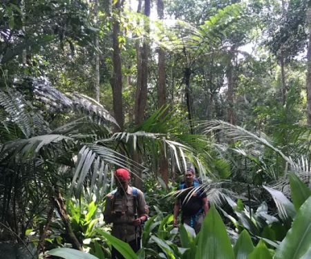
From the moment you set foot on the trail, you'll be immersed in the natural splendor of Selangor. The journey to the peak is not just about reaching the summit; it's about the entire experience – the camaraderie with fellow hikers, the serene sounds of the forest, and the personal triumph of overcoming physical and mental challenges. Whether you're aiming for a personal best or simply wish to connect with nature on a deeper level, Nuang trailhead provides the perfect backdrop for your outdoor aspirations.
It’s important to approach this hike with respect for its demands. While the rewards are immense, adequate preparation is key to a safe and enjoyable journey. This guide will walk you through everything from understanding the trail's difficulty to securing the necessary permits and packing essentials, ensuring you’re well-equipped for an adventure of a lifetime right here in Selangor.
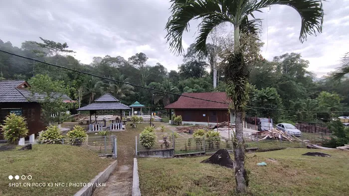
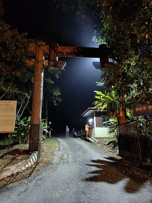
The Nuang trailhead is conveniently located at B52, Kampung Kuala Pansoon, 43100 Hulu Langat, Selangor, Malaysia. This prime location makes it easily accessible for residents across Selangor and neighboring areas. Getting to the trailhead typically involves a drive, and ample parking spaces are available at the entrance, ensuring a smooth start to your hiking day. While public transport options might be limited, ride-sharing services or carpooling with fellow hikers are popular choices for reaching this natural haven. The journey to the trailhead itself offers scenic views, setting the tone for the adventure that lies ahead.
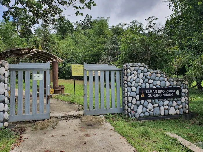
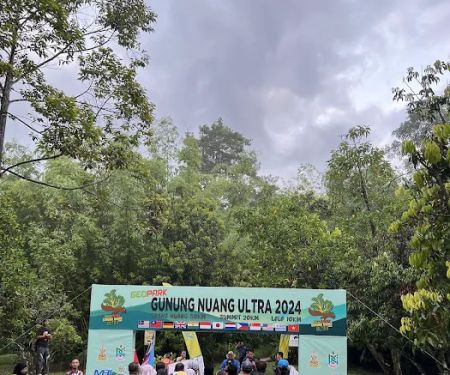
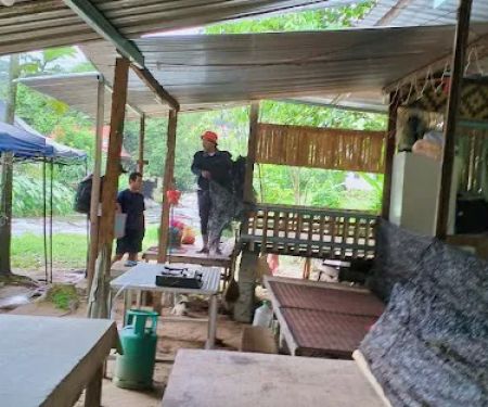
While Nuang is primarily a natural hiking area, the trailhead provides essential facilities to ensure a more comfortable and prepared experience for hikers. These services are designed to cater to the immediate needs of trekkers before and after their strenuous journey:
- Toilet/Dressing Rooms: Conveniently located at the trailhead/entrance, these facilities allow hikers to freshen up before embarking on their trek and change into dry clothes after a long, often muddy, descent.
- Parking Spaces: Sufficient parking is available at the trailhead, accommodating a good number of vehicles, which is crucial given the popularity of Mount Nuang. This eliminates the stress of finding parking and allows hikers to focus on their adventure.
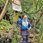
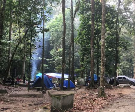
- Last Water Source at Kem Lolo: Hikers are advised that the last reliable water source before the challenging ascent to the peak is at Kem Lolo. This is a critical piece of information for planning water supplies, especially for an almost 13-hour hike. Many hikers utilize this point for refilling water bottles and for prayer breaks (Subuh and Zohor).
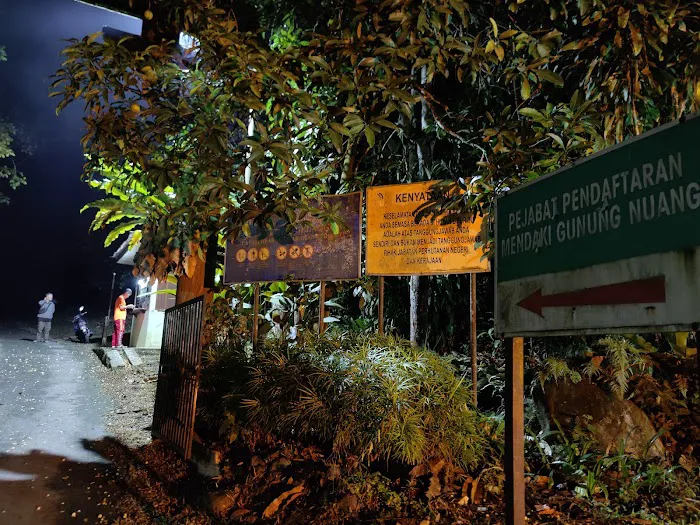
- Permit Application Guidance (Indirect): While permits are not available for purchase directly at the trailhead, the common practice among hikers, especially those with groups, involves a 'Malim Gunung' (mountain guide) handling the application process, typically a week in advance. A fee of RM5 per person is usually required. This highlights the importance of pre-planning for your hike.
Mount Nuang offers a multitude of features and highlights that make it a truly unique and challenging hiking destination in Selangor:
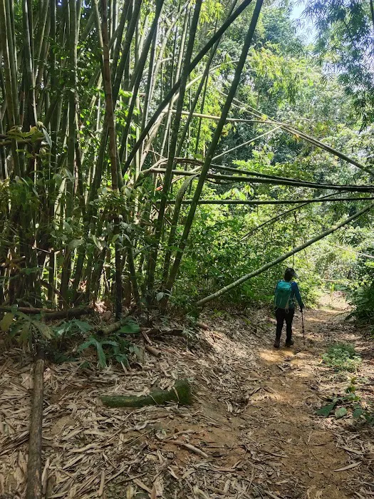
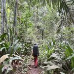
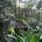
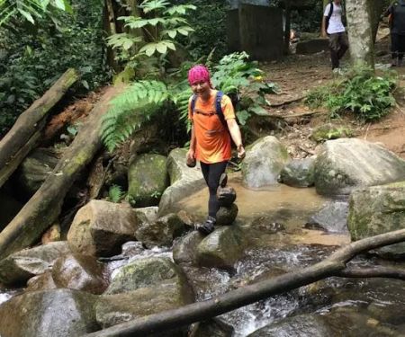
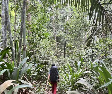
- Challenging Terrain: Nuang is renowned for its difficulty, making it a prime target for those seeking a rigorous physical and mental test. The trail includes sections that are very steep and can be incredibly muddy, especially from Kem Pengasih to the peak, and particularly if it has rained recently.
- Well-Marked Trails (Mostly): The trail is generally easy to follow, with clear markings on trees guiding hikers. However, vigilance is required, especially after the first river crossing where multiple paths might appear, particularly in the dark.
- Long Duration Hike: Expect a full-day commitment. A typical hike can take anywhere from 12 to 13 hours, emphasizing the need for thorough preparation, including adequate food, water, and rest breaks.
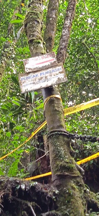
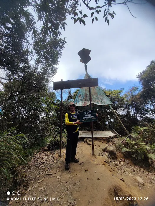
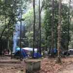
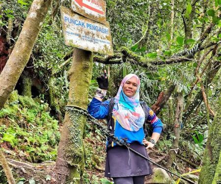
- Strategic Rest Camps: Key camps like Kem Lolo (last water source) and Kem Pacat offer strategic points for rest and regrouping, breaking down the long trek into manageable segments. The stretch from Kem Pacat to Kem Pengasih is noted as particularly steep and challenging.
- Muddy Conditions: Be prepared for significant mud, especially in the upper sections of the trail and after rainfall. This adds to the challenge and necessitates appropriate footwear and potentially hiking poles.
- Cold Peak Conditions: The summit of Mount Nuang can get surprisingly cold. Hikers are strongly advised to bring a jacket to stay warm while enjoying the summit views.
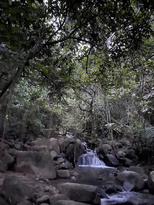
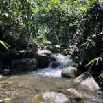
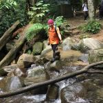
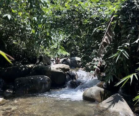
- Scenic River Crossings: The trail involves several river crossings, adding an adventurous element to the trek and providing opportunities for refreshing dips if desired.
As a natural park and a popular hiking destination, the Nuang trailhead does not typically offer commercial promotions or special discounts. The primary 'offer' is the unparalleled experience of conquering Mount Nuang itself. The permit fee is a standard RM5 per person, which contributes to the upkeep and management of the trails and facilities. Group rates or special packages are usually managed by independent hiking groups or tour operators who might bundle the permit fee with their guiding services and transportation. It is always advisable to check with any hiking groups you plan to join if they offer an all-inclusive package for the Nuang trek.
For direct inquiries regarding the Nuang trailhead, permits, or specific regulations, it is best to refer to the relevant local forestry department or park authorities responsible for the management of natural parks in Selangor. While a specific direct contact number for the trailhead management might not be publicly listed, general inquiries can often be routed through official government channels. The address for the trailhead is:
B52, Kampung Kuala Pansoon, 43100 Hulu Langat, Selangor, Malaysia
For permit applications, remember that these are generally handled in advance, often through a Malim Gunung (mountain guide) if you are hiking as part of a group. It is recommended to plan your trip at least a week ahead to ensure all necessary permits are secured.
For locals in Selangor, the Nuang trailhead represents far more than just a hiking spot; it's a testament to personal resilience, a gateway to stunning natural beauty, and an accessible escape from the urban hustle. Its proximity to various residential areas in Selangor makes it an ideal weekend adventure or even a mid-week challenge for those seeking to reconnect with nature.
While undeniably difficult, the challenge of Mount Nuang is precisely what makes it so appealing. It serves as an excellent training ground for aspiring mountaineers and a rewarding goal for those looking to push their physical and mental boundaries. As many seasoned hikers attest, if you can conquer Nuang, you can tackle many other peaks. The "beginner-friendly" aspect, despite its difficulty, stems from the mental preparation and gradual build-up advised by experienced trekkers, making it an achievable feat for dedicated individuals.
The facilities available at the trailhead, such as toilets and ample parking, enhance the overall convenience for local visitors. The community aspect, often seen through groups hiking together and the shared experience of overcoming the trail's obstacles, fosters a sense of camaraderie unique to the Nuang experience.
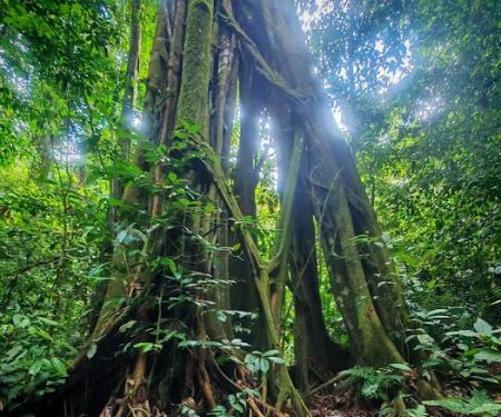
Moreover, the trek itself offers diverse landscapes, from the initial river crossings to the increasingly muddy and steep paths, culminating in the chilly, rewarding peak. This variety keeps the hike engaging and provides numerous opportunities for appreciating Selangor's rich biodiversity.
In essence, Nuang trailhead is perfectly suited for locals because it offers an accessible, challenging, and incredibly rewarding outdoor experience right at their doorstep. It's a place where you can test your limits, build resilience, and create lasting memories amidst the stunning natural backdrop of Selangor. So, gather your gear, prepare your mind, and embark on an unforgettable journey to the summit of Mount Nuang – a true local treasure awaiting your exploration.
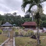
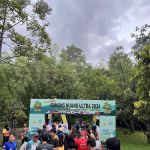
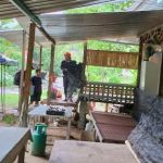
Nuang trailhead Photos

Nuang trailhead Location
Nuang trailhead
B52, Kampung Kuala Pansoon, 43100 Hulu Langat, Selangor, Malaysia
 Nuang trailhead
B52
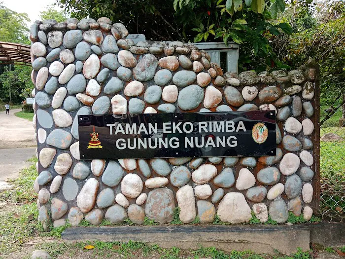
 Taman Eko Rimba Nuang
Nuang trailhead
 Suraya Riverside
TNB Pangsun
 Hutan Terkutuk
6VF7+QC
 Kem Lolo
43100 Hulu Langat
 Bukit Chenuang Trailhead
Unnamed Road
 Jeram Perlus Waterfall
43100 Hulu Langat
 Kem Pacat
Unnamed Road
 Jeram Perlus Waterfall Parking Trailhead
5W92+G5
 Puncak Pengasih
Unnamed Road
 Jeram Perlus trailhead
43100 Hulu Langat
 State Boundary of Selangor-N.S-Pahang
Kenaboi
 Sliding gabai
5W85+MR
Nuang trailhead Reviews
Trail: Trail is easy to follow except for maybe after the first river crossing especially in the dark, it seems like there are a couple of trails to be followed. Be aware of the markings left on the trees and you should be fine. If it didn't rain the night before, the trail will be fairly dry except from Kem Pengasih to the peak. The muddiest trail I've ever hiked in.Difficulty: Hard. If you’re a beginner and you’re wondering if you can hike Nuang, I’m a beginner myself and if I can do it, you can too. Try hike a couple of hills/mountains or climb the stairs every day a week or two before the hike and you should be okay. The most important thing is to prepare mentally. Know what to expect and prepare accordingly. I made a mistake of bringing too many snacks and in the end, I only ate a small amount of it. If I were to do it again, I’d bring about 2-2.5 litres of water, a couple of apples, energy bars and sandwiches. And a first-aid kit. That’s all. I started around 5am and ended the hike at around 5:50pm, so it’s an almost 13-hour hike so prepare accordingly.Facilities: Toilet/dressing rooms only available at the trailhead/entrance. Last water source is at Kem Lolo. We did our Subuh and Zohor there. Sufficient parking spaces available at the trailhead.Permit: Not available to purchase at the trailhead. I think you must apply a week before the hike. Most hikers came with a group, and I believe to hike Nuang, you are required to have a Malim Gunung with you, so they’re the one who prepares the application. A fee of RM5 per head for the permit.Others: Hiking pole helped me tremendously and so does gloves. Kem Pacat to Kem Pengasih is very very steep and challenging so be careful of your surroundings so as not to fall. Take it easy, rest when you need to and good luck! Oh and it gets really really cold at the peak so bring a jacket.Not proofread so grammar mistakes abound!
Feb 26, 2024 · I. Ibrahim12 Hours hike😅 don't play play, this is not for the weak ones. Very muddy from middle part to peak area. Mental power must be kuat 💪Bring: gloves, Food, enough small bites, minimum 2 to 3 litre of water & softdrinks, painkiller cream/spray/medicine, hiking stick and lastly bring your smile when reach the peak 😄
Jul 31, 2022 · Ray ChongThis trail is 20km return trip, elevation about 1600EG. Normal time 8 to 12 hours to complete.Do your due diligence before conquering this mountain.Easier trail to complete Gunung Nuang is via Janda Baik which you can complete it within 8 hours.Before conquer Gunung Rajah, please complete this trail first.Trailhead -> 6 huts -> start hike Camp Lolo -> Camp Pacat (make sure you're not damn tired here) rest and eat -> Puncak Pengasih -> Puncak Nuang 😀Recommended 4L of water, 2 meals, 3 snacks, 2 powerbars, 2 powergels, hiking pole&raincoat(this trail most of the time is muddy), hiking glovesBeware of rainy season, the trail will be muddy and it's slippery. Must be aware of the pouring water from the Hill top if it's raining.Camp Lolo waterpoint if you're lack of water.Camp Pacat does not have water point.
Jun 12, 2022 · Mike TehMake sure bring more than 3 litres, bring enough food and energy bar. Go with friends with well training, no newbie for this hill. minimum 8 hours go and return for medium level hiker
May 01, 2022 · Neskson Tan Chong HaoToilet provided ✅Parking ✅Hiking Permit from office ✅
Oct 09, 2022 · Qila MinionsFamily
More Adventure
 Taman Eko Rimba Nuang5.0 (3 reviews)
Nuang trailhead, B52, Kampung Kuala Pansoon, 43100 Hulu Langat, Selangor, Malaysia
 Suraya Riverside4.0 (12 reviews)
TNB Pangsun, Jalan, Kampung Kuala Pansoon, 43100 Hulu Langat, Selangor, Malaysia
 Hutan Terkutuk0.0 (0 reviews)
6VF7+QC, 43100 Hulu Langat, Selangor, Malaysia
 Kem Lolo4.0 (15 reviews)
43100 Hulu Langat, Selangor, Malaysia
 Bukit Chenuang Trailhead3.0 (23 reviews)
Unnamed Road, Kampung Padang, 43100, 43100 Hulu Langat, Selangor, Malaysia
 Jeram Perlus Waterfall5.0 (5 reviews)
43100 Hulu Langat, Selangor, Malaysia
 Kem Pacat4.0 (44 reviews)
Unnamed Road, 43100 Hulu Langat, Selangor, Malaysia
 Jeram Perlus Waterfall Parking Trailhead0.0 (0 reviews)
5W92+G5, 43100 Hulu Langat, Selangor, Malaysia
 Puncak Pengasih4.0 (38 reviews)
Unnamed Road,, 43100 Hulu Langat, Selangor, Malaysia
 Jeram Perlus trailhead4.0 (6 reviews)
43100 Hulu Langat, Selangor, Malaysia
 State Boundary of Selangor-N.S-Pahang5.0 (1 reviews)
Kenaboi, Negeri Sembilan, Malaysia
 Sliding gabai4.0 (2 reviews)
5W85+MR, 43100 Hulu Langat, Selangor, Malaysia
Categories
Popular
 Naughty Nelly USJ94.0 (162 reviews)
 shaklee pahang4.0 (18 reviews)
 House Of Nostalgia Kuala Lumpur5.0 (1 reviews)
 Teratak980.0 (0 reviews)
 HASBI Homestay Nilai Impian Nilai 35.0 (4 reviews)
 Homestay De'Berah4.0 (12 reviews)
Must-Read Blog Posts
Most Searched
Trending Blog Posts
 Exploring the Architectural Beauty of Mosques in Malaysia: A Journey Through Islamic Architecture
 Exploring the Unique Designs of Mosques in Malaysia: A Journey Through Islamic Architecture
 How to Get to the Famous Mosques in Kuala Lumpur by Public Transport: A Complete Travel Guide
 Visiting Malaysia’s Most Famous Mosques During Eid: A Unique Cultural Experience
 Top Mosques to Visit During Ramadan in Malaysia: A Traveler's Guide
 Discover the History of Masjid Titiwangsa in Kuala Lumpur: A Cultural and Architectural Gem