
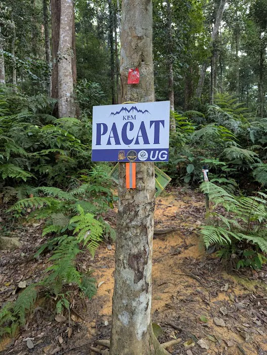
Kem Pacat Introduce
For many of us in Selangor who cherish the great outdoors, a challenging hike that truly tests our limits is an experience like no other. Gunung Nuang, the highest peak in Selangor, stands as a formidable yet highly rewarding destination, and nestled along its well-known trail is Kem Pacat. This isn't just a simple rest stop; it's a significant waypoint on a demanding journey, offering a space to recuperate and connect with fellow adventurers before tackling the steepest sections. From our perspective as local hikers, knowing about Kem Pacat is essential for planning a successful and safe ascent of Gunung Nuang, making it a pivotal point in one of Selangor’s most iconic treks.
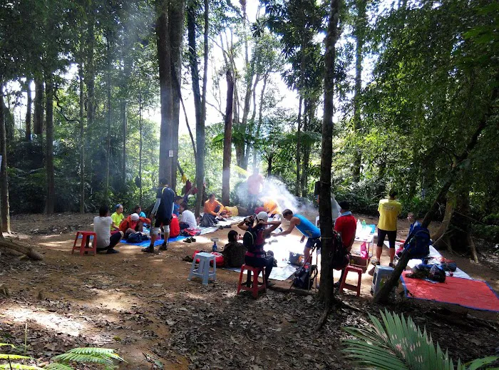
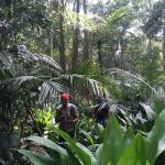
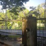
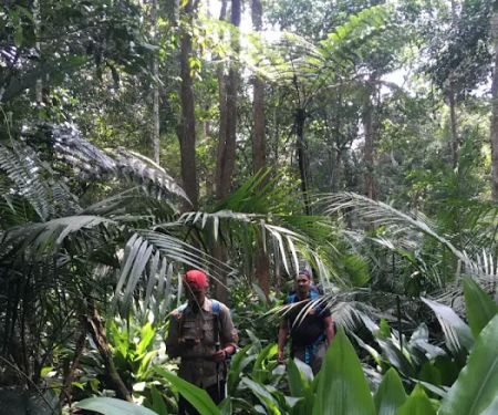
Kem Pacat, which translates to "Leech Camp," is a well-known checkpoint and rest area on the popular Gunung Nuang hiking trail, particularly when ascending via the Pangsun route in Hulu Langat. It serves as a crucial mid-point for hikers, providing a relatively flat and open space after several hours of trekking. While the name might give some a shiver (and indeed, leeches can be present, especially after rain!), its primary function is as a vital rest station for those attempting the challenging summit of Gunung Nuang. It's often where hikers take a longer break, refuel, and prepare for the more strenuous sections of the climb that lie ahead.
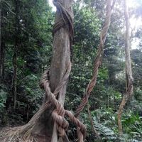
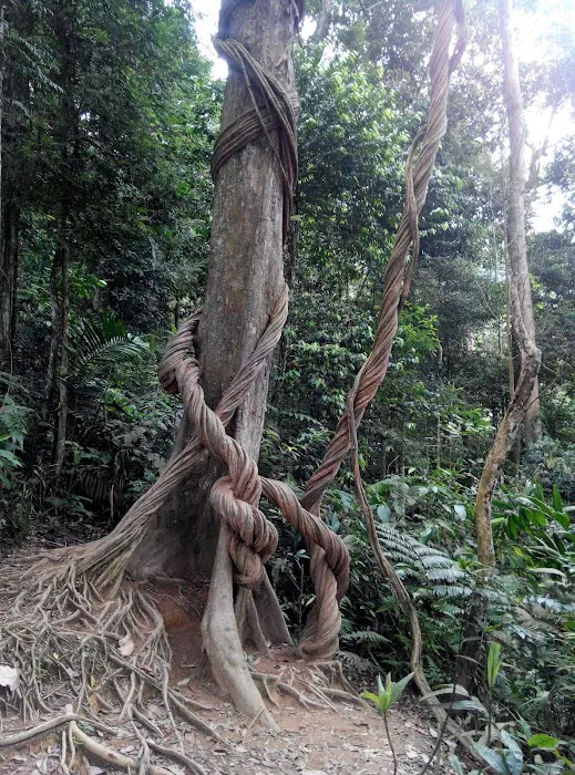
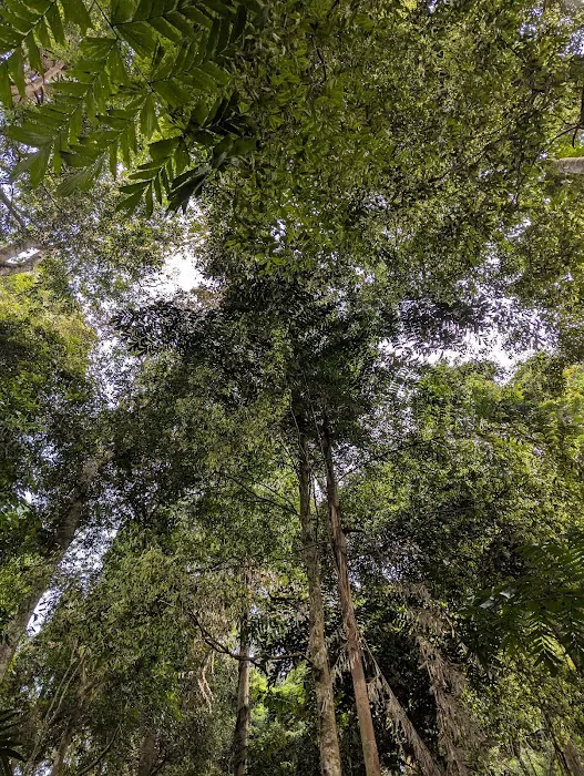
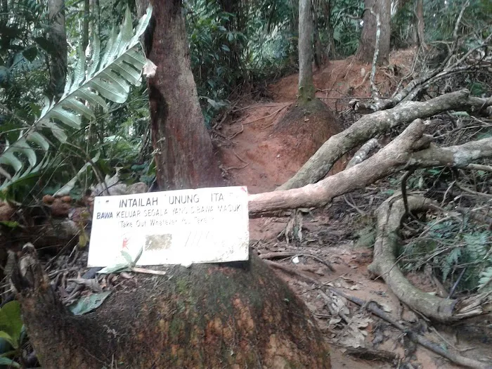
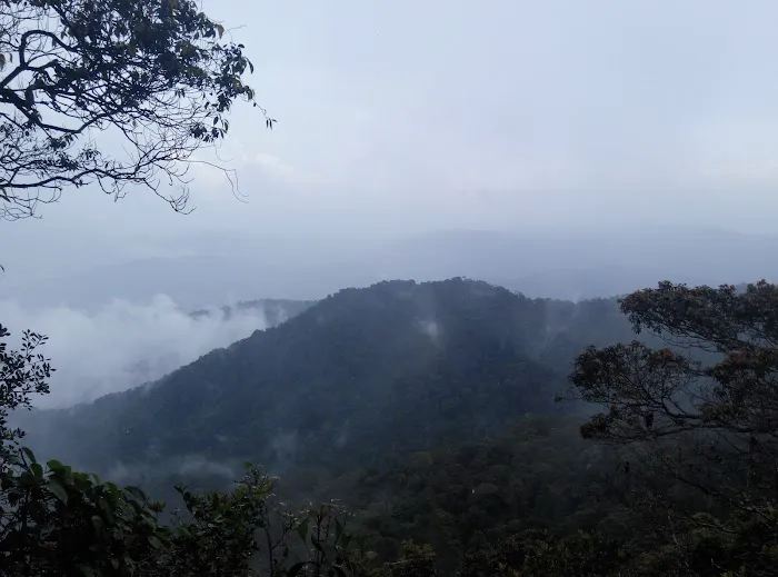
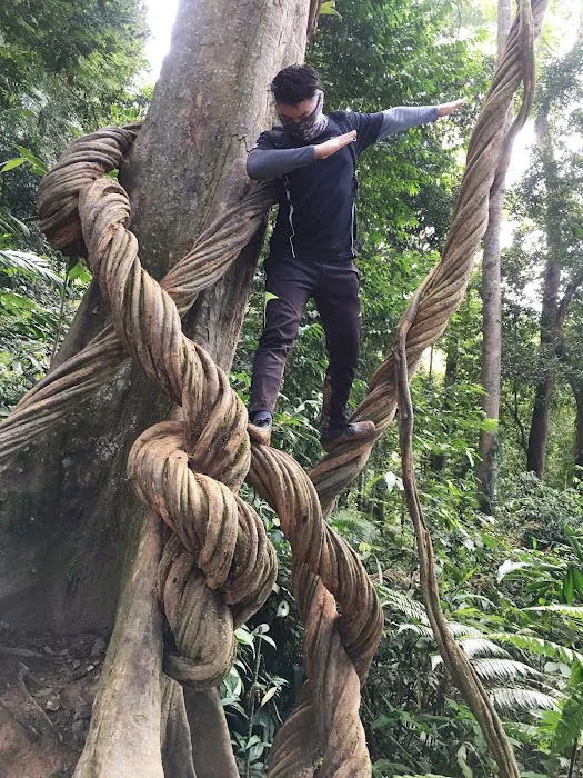
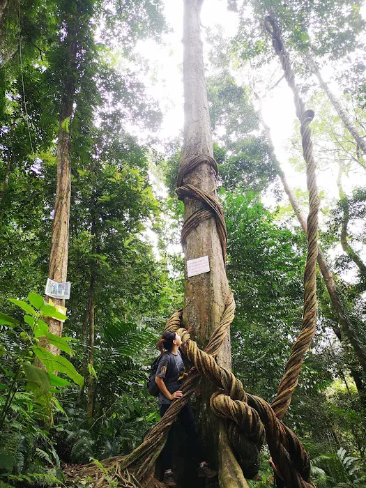
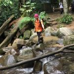
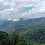
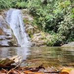
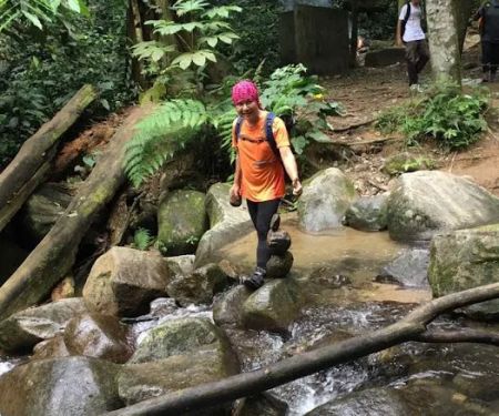
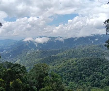
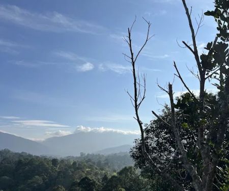
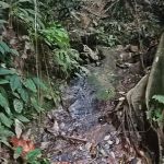
As a part of the Gunung Nuang trail, Kem Pacat is characterized by its surrounding lush rainforest. Hikers will experience dense jungle, the sounds of nature, and often muddy and slippery terrain, especially during or after wet weather. The journey to Kem Pacat itself is a significant hike, requiring a good level of fitness and preparation. The provided information suggests it takes approximately 3.5 hours from the parking area to reach Kem Pacat, or about 3 hours 20 minutes from the trailhead. This indicates it’s not a casual stroll but a substantial trek. It’s known to have ample space for resting or even setting up a camp for those attempting a multi-day hike to the summit or beyond. Importantly, a previously notable "tree with big roots" that served as a landmark is now reportedly missing, highlighting that trail conditions can change and it’s always wise to stay updated.
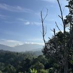
The experience of reaching Kem Pacat is often described as a moment of relief and readiness for the next phase of the climb. It represents a transition point from the initial long, undulating jeep track and river crossings to the steeper, more challenging ascents towards Puncak Pengasih (false peak) and ultimately Gunung Nuang's summit. For us in Selangor, Kem Pacat is more than just a spot on a map; it's a symbol of perseverance and a testament to the wild beauty that exists just outside our urban centers, offering a true jungle adventure for those willing to embark on it.
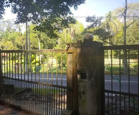
Kem Pacat is located along the trail to Gunung Nuang, accessible from the Pangsun trailhead in Hulu Langat, Selangor. The exact address provided, "Unnamed Road, 43100 Hulu Langat, Selangor, Malaysia," points to the general area where the trailhead is situated, typically at the Gunung Nuang Recreational Forest entrance near Kampung Pangsun. For us locals, reaching Hulu Langat is quite manageable. By car, it's accessible via the Cheras-Kajang Expressway (Grand Saga Highway) or the SILK Highway, leading into the smaller local roads towards Pangsun. Ample parking is usually available at or near the trailhead, though a small fee might be collected by the caretakers or local community for parking and entry.
Public transportation to the precise trailhead is not direct. While there are Rapid KL bus services that go towards Hulu Langat town, reaching Pangsun and the Gunung Nuang trailhead would likely require an e-hailing service (Grab) or a local taxi from the nearest major town or bus stop. Given the remote nature of the trailhead, having your own transport or carpooling with fellow hikers is highly recommended for convenience and flexibility. This ensures a smoother start and end to what is often a full-day or multi-day hiking expedition. The journey to the trailhead itself offers glimpses of rural Selangor, transitioning from urban sprawl to more serene kampung (village) landscapes, setting the mood for the adventure ahead.
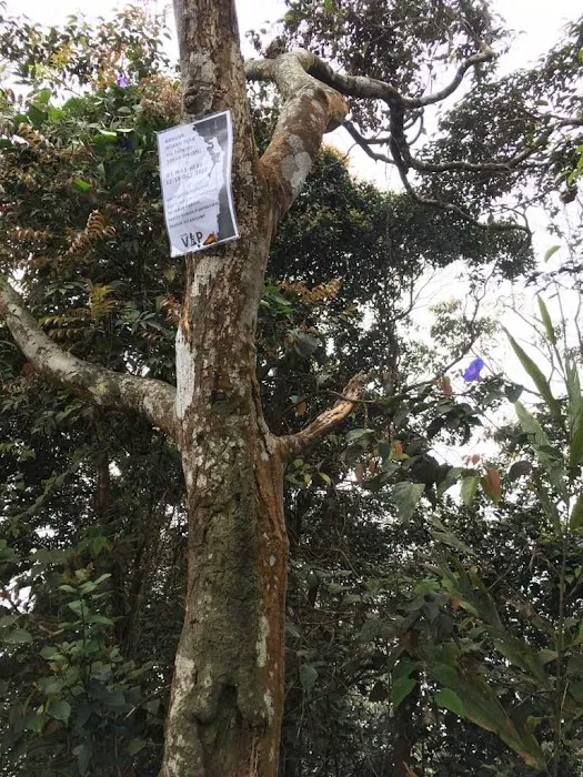
As a designated rest area within a challenging hiking trail, Kem Pacat itself does not offer commercial "services" in the traditional sense, such as shops or staffed facilities. The "services" it provides are inherent to its role as a key waypoint for hikers on the Gunung Nuang trek:
- Resting Space: A relatively flat and open area providing ample room for hikers to take a break, unpack snacks, and stretch.
- Camping Spot (potential): For those attempting a multi-day climb of Gunung Nuang, Kem Pacat offers a suitable, albeit basic, area for setting up tents overnight.
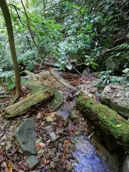
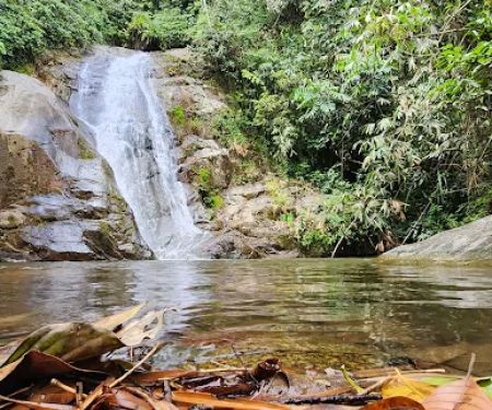
- Water Source (potential): While not always clearly marked or immediately next to the main rest area, many major checkpoints on long hiking trails like Nuang have access to natural water sources (streams or springs) nearby. Hikers should be prepared to filter or treat this water.
- Shelter (basic): Sometimes, a rudimentary hut or natural shelter might be present, offering minimal protection from rain or sun.
- Strategic Location: Its position marks a significant milestone in the hike, indicating progression and preparing hikers for the next level of challenge.
Hikers planning to utilize Kem Pacat should be entirely self-sufficient, carrying all necessary food, water (or purification methods), first-aid, and camping gear if planning to stay overnight.
Kem Pacat, as a key point on the Gunung Nuang trail, has several features and highlights that are significant for hikers:
- Crucial Mid-Point: It serves as the second major checkpoint after Kem Lolo, offering a much-needed rest after a strenuous segment of the hike.
- Camping Potential: The ample space makes it a viable spot for overnight camping for those undertaking a 2-day/1-night ascent of Gunung Nuang, breaking up the challenging climb.
- Natural Setting: Fully immersed in the primary rainforest of Hulu Langat, it offers a deep connection with nature, away from urban distractions.
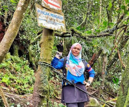
- Preparation Zone: It's the last significant flat area before the increasingly steep and challenging ascent to Puncak Pengasih and the Gunung Nuang summit, prompting hikers to mentally and physically prepare for the final push.
- Challenging Terrain Indicator: Reaching Kem Pacat signifies that hikers have successfully navigated the initial river crossings and the long jeep track, and are now entering the more technical and demanding parts of the trail.
- Leech Encounter (be prepared): While the name might deter some, the presence of leeches (especially in wet conditions) is a natural aspect of rainforest hiking and a reminder of the raw, untamed environment.
As a natural checkpoint and rest area within a forest reserve hiking trail, Kem Pacat does not offer commercial promotions or special offers in the typical sense. Access to the Gunung Nuang trail, and by extension Kem Pacat, usually involves a small entrance fee collected at the trailhead by the Forestry Department or appointed caretakers. Any "promotions" would be related to general access or community-driven initiatives:
- Entrance Fees: Expect a nominal fee (e.g., RM1-RM5 per person) for entry into the Gunung Nuang Recreational Forest, which covers access to the trails including Kem Pacat.
- Parking Fees: A small fee might be charged for parking at the trailhead.
- Permit Requirements: For certain times or group sizes, a permit from the Selangor Forestry Department might be required, which could involve an application fee. It's always best to check the latest regulations before planning your hike.
- Organized Group Events: Local hiking clubs or outdoor adventure companies might offer guided trips to Gunung Nuang, which would include the journey to Kem Pacat, often bundled with transportation, guides, and sometimes meals. These are "promotions" for their services rather than the site itself.
Always confirm the latest permit and fee requirements with the Selangor State Forestry Department or relevant local authorities before embarking on your hike to Kem Pacat and Gunung Nuang.
For information regarding the Kem Pacat hiking area (as part of the Gunung Nuang trail), here is the primary address for the trailhead:
Address: Unnamed Road, 43100 Hulu Langat, Selangor, Malaysia (This refers to the general area of the Gunung Nuang Recreational Forest trailhead near Kampung Pangsun).
There is no direct phone number for "Kem Pacat" itself, as it is a point on a hiking trail. For inquiries regarding Gunung Nuang, including trail conditions, permits, or general forest reserve regulations, you should contact the Selangor State Forestry Department (Jabatan Perhutanan Negeri Selangor) or the local district forest office responsible for the Hulu Langat area. Their contact details can typically be found on the official Selangor State Government or Forestry Department websites. It is highly advisable to make such inquiries, especially for a challenging hike like Gunung Nuang, to ensure you have the latest information on safety, regulations, and any potential trail closures.
For us locals in Selangor, Kem Pacat on the Gunung Nuang trail is truly suitable because it offers an unparalleled opportunity for a challenging and deeply rewarding outdoor adventure right on our doorstep. While the 3.5-hour trek to reach it from the parking area is demanding, it provides a perfect training ground for more ambitious climbs or a rigorous day hike for those seeking to push their physical and mental limits. It allows us to immerse ourselves in the beauty of Selangor's rainforest, offering a much-needed escape from urban life and a chance to experience raw nature. Kem Pacat serves as a testament to our endurance and provides a crucial respite before the final push, making the entire Gunung Nuang experience a benchmark for many local hikers and a cherished part of our Selangor outdoor pursuits.
Kem Pacat Photos
Kem Pacat Location
Kem Pacat
Unnamed Road, 43100 Hulu Langat, Selangor, Malaysia
 Kem Pacat
Unnamed Road
 Puncak Pengasih
Unnamed Road
 State Boundary of Selangor-N.S-Pahang
Kenaboi
 Kem Lolo
43100 Hulu Langat
 Starting Point Gunung Nuang via Janda Baik
3.303979
 Bukit Repin Trailhead
Unnamed Road
 My Farm
Kampung Janda Baik
 bukit Galang Bendul
28750 Bentong
 Bukit Janda Baik
8VXG+MP
 Birding Place
campong
 Lata Tampit
Kampung Janda Baik
 Taman melawati
Jln Tiara Kemensah 3
 Kemensah Hiking Trailhead
Jln Tiara Kemensah 3
Kem Pacat Reviews
It will take approximately 3.5 hours from parking to reach here.
Mar 31, 2025 · Anandharaj SubramaniamAbout 3h 20m from trailhead. The tree with big roots missing. A station with ample space to take a rest or to setup a camp.
Sep 01, 2022 · Jasper WThe slowest member took 4 hours to Camp Pacat.
Jul 09, 2017 · Kow JeffreyChilly place... Got fresh water source... Need to hike around 8-8.5km to be here... Sometimes this place can be misty...
Aug 15, 2022 · Zamri ArshadGreat experience but for beginner, better develop your stamina first. It will strain your energy and mental.
Jun 24, 2022 · Alia Asri
More Adventure
 Puncak Pengasih4.0 (38 reviews)
Unnamed Road,, 43100 Hulu Langat, Selangor, Malaysia
 State Boundary of Selangor-N.S-Pahang5.0 (1 reviews)
Kenaboi, Negeri Sembilan, Malaysia
 Kem Lolo4.0 (15 reviews)
43100 Hulu Langat, Selangor, Malaysia
 Starting Point Gunung Nuang via Janda Baik4.0 (138 reviews)
3.303979,101.887121, Pahang, Malaysia
 Bukit Repin Trailhead4.0 (8 reviews)
Unnamed Road, Bentong, Pahang, Malaysia
 My Farm0.0 (0 reviews)
Kampung Janda Baik, 28750 Bentong, Pahang, Malaysia
 bukit Galang Bendul0.0 (0 reviews)
28750 Bentong, Pahang, Malaysia
 Bukit Janda Baik0.0 (0 reviews)
8VXG+MP, 28750 Bentong, Pahang, Malaysia
 Birding Place1.0 (1 reviews)
campong, Jalan Sumsum Hilir, Kampung Janda Baik, 28750 Bentong, Pahang, Malaysia
 Lata Tampit3.0 (5 reviews)
Kampung Janda Baik, 28750 Bentong, Pahang, Malaysia
 Taman melawati5.0 (1 reviews)
Jln Tiara Kemensah 3, 68000 Ampang, Selangor, Malaysia
 Kemensah Hiking Trailhead4.0 (120 reviews)
Jln Tiara Kemensah 3, Taman Tropika Kemensah, 68000 Ampang, Selangor, Malaysia
Categories
Popular
 Rubber Tapper Waterfall0.0 (0 reviews)
 BVLGARI The Gardens4.0 (7 reviews)
 Nasi Lemak Blues4.0 (26 reviews)
 Surau RTC Kelantan5.0 (1 reviews)
 Time Flies Bistro4.0 (9 reviews)
 warung cheq ad4.0 (6 reviews)
Must-Read Blog Posts
Most Searched
Trending Blog Posts
 Exploring the Architectural Beauty of Mosques in Malaysia: A Journey Through Islamic Architecture
 Exploring the Unique Designs of Mosques in Malaysia: A Journey Through Islamic Architecture
 How to Get to the Famous Mosques in Kuala Lumpur by Public Transport: A Complete Travel Guide
 Visiting Malaysia’s Most Famous Mosques During Eid: A Unique Cultural Experience
 Top Mosques to Visit During Ramadan in Malaysia: A Traveler's Guide
 Discover the History of Masjid Titiwangsa in Kuala Lumpur: A Cultural and Architectural Gem