
Starting Trail Bukit Tokki Introduce
For us, the nature enthusiasts and adventure seekers in Pahang, having a variety of hiking trails within easy reach is truly a blessing. While the towering mountains might call to some, there's also immense joy in discovering accessible local gems that offer a refreshing escape into nature without requiring an extensive journey. One such beloved spot, particularly for those of us in Kuantan, is the Starting Trail Bukit Tokki.
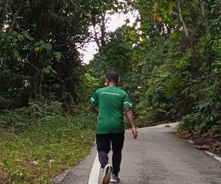
Bukit Tokki, a prominent hill within the Kuantan landscape, offers a fantastic opportunity to immerse ourselves in the lush greenery and fresh air that defines our beautiful state. The Starting Trail, as its name suggests, is a well-known entry point for locals eager to embark on a rewarding climb. It's a place where you can challenge yourself with a steady ascent, discover unique natural features, and enjoy the peace and quiet of the forest.
This article is specifically crafted for us, the local users in Pahang, to provide a clear, engaging, and factual overview of the Starting Trail Bukit Tokki. We'll explore its precise location and how easily accessible it is, what kind of experience you can expect on the trail, any services or features that enhance your hike, and ultimately, why this particular hiking area is an excellent choice for your next outdoor adventure right here in Kuantan.
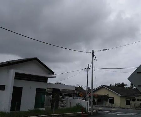
The Starting Trail for Bukit Tokki is conveniently located at 24, Jalan Kampung Darat Sekolah 33, 26100 Kuantan, Pahang, Malaysia. This address places it within a residential area in Kuantan, making it highly accessible for residents of the city and surrounding districts in Pahang. Its integration into a more populated locale means that reaching the trailhead is relatively straightforward, whether you're driving or using local transport.
For those driving, ample roadside parking is usually available near the starting point, particularly around what is described as "the bungalow house under construction," which serves as a recognisable landmark mentioned in local reviews. The address in Kampung Darat Sekolah points to a more residential and accessible part of Kuantan, rather than a remote jungle entry, which is a significant advantage for casual hikers or those on a tight schedule.
The proximity to Kuantan city means that you can easily combine a hike at Bukit Tokki with other errands or activities in the city. After a refreshing trek, you're just a short drive away from various amenities, eateries, and other attractions Kuantan has to offer. This ease of access significantly contributes to its popularity among locals looking for a convenient nature escape.
As a natural hiking trail, Starting Trail Bukit Tokki does not operate as a commercial facility with a formal list of "services offered" in the traditional sense, like a managed park or a recreational center. However, the experience of hiking here is supported by certain informal provisions and community practices. Based on the nature of such local trails in Pahang, here's what one might expect in terms of available "services" or amenities:
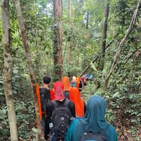
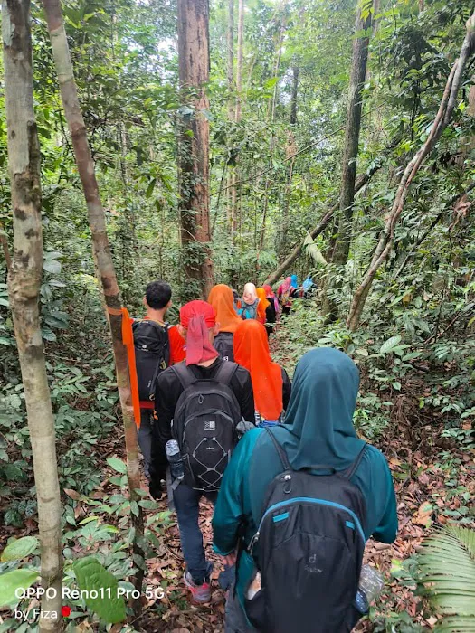
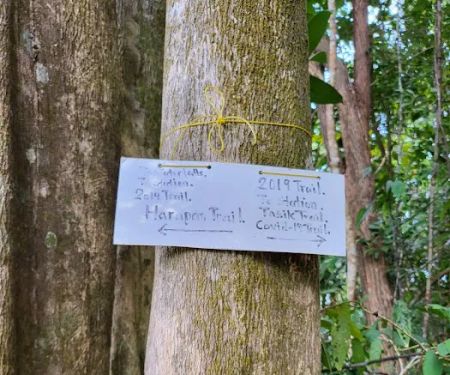
- Trail Markers: Despite the lack of formal signage to the peak, local users have noted the presence of "several trail markers" in the beginning. While these might not be official directional signs with distances, they serve as crucial guides to keep hikers on the correct path, particularly where the path might be covered in leaves.
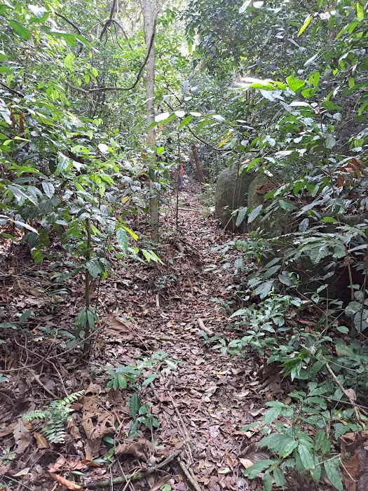
- Clear Path: Even with fallen leaves, the path is described as "clearly marked," suggesting that regular usage by the local hiking community helps maintain the visibility of the trail, acting as an informal service to new visitors.
- Informal Parking: While not a formally managed car park, the area near the starting point (e.g., the "bungalow house under construction") typically offers informal parking spaces along the roadside. This unmanaged, but usually available, parking facilitates access for hikers.
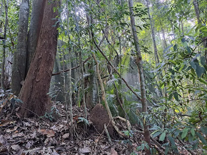
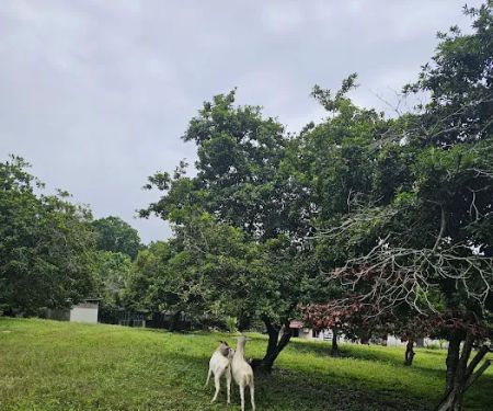
- Natural Environment: The primary "service" is the unadulterated natural environment itself – a lush forest cover providing shade, fresh air, and an immersive experience away from urban bustle.
- Community Shared Knowledge: While not a tangible service, the local hiking community often shares information, tips, and updates about the trail through word-of-mouth or online forums. This collective knowledge acts as an invaluable "service" for those seeking details beyond what's physically present on the trail, particularly regarding alternative routes or trail conditions. This addresses the feedback about desiring more info about trails without GPS.
- No Entrance Fee: Typically, local unmanaged trails like Bukit Tokki do not impose an entrance fee, making it a freely accessible recreational option for the community.
It's important for hikers to be self-sufficient when visiting Bukit Tokki, carrying their own water, snacks, and relying on personal navigation tools like GPS apps for precise information on elevation and peak location, especially given the feedback about wanting more formal signage to the peak.
Starting Trail Bukit Tokki offers several distinctive features and highlights that make it a compelling choice for hikers in Kuantan, Pahang:
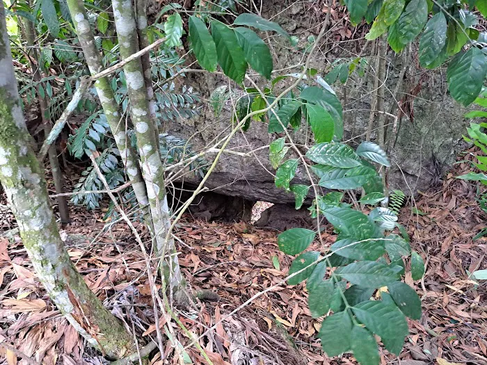
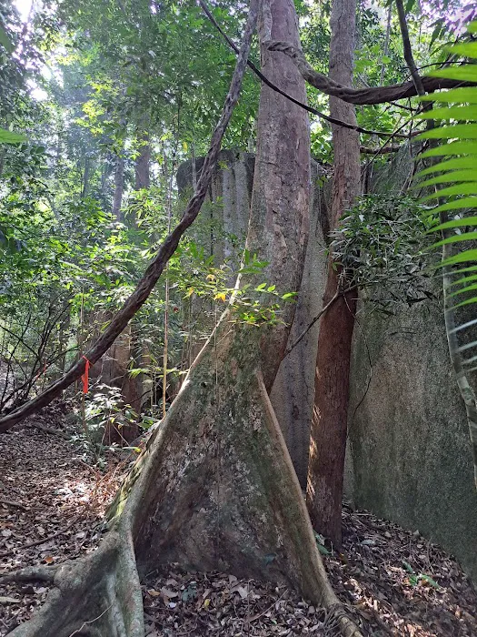
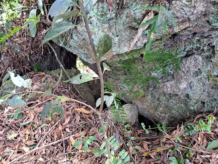
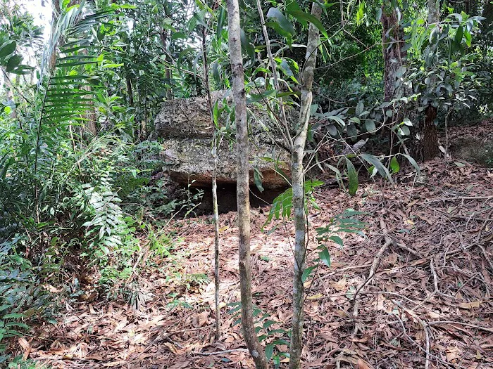
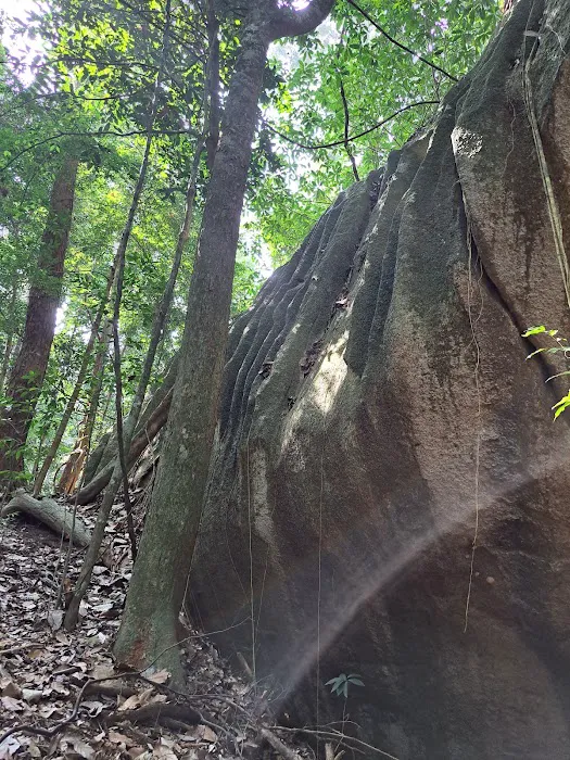
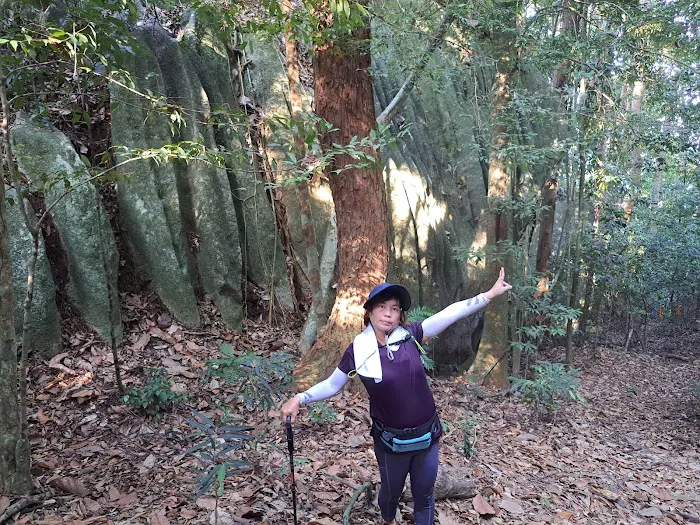
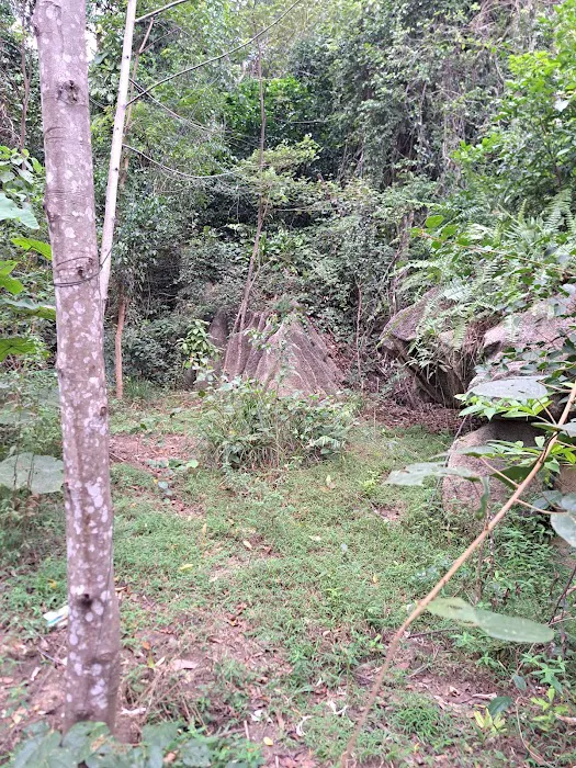
- Unique "Wave Rocks" Formations: A notable and visually striking feature mentioned by visitors is the presence of "a lot of wave rocks" in the beginning of the trail. These unusual geological formations create an interesting and "quite a sight to behold" experience right from the start, setting this trail apart from others.
- Steady Uphill Challenge: The trail is described as going "up all the way to the peak." This consistent ascent provides a good workout and a rewarding sense of accomplishment upon reaching the summit. It's a moderate challenge suitable for those looking to exert themselves without facing overly technical terrains.
- Clearly Marked Path (Initial Sections): Despite the natural forest environment and fallen leaves, the path is noted to be "clearly marked" in the initial sections. This helps hikers stay on track, especially for those new to the trail, ensuring a more confident start to their trek.
- Accessible Peak Elevation: While lacking formal signage, GPS apps indicate the peak is around 408m. This elevation offers decent views and a sense of achievement for a relatively accessible hill, making it suitable for regular exercise or a quick escape into nature.
- Lush Forest Immersion: The trail plunges hikers into a natural forest environment, providing shade, fresh air, and the sounds of nature. This offers a refreshing break from urban life and an opportunity to appreciate Pahang's biodiversity.
- Potential for Multiple Routes: Reviews suggest that "hikers can also enter via other route," indicating a network of trails around Bukit Tokki. This offers the possibility of exploring different paths on subsequent visits, adding variety for regular hikers (though more detailed mapping might be needed for exploration).
- Proximity to Kuantan City: Its location within Kuantan means it's a convenient option for locals who want to fit a quick hike into their schedule without having to travel far from the city center.
These features combine to make Starting Trail Bukit Tokki an attractive and fulfilling hiking destination for the local community in Pahang, offering unique geological sights and a satisfying climb.
As a natural hiking area and unmanaged trail, Starting Trail Bukit Tokki does not offer commercial "promotions" or "special offers" in the way a business would. There are no entrance fees to be discounted, nor are there loyalty programs for repeated visits. However, the inherent "offers" for us, the locals of Pahang, lie in its free accessibility and the natural benefits it provides:
- Free Access: The most significant "offer" is that there is typically no charge to enter or hike the Starting Trail Bukit Tokki. This makes it an incredibly cost-effective option for regular exercise, recreation, and connecting with nature without any financial barrier.
- Open to Public: The trail is open for public use, allowing anyone from the community to enjoy its natural beauty and challenging terrain at their convenience, usually from dawn till dusk.
- Health and Wellness Benefits: The opportunity to engage in physical activity, breathe fresh air, and de-stress in a natural environment is a continuous "promotion" for physical and mental well-being, available to all locals at no cost.
- Community Engagement: While not a formal promotion, the trail fosters community engagement as many locals frequent it, sometimes forming groups or sharing experiences. This informal "offer" of social connection and shared activity is a valuable benefit.
- Accessible Natural Landmark: The unique "wave rocks" and the rewarding peak view are constantly available "highlights" that serve as their own kind of attraction, offering a unique visual experience every time you visit.
Because it is a natural, unmanaged site, any specific "promotions" would likely come from external sources, such as local hiking clubs organizing free group hikes, or perhaps a local sports shop offering discounts on gear for those engaging in outdoor activities. However, for the trail itself, its primary "offer" remains its natural beauty and accessibility to the public, free of charge.
As a natural hiking trail that is not managed by a specific commercial entity, there isn't a direct "contact person" or "phone number" for Starting Trail Bukit Tokki itself. However, here's the location information:
- Address: 24, Jalan Kampung Darat Sekolah 33, 26100 Kuantan, Pahang, Malaysia
For any specific inquiries about trail conditions, alternative routes, or if you're looking for local hiking groups to join, the best approach for us, the locals, would be to:
- Consult Online Hiking Forums or Social Media Groups: Many local Kuantan or Pahang hiking groups on platforms like Facebook are excellent resources. Members often share real-time updates, tips, and even organize group hikes.
- Use GPS Applications: As highlighted in the customer reviews, GPS apps like Alltrails are crucial for navigation and confirming your location on the trail. They provide vital information that is not available via physical signage.
- Engage with Other Hikers: When you visit the trailhead, don't hesitate to politely ask other hikers for tips or information. The local hiking community is generally friendly and willing to share their knowledge.
Remember to always be prepared with necessary supplies and inform someone of your hiking plans, as there are no formal on-site staff or emergency contacts directly for the trail.
For us, the residents of Pahang, particularly those in Kuantan, Starting Trail Bukit Tokki presents itself as an incredibly suitable and appealing option for a refreshing outdoor escape. Its blend of accessibility, moderate challenge, and unique natural features makes it a valuable asset to our local recreational landscape.
Firstly, its convenient location at 24, Jalan Kampung Darat Sekolah 33 within Kuantan means it's just a short drive away for many, making it perfect for spontaneous morning hikes or an afternoon workout. The availability of informal parking further enhances this ease of access, fitting seamlessly into our daily routines.
Secondly, the trail offers a satisfying physical challenge without being overly daunting. The continuous uphill climb provides an excellent workout, ideal for maintaining fitness or preparing for more strenuous treks. Yet, it remains accessible enough for regular hikers and those looking for a moderately intense experience. The "clearly marked" path, even if informal, provides sufficient guidance for much of the ascent.
What truly sets Bukit Tokki apart are its unique features, most notably the "wave rocks" at the beginning of the trail. These fascinating geological formations offer a distinct visual experience right from the start, making the hike more engaging and memorable. The ultimate reward, reaching the approximate 408m peak, offers a great sense of accomplishment and the promise of potential views over Kuantan, depending on the vantage point. While formal signage to the peak is desired by some, the availability of GPS apps effectively addresses this need for precise navigation.
Finally, as a freely accessible natural area, Bukit Tokki provides an invaluable cost-free opportunity for locals to connect with nature, improve their well-being, and enjoy the serene beauty of Pahang's forests. It's a place where we can recharge, challenge ourselves, and appreciate the natural wonders right on our doorstep, cementing its status as a highly suitable and cherished hiking spot for the Kuantan community.
Starting Trail Bukit Tokki Photos
Starting Trail Bukit Tokki Location
Starting Trail Bukit Tokki
24, Jalan Kampung Darat Sekolah 33, 26100 Kuantan, Pahang, Malaysia
 Starting Trail Bukit Tokki
24
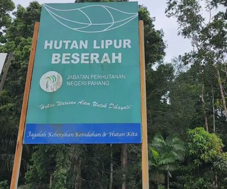
 Hutan Simpan Beserah
Jalan Kampung Jeram
 Hutan Lipur Beserah
26100 Kuantan
 Bukit Tokki
25300 Kuantan
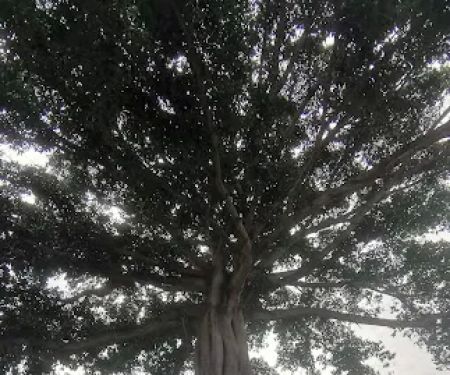
 A giant tree
Taman Satelit Beserah
 Puncak Bukit Tokki
25350 Kuantan
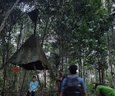
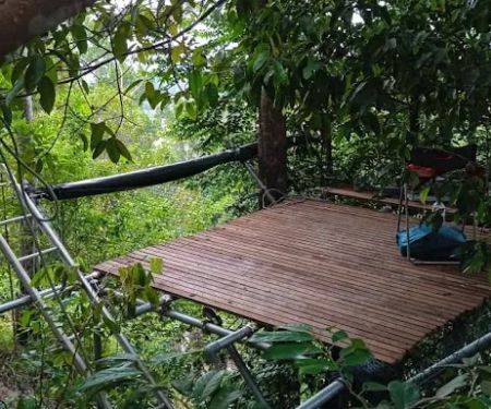
 Free Stay - Pelindung overnight tree platform
Kampung Ceti
 Fateh's Villa
No 1
 Beserah
2
 Bukit Pelindung D Embassy Hiking Trail
81
 Pelindung Beach Trail
Pelindung Hills
 Kopitiam Tasik
R9J6+Q8
 Bukit Pelindung (Puncak Kiri)
424
Starting Trail Bukit Tokki Reviews
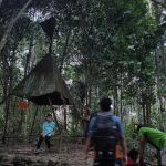
We started at the bungalow house under construction. There were several trail markers. Although it path was full of leaves, buy it was clearly marked. In the beginning, there were a lot of wave rocks. It was quite a sight to behold. The trail just went up all the way to the peak. This trail to the top did not have any signage. Alltrails apps indicated on the map that we were at 408m. That seems to the peak. As we were press fire time, we did not have time to explore the other trail.
Apr 18, 2023 · thai69girlSince im from Kl i wish i had more info about the trails or something like a landmark until reach to the peak without any gps apps.I saw many youtubers share their hike experience here but non with good details on what to expect about the trails.Such as markings showing "➡️to the peak" or xxx meter to the peak. Example Something like simple map at bukit pelindung. That way I could know whether im on the right track or not.It also seems that hikers can also enter via other route.
Jan 25, 2023 · my divelogstatus (mydivelogstatus)Long climbing trail. Not difficult but suitable for beginners.
Oct 10, 2023 · krunchy hauz- May 23, 2024 · Helmi Izzat
- Nov 14, 2024 · Aniq Adam
More Theme Parks
 Hutan Simpan Beserah3.0 (92 reviews)
Jalan Kampung Jeram, 26100 Kuantan, Pahang, Malaysia
 Hutan Lipur Beserah0.0 (0 reviews)
26100 Kuantan, Pahang, Malaysia
 Bukit Tokki5.0 (1 reviews)
25300 Kuantan, Pahang, Malaysia
 A giant tree4.0 (2 reviews)
Taman Satelit Beserah, Jalan Beserah, Kampung Tuan, 26100 Kuantan, Pahang, Malaysia
 Puncak Bukit Tokki4.0 (5 reviews)
25350 Kuantan, Pahang, Malaysia
 Free Stay - Pelindung overnight tree platform4.0 (1 reviews)
Kampung Ceti, 26100 Kuantan, Pahang, Malaysia
 Fateh's Villa4.0 (2 reviews)
No 1, Lorong Beserah Makmur, 20, Perumahan Beserah Makmur, Kampung Baharu, 26100 Kuantan, Pahang, Malaysia
 Beserah4.0 (15 reviews)
2, Jalan Semambu Baru 2, Taman Bandar Emas, 25300 Kuantan, Pahang, Malaysia
 Bukit Pelindung D Embassy Hiking Trail5.0 (4 reviews)
81, Lorong Pelindung 101, Taman Sri Pelindung Satu, 25250 Kuantan, Pahang, Malaysia
 Pelindung Beach Trail5.0 (1 reviews)
Pelindung Hills, 26100 Kuantan, Pahang, Malaysia
 Kopitiam Tasik3.0 (1 reviews)
R9J6+Q8, 25250 Kuantan, Pahang, Malaysia
 Bukit Pelindung (Puncak Kiri)0.0 (0 reviews)
424, Pelindung Heights, 25250 Kuantan, Pahang, Malaysia
Categories
Popular
 A Motel0.0 (0 reviews)
 Agensi Pekerjaan SCS San Bhd2.0 (2 reviews)
 Purple Cane TeaHouz - Jalan Sultan KL Petaling Street4.0 (291 reviews)
 MyTeam Cafe4.0 (70 reviews)
 Veer Hotel Kuantan - Near Indera Mahkota - 5 Min From Town3.0 (276 reviews)
 KIPMall Senawang4.0 (558 reviews)
Must-Read Blog Posts
Most Searched
Trending Blog Posts
 Exploring the Architectural Beauty of Mosques in Malaysia: A Journey Through Islamic Architecture
 Exploring the Unique Designs of Mosques in Malaysia: A Journey Through Islamic Architecture
 How to Get to the Famous Mosques in Kuala Lumpur by Public Transport: A Complete Travel Guide
 Visiting Malaysia’s Most Famous Mosques During Eid: A Unique Cultural Experience
 Top Mosques to Visit During Ramadan in Malaysia: A Traveler's Guide
 Discover the History of Masjid Titiwangsa in Kuala Lumpur: A Cultural and Architectural Gem